A slow-changing weather pattern over Winnipeg will continue to bring daytime highs near the freezing mark and mixed to cloudy skies. By Sunday, though, an approaching low could bring a wintery mix of snow, rain, and freezing rain to southern Manitoba.
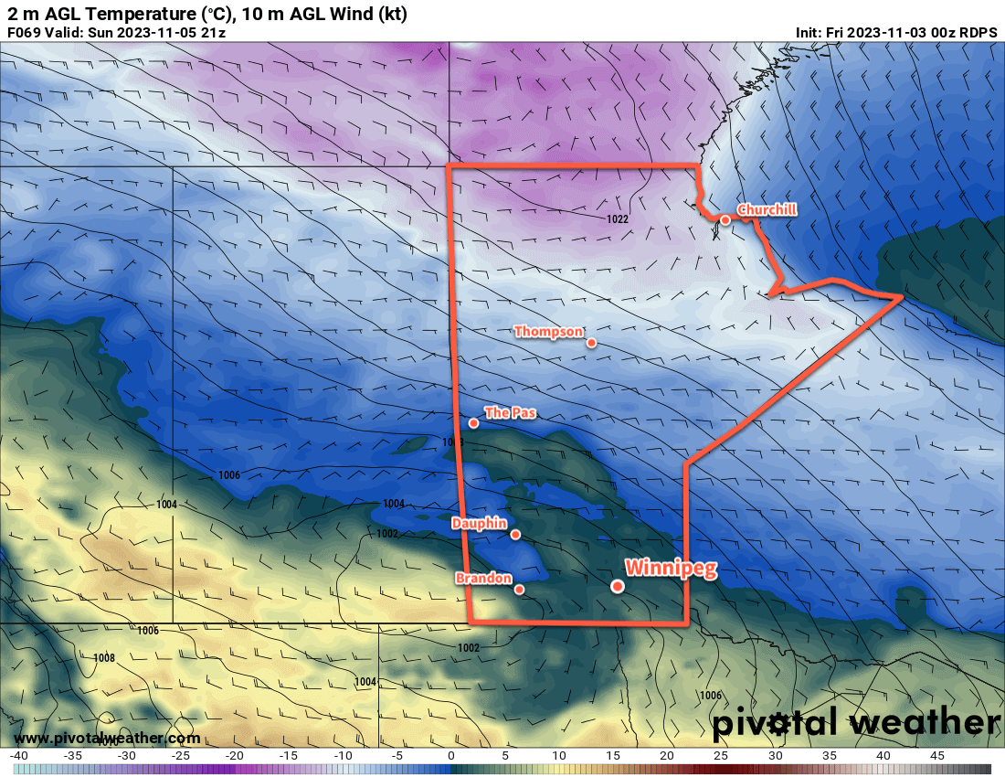
Today will start with some cloud moving through the Red River Valley as a weak front slumps into the region. In its wake, light northerly winds will accompany clearing skies. Some cloud will persist through the day as lake-effect flurries stream off lakes Manitoba and Winnipeg, but the wind direction should favour them flanking Winnipeg rather than moving through the city.
Temperatures will climb up to a high around 0 °C today, then dip to a low in the -5 to -10 °C range tonight.
Heading into the weekend, warmer air will attempt to build into the region. Rather than seeing any notable warm-up, as it often is this time of year, the region instead will be blanketed in cloud. Winds will shift southerly and ease further on Saturday with cloudy skies in the Red River Valley. The remnants of a collapsing low pressure system could bring some light snow to the region on Saturday afternoon.
On Saturday night, a low pressure system developing in Alberta will eject eastwards across Saskatchewan. Winds in the Red River Valley will shift eastwards overnight in response along with a low chance of some light snow. Temperatures will only drop a few degrees from Saturday’s daytime high.
On Sunday, a wintery mix of precipitation will push into Manitoba ahead of the approaching low in Saskatchewan. The day will likely start with some rain and/or freezing rain spreading through southern Manitoba while snow pushes through the Parkland into the Interlake. As the day progresses, the freezing rain will diminish while the rain/snow line lifts northwards. Daytime highs should reach around +2 °C on Sunday afternoon.
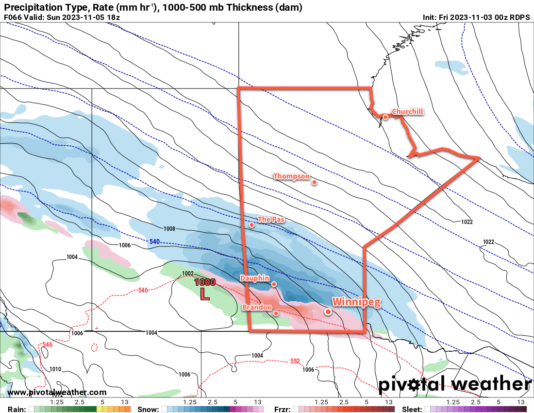
By the end of the day, the low centre will cross through the Red River Valley, followed by northerly winds and the rain/snow line collapsing southwards as the precipitation tapers off overnight. The freezing rain potential in southern Manitoba will largely be confined to the morning, and while conditions could be poor while it’s occurring, the subsequent climb above freezing with temperatures should limit the longevity of its impact. If you have plans to travel on Sunday morning, be prepared for adverse travel conditions and be sure to check highway conditions before leaving.
Long Range Outlook
Temperatures will stay comparatively mild next week with daytime highs likely creeping to the positive side of freezing through the week. Some flurries will be possible, but the next organized precipitation event will likely be with a low pressure complex moving through the region mid-week.
This system could bring another wintery mix of precipitation to southern Manitoba as it passes through.
Don’t expect to see the sun too much; skies will be mainly cloudy this week. Some more organized sunshine could begin to move back into the region in the latter half of the week.
Today’s seasonal daytime high in Winnipeg is +3 °C while the seasonal overnight low is -6 °C.