It will be a warm week in Winnipeg with seasonably warm temperatures continuing.
Sorry that we’re a day late, but fortunately, the weather’s a broken record these days and we didn’t miss much. The weather through the rest of the work week will be driven by a low pressure system moving through northern Manitoba over the next 24 to 48 hours. As it moves into the province today, more warm air will spread into southern Manitoba. This will bring cloudier skies to Winnipeg and area as temperatures climb to a high close to the freezing mark this afternoon. The cloud cover will break up tonight as westerly winds pick up and temperatures fall to a low in the -10 to -5 °C range.
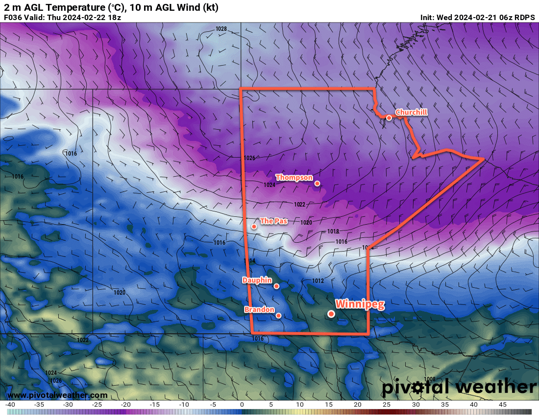
On Thursday, with Winnipeg firmly in the warm sector of this system temperatures will quickly climb to a high just above freezing before a cold front sweeps through later in the afternoon. The cold front will bring some cloud and a chance of flurries to the region as it moves through, along with northerly winds to around 30 gusting 50 km/h. Skies will clear quickly behind the front as an Arctic high drops southwards through the province. Temperatures will head to a low in the -20 to -15 °C range with light winds on Thursday night.
For Friday, the region will see near-seasonal temperatures with a high near -7 °C under mainly sunny skies. Southerly winds will strengthen through the day in the return flow from the departing high. Another low pressure system tracking through the north will be pushing a warm front eastwards into the province through the day. By Friday evening, the warm front will likely be draped through western Manitoba; it will continue to push eastwards through the night, bringing more cloud to the Red River Valley but keeping overnight lows mild near -10 °C.
Long Range Outlook
Winnipeg will move into the warm sector of this second low pressure system on Saturday. The warmer air mass should combine with moderate westerly winds to help send daytime highs well above freezing; Winnipeg will likely see temperatures climb into the 5 to 10 °C range on Saturday afternoon.
The warmest air will move out of the region on Saturday night, but it will stay mild across the region. Sunday should bring daytime highs closer to 0 °C to the region.
Next week wills tart warm, but a strong cold front is forecast to move through on Tuesday. This would usher an Arctic air mass back into the Prairies and send temperatures tack to below-seasonal values for a couple days. That said, the cold snap is expected to be short with milder weather returning by the end of the week.
Today’s seasonal daytime high in Winnipeg is -7 °C while the seasonal overnight low is -17 °C.