Summer Sizzler For The Game 6 Winnipeg Whiteout Street Party

Temperatures will soar into the upper 20’s in Winnipeg today, bringing the first taste of summer for fans heading downtown to cheer on the Jets!

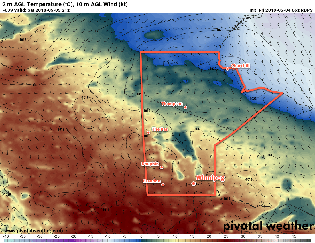
Winnipeg will see light southerly winds with temperatures soaring to a high near 29°C today. Skies will remain sunny with southwesterly winds of 10 to 20 km/h for much of the day, but a cold front slumping southwards will move through Winnipeg this evening, bringing northerly winds near 30 km/h, slightly cooler temperatures, and some cloud cover.

Winnipeg Jets Whiteout Party!
If you’re heading downtown for the Jets game tonight, you’ll be in for some great conditions. Starting around 6PM, temperatures downtown will be near 26°C with light winds. The cold front will push through around 7 or 8PM, bringing northerly winds of 15-25 km/h and cooling temperatures to around 18°C by 10PM. A bit of cloud cover will move in through the evening, producing mixed to mostly cloudy skies by late in the evening. It looks like everything should remain dry with the cold front not likely bringing any rain to the city.

This warm weather will come with a risk, though. Extremely dry conditions continue, and as yesterday’s fire on Wilkes showed, it doesn’t take much to start a blaze.1 Relative humidity values will be under 20% today, continuing to present a significant fire hazard.

RDPS 2m Temperature Forecast valid 21Z Monday May 7, 2018
Hot conditions with temperatures nearing the 30°C mark will be in place over southern Manitoba on Monday afternoon

The latter half of tonight will bring cloudy skies to the city with temperatures dipping to a low near 12°C.

Tuesday will bring mixed to mostly cloudy skies to Winnipeg. Temperatures will be much cooler than Monday, but still quite pleasant with a high near 19°C. Winds will remain breezy out of the northeast at 20 to 30 km/h. Beginning in early evening, a chance for showers or thunderstorms will develop through the Red River Valley that will persist through the night. Activity isn’t necessarily expected to be significant or widespread, but a little activity is possible as a low pressure system moves through the province. Winnipeg should see a low near 12°C on Tuesday night.

GDPS 10m Wind Forecast valid 00Z Thursday May 10, 2018
Breezy conditions will develop in Winnipeg behind a cold front that moves through the area on Wednesday afternoon

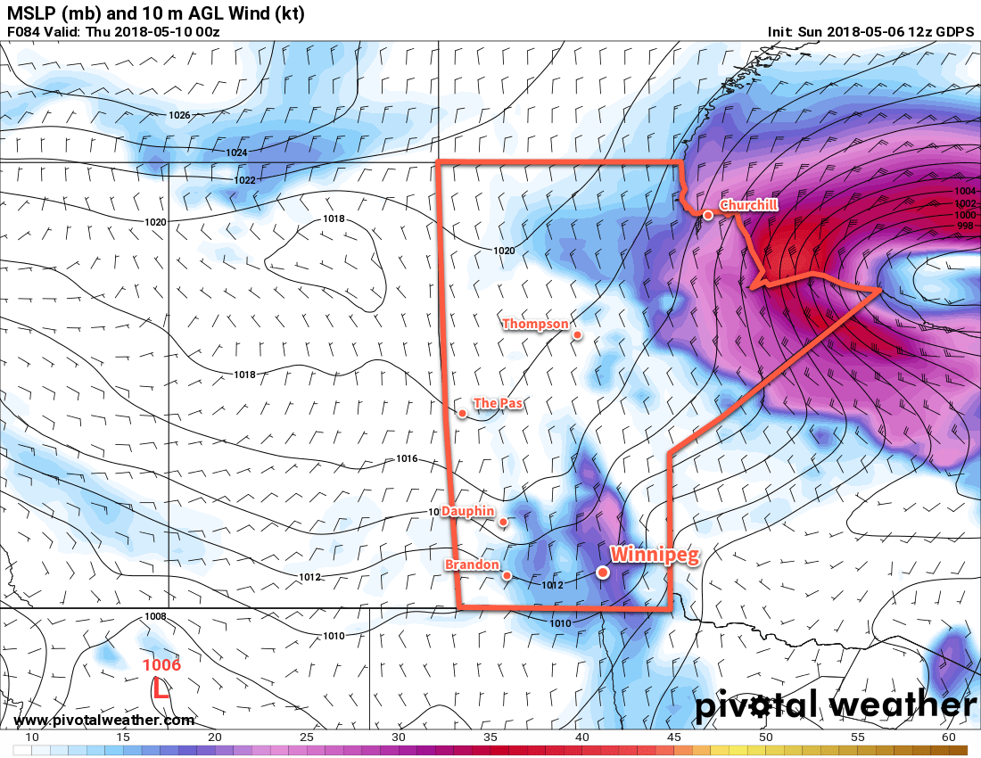
Wednesday will marked by breezy northerly winds in the wake of a cold front that moves through early in the afternoon. Temperatures will climb to a high near 18°C before the front moves through, then cool to the low-teens through the afternoon. Winds will pick up out of the north behind the front, strengthening to 30 to 40 km/h. On the bright side, the northerly winds will clear out the cloud in the Red River Valley, bringing mainly clear skies for Wednesday night with a low near +3°C.

Long Range Outlook

The remainder of the week will bring cooler temperatures and variable cloudiness. Unfortunately, no significant rain is on the horizon, so the dry weather continues.

Winnipeg’s seasonal daytime high is currently 18°C while the seasonal overnight low is 4°C.

  1. Numerous witnesses on scene reported sparks from a passing train as the igniter for the fires. No formal announcement had been made yet at the time of writing.

Pleasant Weekend Ahead

Winnipeg will see a pleasant spring weekend ahead with plenty of sun and daytime highs near 20°C.

A high pressure system gradually moving into the province over the coming days will bring sunshine and seasonably warm temperatures. Winds will be out of the northwest at around 20 km/h today under mainly sunny skies with a high near 20°C. A few clouds will move into the region tonight as a weak disturbance rolls through, bringing just a slight chance of showers to the region through the overnight hours. Temperatures will dip down to around 5°C for the low.

RDPS 2m Temperature Forecast valid 21Z Saturday May 5, 2018
An area of high pressure moving through the province will bring sunshine and seasonably mild temperatures to southern Manitoba this weekend

Winnipeg will see partly cloudy skies this weekend with daytime highs close to the 20°C mark. Winds on Saturday will be out of the north at around 20 km/h as the high pressure system approaches. On Sunday, winds shift to light out of the south as the high exits the province. Saturday will bring another seasonal low near 4°C, but warmer air building into the region on Sunday will keep lows much warmer on Sunday night. Winnipeg should see a low around 10°C heading into Monday morning.

Long Range Outlook

Next week continues to look seasonably warm, however Winnipeg may finally begin to see the chance for some much-needed rain. Forecasts show the storm track pushing northwards out of the United States into the southern Prairies with the  potential for rain or thunderstorms Monday night into Tuesday. This chance repeats again on Friday or Saturday as another low moves through.

Unfortunately, these systems will be driven largely by convection, making forecasts this far out practically useless. It’s safe to say that it will be a bit more unsettled and Winnipeg will see more cloud next week; we’ll have to wait and see if that translates into rain.

Winnipeg’s seasonal daytime high is currently 17°C while the seasonal overnight low is 3°C.

Warmer Weather Brings Chance of Showers

Winnipeg will see a couple chances for showers over the next couple days as temperatures recover back towards above-seasonal values.

After an unpleasant Tuesday, today will bring a significant improvement in the weather. Yesterday’s cool northwesterly winds will be absent. Instead, light southerlies will push temperatures back up to around 17°C. A sunny start to the day will give way to afternoon clouds as a weak upper trough moves into the region. It will spread showers eastwards as it moves through, beginning over southwestern Manitoba early to mid-afternoon and onwards through the Red River Valley through the late afternoon into the early evening.

Skies will clear this evening with westerly winds of 10 to 20 km/h and temperatures dipping to a low near +3°C.

Showers will move across the Red River Valley later this afternoon

Thursday will bring plenty of sun alongside moderate westerly winds of 30 gusting 50 km/h send temperatures soaring to around 23°C. There will be a few clouds and a slight chance of showers in the afternoon as a weak cold front slumps southwards. Winds will shift northwesterly behind the front and ease to around 10 to 20 km/h. A few clouds will linger overnight as temperatures dip to a low near 5°C.

Friday will bring slightly cooler temperatures with a high near 17°C. Aside from a bit of a breeze out of the northwest near 30 km/h, it will be a beautiful early May day: few clouds and no chance of rain. Some cloud cover will begin moving into the region on Friday night ahead of the next low pressure system crossing the southern Prairies. Winnipeg should see a low near 4°C on Friday night.

Long Range Outlook

The weekend will bring warm weather with highs in the upper teens or low 20’s. Saturday will bring mixed skies with a chance of showers, but things clear out Sunday for what looks like a beautiful end to the weekend.

Winnipeg’s seasonal daytime high is currently 16°C while the seasonal overnight low is 3°C.

Cooler, Cloudier Conditions to Start The Week

The start of the work week will stand in stark contrast to the sunny and mild (albeit windy) conditions of the weekend. A low pressure system moving through the region will bring cloudier and much cooler weather.

A compact and potent low pressure system moving into the province will be the weather-maker over the next couple days. Skies will remain mostly cloudy today as the system moves into the province, but most of the showers and thunderstorms it generates should remain north of the Red River Valley. Winnipeg will see a slight chance of a passing shower through the morning hours, depending on how much it fills in south of the low overnight. More notable will be the strong northwesterly winds up to 50 gusting 70 km/h that will move into the region behind this system’s cold front. The winds will pick up as the low passes mid-morning, strengthening into the afternoon. Temperatures will fall as the winds usher in cooler air, down to around 9°C by evening.

Skies will remain cloudy overnight with a low near +2°C. The winds will remain out of the northwest at 20 to 30 km/h. Winnipeg and the Red River Valley will see another chance of showers move in late overnight as the region is grazed by a disturbance moving across North Dakota.

RDPS 2m Temperature Forecast valid 18Z Monday April 30, 2018
A cold front moving through Winnipeg on Monday morning will usher in cooler temperatures and strong northwesterly winds.

Tuesday will continue to bring cloudy skies to Winnipeg and cool temperatures with a high of just 8°C expected in the city. The morning will continue to bring a chance for some light showers, but that should taper off by midday. And for those tired of the breezy winds, they will continue to taper off through the day. The cloud cover will begin to break up overnight as temperatures head to a low near +1 or +2°C.

The sun will finally reappear on Wednesday as Winnipeg sees mixed skies. Temperatures will begin rebounding as highs climb into the upper teens. Winds will be just 10 to 20 km/h and no precipitation is forecast thanks to a ridge of high pressure moving through the region. Skies will remain partly cloudy on Wednesday night with a low near +3°C.

Long-Range Outlook

The latter half of the week looks to return to more unsettled conditions as the next low pressure system moves through the province. At this point it looks like Winnipeg has a good chance of seeing some rain on either Thursday or Friday, but there are indications that this system may have a sizeable convective component, which makes determining areas of rain very difficult this far out.

This low will likely bring mild temperatures to Winnipeg on Thursday, but unpleasant northwesterlies may return on Friday, ushering in another batch of near- to below-seasonal temperatures to start off the weekend.

Winnipeg’s seasonal daytime high is currently 16°C while the seasonal overnight low is 2°C.