Winnipeg will see a mixed bag of conditions over the coming days as seasonal temperatures build back into southern Manitoba.
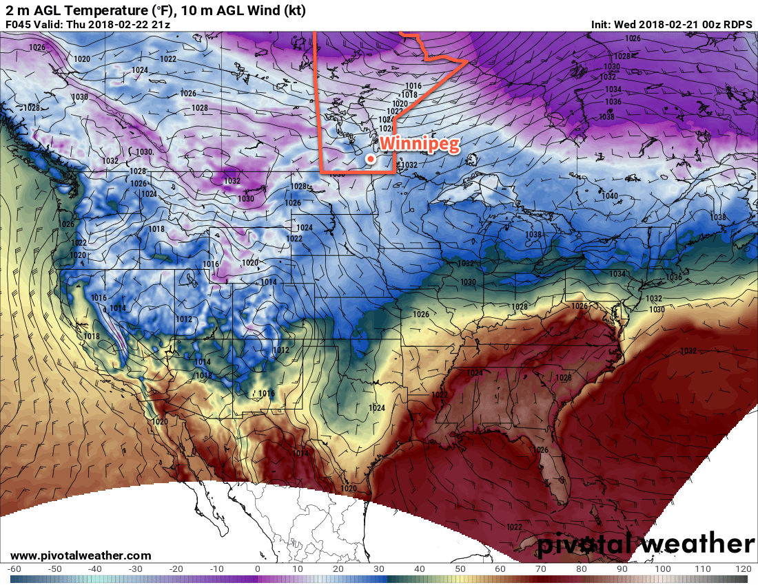
Winnipeg will finally move towards seasonal temperatures as the icy grip of Arctic air is shown the door by milder Pacific air spreading eastwards across the Prairies. To round out the work week, Winnipeg will see mainly sunny skies once a bit of morning cloud moves out of the region. Temperatures will climb to around -8°C, just a tad warmer than it was yesterday. Skies should remain mainly clear tonight with temperatures dipping down to around -17°C.
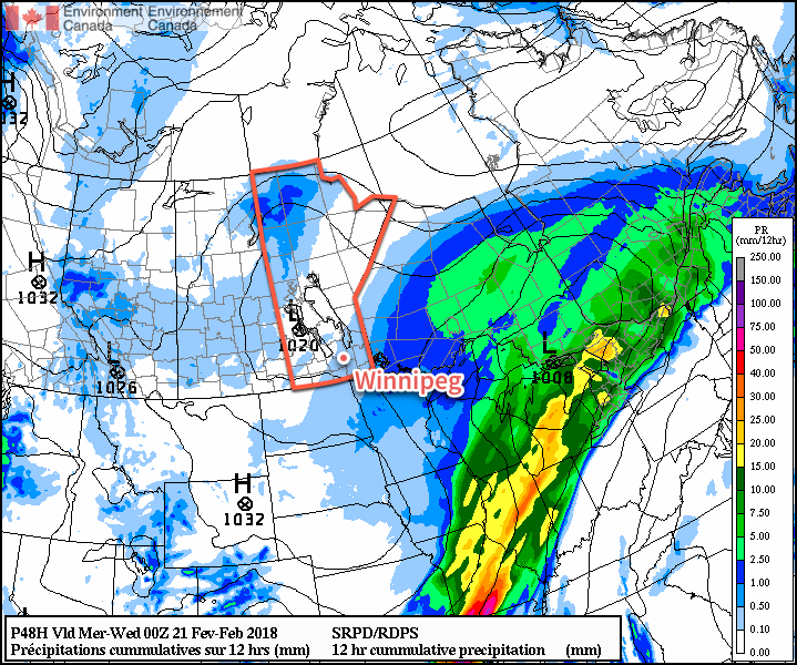
Warmer air will push into the region for Saturday, but it will come with those wonderful southerly winds that Winnipeg so often receives when warmer weather is on the way. Temperatures will climb to a high near -5°C, but those southerly winds will strengthen to 30 to 40 km/h with gusts up to 60 km/h by Saturday afternoon. Skies will start off sunny, but by mid- to late-afternoon, cloud will begin moving into the region from the south. The wind will taper off through the evening as skies continue to cloud over. Some light snow will move into southern Manitoba overnight, but nothing more than a skiff is expected. Besides bringing the snow, the cloudy skies will help temperatures remain a bit milder with a low near -11°C expected in Winnipeg.
Winnipeg will see cloudy skies on Sunday with any remaining light snow tapering off in the morning. Winds will be much lighter, and temperatures will climb to a high near -4°C. Winnipeg may see some clear breaks on Sunday night, but more cloud will begin pushing in early Monday morning as another low pressure system moves into the region.
Long Range Outlook
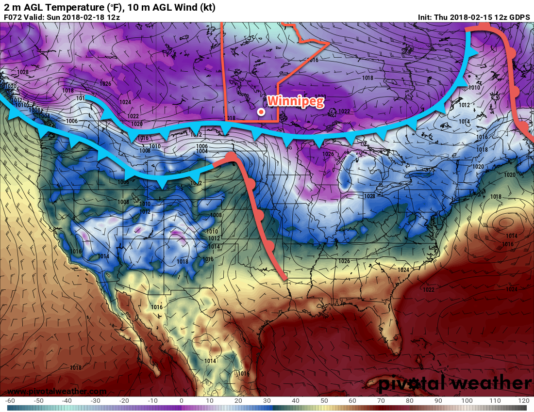
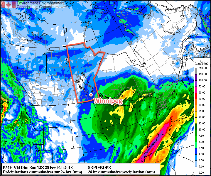
Milder temperatures look like they’re here to stay, with seasonal to slightly above seasonal temperatures remaining in place for much of next week. Precipitation still looks minimal, though, with no significant snow expected in the coming week.
Winnipeg’s seasonal daytime high is currently -6°C while the seasonal overnight low is -16°C.