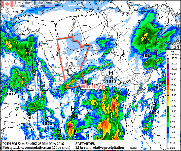
The wet & unsettled weather seen over the last week in Winnipeg will continue, albeit in a more disorganized fashion, as the series of disturbances that have brought anywhere from 30-70mm of rain to the Red River Valley this week begin moving out of the region only to be quickly replaced.
Today will continue the soggy trend with another round of showers developing through the Red River Valley. Temperatures will be slightly cooler than normal with a daytime high near 19°C. Skies will be mostly cloudy, however there is a chance of seeing the odd sunny break through the day. Winds will be out of the north at around 10-20 km/h through the day. Skies will remain fairly cloudy tonight with a low near 12°C.
Saturday will bring mixed to cloudy skies to the Red River Valley with a high temperature near 20°C. A few light showers are possible, particularly through the morning hours as a disturbance passes through the Whiteshell, bringing rain through the southeastern portion of the province. Winds will be relatively light through the day. Expect a low on Saturday night near 12°C with some clearing working into the Red River Valley.
Sunday will be the warmest day of the next 3 with a high near 22°C. We'll likely see a fair amount of sun through the morning and midday, but by the late afternoon a trough pushing across the province from the west will bring another chance for showers to Winnipeg & the Red River Valley. Winds will once again be fairly light. Temperatures will dip to around 13°C for a low on Sunday night under partly cloudy skies.
Long Range
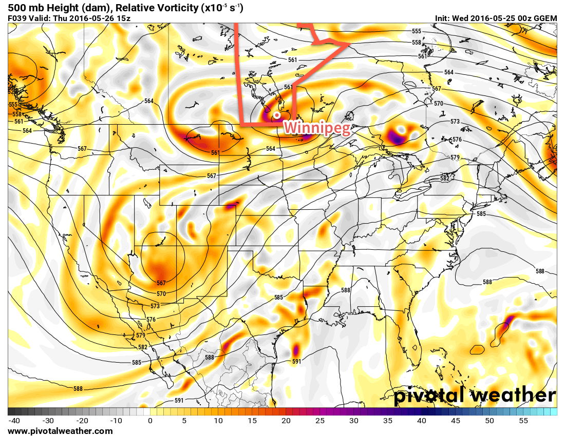
The start of next week brings another chance for significant widespread rain for Southern Manitoba as a strong low pressure system develops in Alberta and then pushes eastwards across the Prairies.
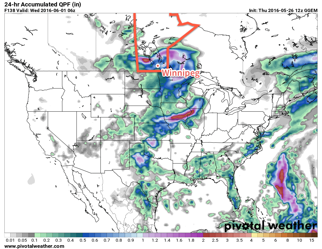
There's some inconsistency on the timing of this feature. The GDPS is fairly progressive with it and pushes it across the region on Tuesday with another moderate rainfall associated with it. The GFS, however, is much slower.
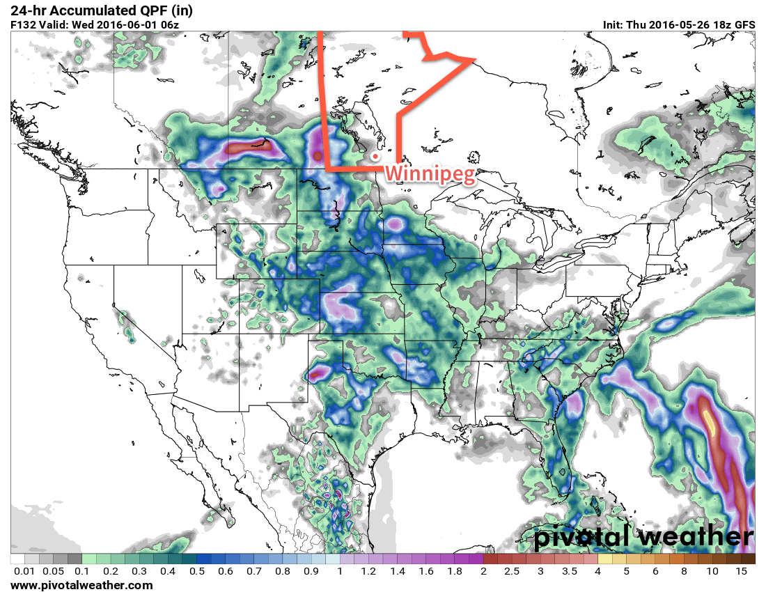
The GFS is much slower and holds this system back in Saskatchewan and southwestern Manitoba through Tuesday, and then shifts it in such a way that little rain actually falls over the Red River Valley.
Most long-range models all see this system developing, but with the disagreement in its development & progression, it means at this point we can just say that there's a chance for rain early next week, but we'll have to wait and see.
Winnipeg’s seasonal daytime high is currently 21°C while the seasonal overnight low is 7°C.