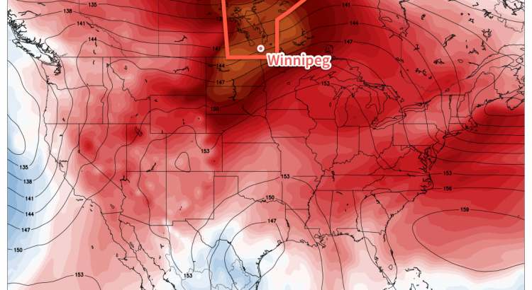
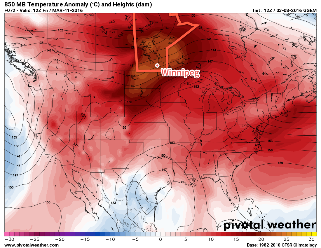
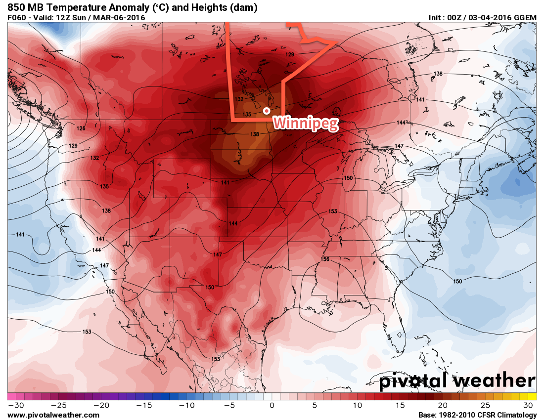
The sunny weather is arriving later than expected in Winnipeg no thanks to persistent low cloud that simply wouldn’t leave the region despite clear skies working in on either side of the Red River Valley. With that behind us, though, the warm weather arrives today alongside plenty of sunshine for what will be the start to a beautiful weekend in the Winnipeg area.
A fairly pleasant day is on the way today with the sun finally making an appearance, sending temperatures well above normal and close to record values. The mercury will climb towards the 10°C mark this afternoon, slightly short of the record value of 12.8°C that was at in 2012. The wind will be fairly gusty out of the south this morning and will shift to breezy out of the west behind a warm front that passes through midday.
Skies will be mixed as some remnants of yesterday’s low cloud clear out and are replaced by variable cloud from the warm front moving through the region. We will see sunshine today, particularly once the drier westerly winds kick in and flush out any remaining moisture stuck in the Valley.
The overnight low is expected to dip down to around -1°C tonight under partly cloudy skies and diminishing winds.
Saturday will be the nicest day of the of the weekend with partly cloudy skies, relatively light winds and very mild temperatures. The daytime high on Saturday will climb to around 10-11°C, a potentially record-breaking high for March 12th.
Mild air continues to flow over Southern Manitoba on Saturday night as southerly winds increase ahead of an incoming trough of low pressure. Winds will increase to around 30-40km/h late Saturday. The warmer air moving in alongside the wind will keep overnight lows fairly mild; the temperature will dip only to 2 or 3°C on Saturday night.
Sunday will be a mild day but the weather will turn cloudier and potentially wet. A trough of low pressure moving into the province will result in a cloudier day with a high once again near 11°C. Heading into the afternoon, the chance for some rain will increase throughout the Red River Valley and areas east. Significant rainfall is not expected[1], but for the areas that end up seeing any precipitation, a few mm may be possible. The cloud will help temperatures remain very mild on Sunday night with temperatures expected to dip to near 4°C.
New Record Temperatures?
We have the potential of breaking some record temperatures over the next few days, particularly on Saturday and Sunday.
| Date | Record High | Record Warm Min |
|---|---|---|
| March 11 | 12.8°C (2012) | 2.8°C (1878) |
| March 12 | 9.7°C (2012) | 2.5°C (2012) |
| March 13 | 12.2°C (1902) | 1.6°C (1995) |
Saturday’s high near 10°C will challenge the 3 year old record from 2012. Saturday night’s low near 2 or 3°C combined with Sunday night’s low near 4°C may challenge the record warmest low temperature for March 13, which currently sits at 1.6°C and was set in 1995.
Sunday’s high temperature is not expected to reach the current record of 12.2°C set in 1902. The low near -1°C on Friday night will prevent the record warm low temperature for March 12th of 2.5°C set in 2012 from being broken.
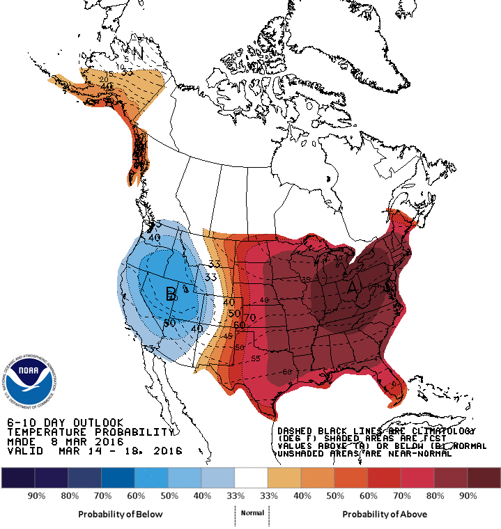
Long Range: Mild & Unsettled
Heading into next week the forecast is for continued warmth for the first half of the week and then a return towards seasonal values through the second half.
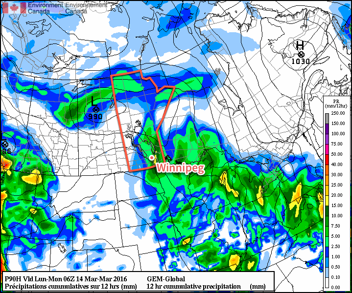
Regarding precipitation, most of any potential will be tied up in a mid-week low pressure system that will usher in the cooler temperatures. It appears like it will be a complex mess of multiple low pressure systems merging into a vortex over Northern Ontario, so at this point it would be an exercise in futility to try and make any guesses on what any one place will see from that system. It’s probably safe to say that there will be a chance for rain changing to snow mid-week.
But, before then, enjoy the spring warmth!
Winnipeg’s seasonal daytime high is currently -2°C while the seasonal overnight low is -12°C.
- Although, as shown above, the GDPS is forecasting convective elements that could produce 10-20mm of rain, I’m not convinced at this point that potential will be realized. I’ll post an update in the comments below if Sunday looks like it may produce some heavier showers. ↩