After a brief one-day break with seasonal temperatures, warmer weather will gradually build back into southern Manitoba.
Seasonal temperatures return to the Red River Valley today behind a cold front that moved through the region overnight. Northerly winds will continue through the day near 30 gusting 50 km/h as temperatures climb to a high in the upper teens. The wind will die off tonight as a ridge of high pressure moves in and sends temperatures down into the low single digits.
An upper ridge will begin to build back across the Prairies mid-week, bringing more sunshine and warmth to the region. On Wednesday, temperatures will climb to around the 20 °C mark with light southeast winds developing in the afternoon.
Wednesday evening’s Whiteout Street Party for Game 1 against the Dallas Stars should see temperatures near 16 or 17 °C at puck drop that cool to around 11 °C by the end of the game. The low overnight will dip down into the upper single digits under clear skies.
Warmer weather returns for Thursday as daytime highs climb into the mid- to upper-20s as southerly winds of 30 to 40 km/h redevelop over the region. Those southerly winds will ease and turn northerly on Thursday night as a weak cold front pushes through the region. It may bring clouds and a chance of showers overnight into early Friday morning. Temperatures will head to an overnight low in the low teens.
Long Range Outlook
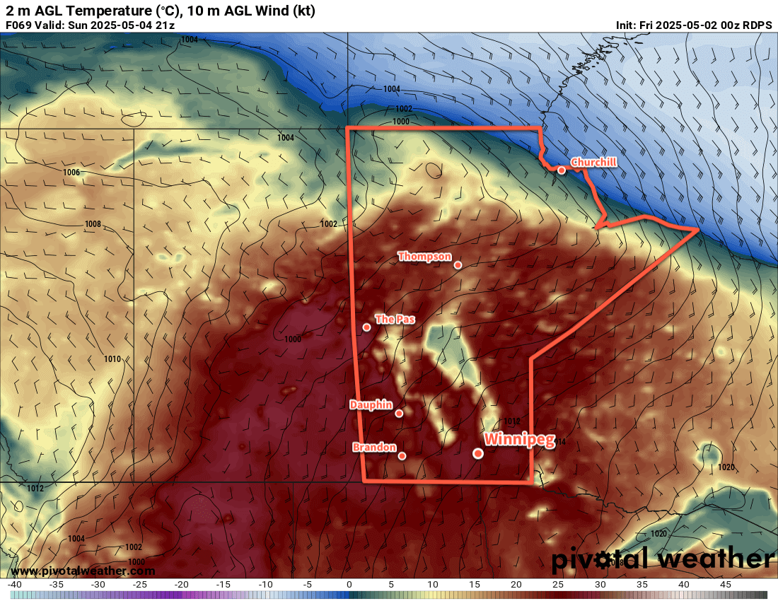
Friday and Saturday are looking like they will bring seasonal to mild temperatures to the region along with an end to the sunny skies with cloud cover possible later Friday into Saturday. Showers may be possible Saturday night as warmer air pushes into the region. Sunday will be another hot day with highs in the upper 20s possible. That heat will likely build into Monday and bring the chance for Winnipeg’s first 30 °C day of the year.
For Friday’s Whiteout Street Party, the weather should be similar to Wednesday with the only notable difference being a more noticeable northerly breeze. Which, to be honest, will likely be low down on the “things to notice” list if you’re planning on heading downtown for the game.
Go Jets go!
Today’s seasonal daytime high in Winnipeg is 17 °C while the seasonal overnight low is +3 °C.