Beautiful Summer Weekend Ahead

Get the sunscreen & shorts out, there’s a beautiful summer weekend ahead for Winnipeg & the Red River Valley.

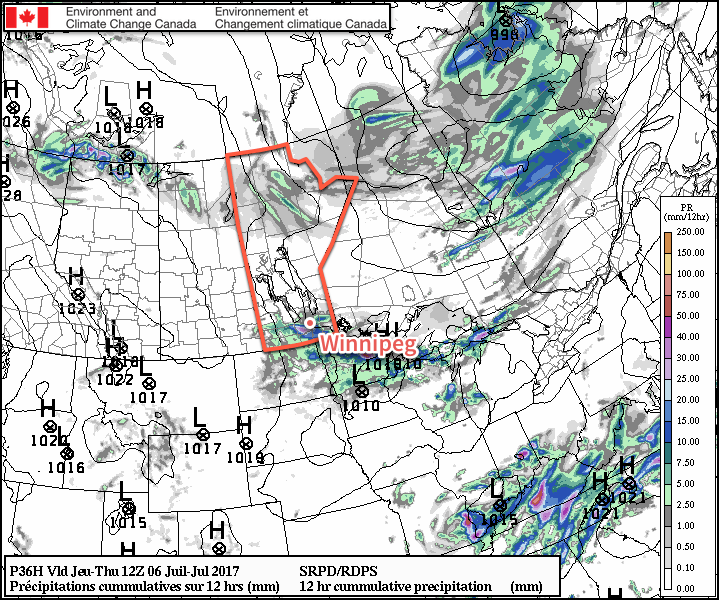
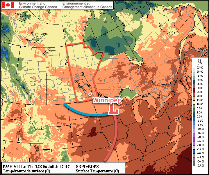
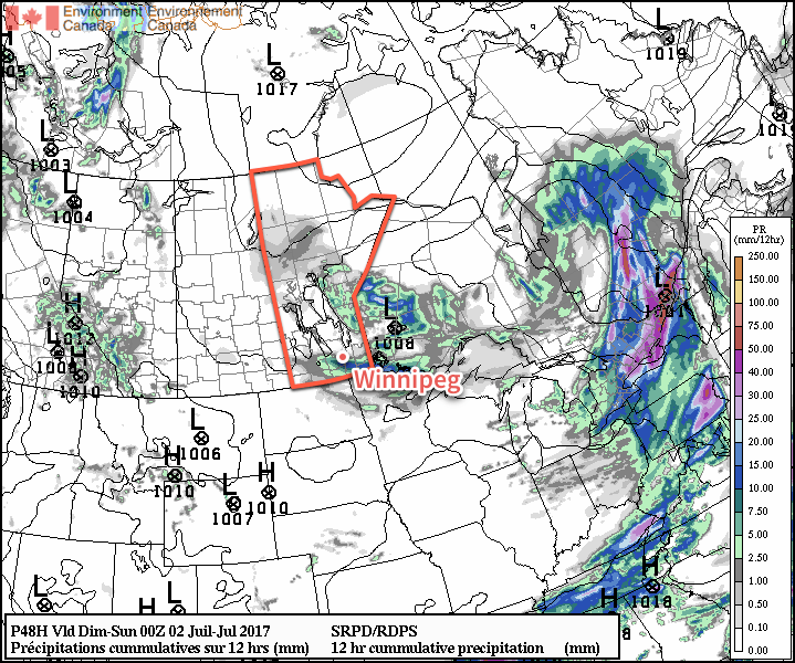
Today will be a beautiful mostly sunny day…after a weak disturbance tracking through the region overnight clears out early this morning, likely bringing some showers or thundershowers through the city with it. In its wake, skies will clear as temperatures head to a high near 25°C with light winds out of the northwest. Not much to say about today; it’s going to be a nice one!

Tonight will bring clear skies to the region with a low near 15°C and light winds the shift to southerly through the early evening as a weak warm front moves through.

If there was little to say about today, Saturday has even less. Temperatures will climb to a high near 28°C under clear skies. Winds will back to the northwest midday and increase to 15-25 km/h for the afternoon as a weak trough swings through the Red River Valley. Expect a low near 14°C on Saturday night with light winds and partly cloudy skies.

Sunday will bring a few more clouds to the region as a disturbance moves through North Dakota, but it appears conditions will be dry for Winnipeg & much of the Valley. A few showers or thunderstorms will be likely Saturday night into Sunday morning over the southwestern corner of the province and some of this activity could creep into the southwestern Red River Valley early Sunday, but it seems unlikely at this point. Temperatures will remain warm with highs once again near 28°C with light winds.

Skies will clear for Sunday night with temperatures heading to a low near 15°C.

Long Range

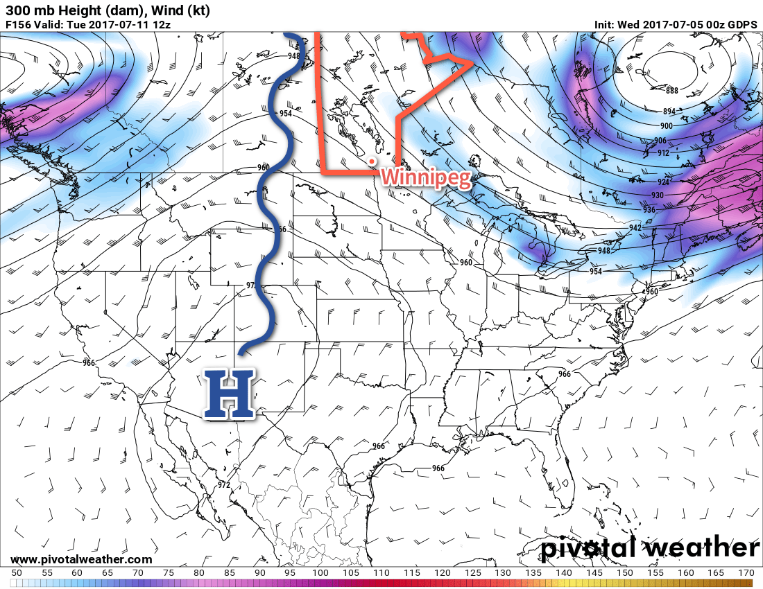
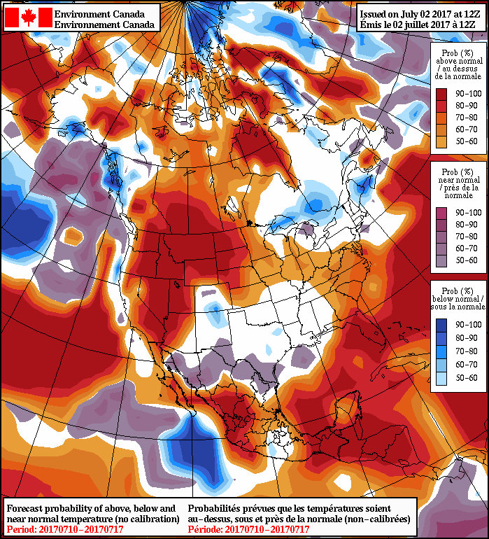
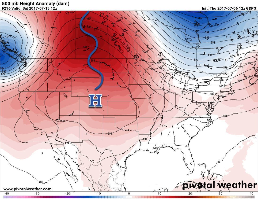
As we’ve been advertising all week, it continues to look like next week will be a warm one. A warm and sunny start to the week will then see a disturbance moves through the Prairies on Tuesday and Wednesday. Behind that system, the upper-level ridge responsible for the warm, dry weather will rebound and strengthen as it shifts eastwards from the western Prairies.

A potent upper-level ridge is forecast to develop over the Prairies in the latter half of next week.
As the upper ridge shifts eastwards, it will spread even more intense warmth into southern Manitoba. Current indications show the latter half of the week seeing daytime highs in the low 30’s and overnight lows near 20°C.

Winnipeg’s seasonal daytime high is currently 26°C while the seasonal overnight low is 13°C.

Cover photo by Flash Bros

Beautiful Summer Weather Continues

There will be plenty of sunshine over the next few days as near-seasonal warmth remains in place over southern Manitoba. After a risk of thunderstorms this evening, conditions will settle and Winnipeg will round out the work week under plenty of sunshine.

Today will be a beautiful day in Winnipeg; this morning will start off still a bit muggy as some remnant humidity from yesterday remains trapped near the surface, but things should dry out quite quickly as the temperature rises through the morning. With a more comfortable humidity level, Winnipeg’s high of 29°C under mainly sunny skies will make for a great summer day.

The Red River Valley will see some increasing cloud cover late in the day as a disturbance slides along the international border and drags a cold front southwards. This will likely trigger thunderstorms, however the extent is still uncertain. The chances are best close to the U.S. border, and then diminish heading northwards. North of the Trans-Canada Highway, it appears there will be just a very small chance of seeing anything. Temperatures will then drop to a low near 17°C with any remaining cloud clearing out overnight.

The RDPS is forecasting thunderstorms to roll across southern Manitoba on Wednesday night.

Temperatures will drop back closer to seasonal on Thursday as slightly cooler air moves into the region behind a cold front that will pass through early in the day. Winds will pick up out of the northwest to around 30 gusting 50 km/h as temperatures climb to high of 25°C under sunny skies with just a few afternoon clouds.

The wind will taper off in the evening as temperatures dip down to a low near 12°C with just a few clouds lingering through the night.

A cold front will move through Southern Manitoba on Wednesday night, slumping south of the border by Thursday morning.

Friday will be another beautiful day with temperatures once again climbing to a seasonal 25 or 26°C. Winds will be much lighter than Thursday, and skies will be partly cloudy to mixed for much of the day. All in all still a very pleasant summer day. Expect lows to dip down into the mid-teens on Friday night.

Heat Builds in Through Weekend

Warmer weather will build back into the region this weekend with temperatures climbing back into the upper 20’s or perhaps even the low 30’s.

An upper-level ridge (blue squiggle) will build into the Prairies early next week.

This warm weather will be the result of an upper-level ridge building into the Prairies. This feature will remain established over the Prairies for much of next week, giving Winnipeg and the Red River Valley above normal temperatures through much of next week. Conditions look generally dry, but we may see one or two chances of thunderstorms through the week. Summer has arrived!

Winnipeg’s seasonal daytime high is currently 26°C while the seasonal overnight low is 13°C.

Stormy Tuesday Brings The Heat

The heat will be cranking up over the Prairies this week, and Winnipeg will see increasing warmth through the start of the week. A potentially stormy Tuesday will be a marked turning point as hot and muggy weather moves into the region. Heading into the second half of the week, conditions will be more settled but the heat sticks around for the foreseeable future.

A major pattern shift is underway that will bring a prolonged period of heat to much of western North America. Winnipeg will begin feeling the impact today as temperatures climb towards a high of 27°C under mixed skies. Winds will pick up out of the south-southeast to around 20 km/h in the afternoon as low pressure system begins approaching the province from Saskatchewan. The humidity will remain relatively comfortable today, though, with dew point temperatures expected to remain around 13 or 14°C.1

Winds will continue out of the south-southeast tonight with temperatures remaining warm overnight; the expected low is just 17°C as a warm front pushes across the Red River Valley.

The RDPS shows an organized line of thunderstorms developing on Tuesday afternoon.

Summer will arrive in all forms for Winnipeg on Tuesday. Now in what’s known as the warm sector, the humidity will rise quite quickly on Tuesday morning with dew points reaching around 18-19°C. Temperatures will climb towards a high of 29°C which will feel closer to the mid-30’s with the humidity factored in. For the afternoon, attention will turn towards the potential for severe thunderstorms as a cold front pushes southeastwards into the Red River Valley.

Going over the MIST ingredients:

  • Moisture: Plenty of moisture available with dew points in the upper teens being fed into any storms that develop. Moisture also seems to be relatively deep, so dramatic reductions due to mixing are unlikely.
  • Instability: MLCAPE values climb towards the 2000 J/kg mark with marginal capping. The low-level inversion will erode with the injection of 850 mb cooling while 700 mb temperatures remain below the 10°C threshold.
  • Shear: Surface – 6km bulk shear values peak around 30 kt which would be ample for storm organization.
  • Trigger: Two primary foci for convection: a pre-frontal trough that moves through midday, and then a cold front that pushes into the region mid- to late-afternoon.

These thunderstorms may be severe with the primary threats being large hail and localized flooding due to intense downpours. Strong wind gusts are possible with these storms as well. At this point, it seems like a tornado threat is unlikely, but we’ll keep an eye on things as they develop.

After the cold front slides through, winds will shift out of the northwest at around 15-25 km/h and the humidity will begin to ease as drier air moves into the region. Temperature will still remain warm, though, with overnight lows dropping only to around the 17°C mark once again.

Wednesday will be another hot day with temperatures climbing to around the 28°C mark with partly cloudy skies in the morning. The humidity will be much more comfortable than on Tuesday thanks to drier air that works in through the day and drops dew points back down to the low teens for the afternoon. Expect a low near 17 or 18°C on Wednesday night with a slight chance of another shower or thunderstorm as a weak disturbance slides through the region.

Long Range.

Looking further ahead, temperatures will cool towards seasonal to round out the work week as slightly cooler air moves in behind Wednesday night’s disturbance.

NAEFS 8-14 Day Temperature Anomaly Forecast — Valid July 10 – 17, 2017

The heat begins building back in through the weekend, and next week is looking quite warm and relatively humid as an upper ridge builds over the western Prairies, spreading above-normal temperatures across the region.

Winnipeg’s seasonal daytime high is currently 25°C while the seasonal overnight low is 13°C.


  1. The dew point only begins having a significant impact on how hot and/or muggy it feels once it begins climbing above 15°C or so. 

Conditions Begin Improving For Canada’s 150th Anniversary Celebrations

Conditions are set to gradually settle as the upper low responsible for the stormy weather of late begins working on an exit from Manitoba. There will be a couple more chances for showers, but conditions will begin improving on Canada Day and lead into a stretch of hot and dry weather.

This morning will start with slight chance of a shower or two through Winnipeg and the Red River Valley as a cold front swings across, but then the chance for any rain quickly drops off and then skies will begin to clear out for the afternoon. Winds will be persistent out of the northwest at 20-30 km/h as temperatures climb to a high of just 19°C. Expect a low near 10°C under partly cloudy skies.

Canada Day

Canada Day will start off with cloud cover moving through the region and a chance of showers as the upper low that has been responsible for the showery and stormy weather the past few days finally moves through. Once the low is past, it should be mainly dry, however an isolated afternoon pop-up shower or two will be possible. The cloud cover should clear out towards the evening. Temperatures will continue below seasonal, with highs only around 19 or 20°C.

Canada Day Temperature & Cloud Forecast for Winnipeg, MB
Time Temperature Cloud Cover
7:00 AM 14°C 40%
10:00 AM 17°C 80%
1:00 PM 19°C 80%
4:00 PM 19°C 60%
7:00 PM 19°C 40%
10:00 PM 16°C 20%
1:00 AM 13°C 10%

Heading into the evening, temperatures will gradually fall towards the mid-teens for fireworks at 11PM. The clearing skies combined with lowest mosquito counts in 40 years should make for very pleasant viewing conditions! Just remember to bring a sweater! Temperatures will fall to a low near 11°C overnight.

A narrow band of showers is expected to produce 5-15mm of rain across a portion of the Red River Valley on Saturday morning.

Sunday & Beyond

Sunday will be a positively pleasant day compared to the last while. A sunny morning will give way to mixed skies in the afternoon as temperatures climb to a high near 23 or 24°C. No rain! Temperatures will then dip to a low near 14°C under partly cloudy skies.

All indications are that the heat is on next week! Temperatures are set to climb into the upper 20’s by midweek with increasing humidity as well. By the second half of next week, daytime highs near 30°C combined with dew point values near 17°C will make for days that feel like the mid-30’s. It also appears that it will be fairly dry, although Tuesday may bring the potential for some thunderstorm activity.

It’s worth noting that in addition to the warm daytime highs, the higher dew points expected to move into the region will also keep overnight lows mild — likely in the 17-19°C range — so it would be good to ensure that if you have air conditioning that it’s ready for the summer! It looks like the first blast of hot, muggy weather is on the horizon.

NAEFS 8-14 Day Temperature Anomaly Forecast — Valid July 7 – 14, 2017

Heading into the longer-range, ensemble guidance continues to suggest that southern Manitoba will continue to see above-seasonal temperatures. It appears that the cooler temperatures of June will be left in the dust by the first significant stretch of summer warmth.

Winnipeg’s seasonal daytime high is currently 25°C while the seasonal overnight low is 13°C.