Sunny Skies and Warm Temperatures this Week

This week will feature a return sunny skies and warm temperatures, weather that we haven’t seen a lot of over the last week.

A surface high over Manitoba will bring sunny skies and mild temperatures

This Week

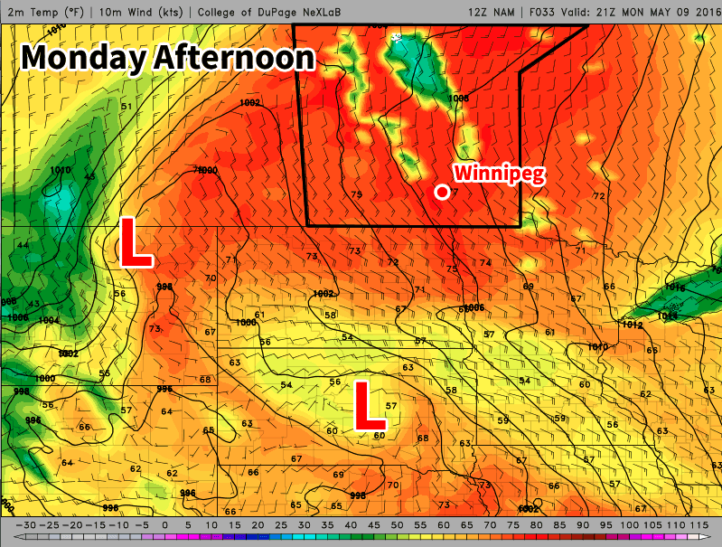
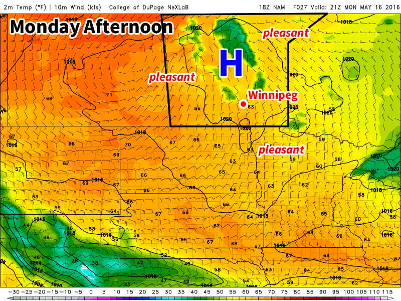
Today will be one of the cooler days this because we’ll still be in the coolish air mass leftover from the surge of arctic air late last week. However, high temperatures will still be in the upper teens under mainly sunny skies. Winds will be from the north as we’ll still be on the western edge of an upper trough, but the wind should shift to a southerly component on Monday night.

Tuesday will see even warmer conditions as temperatures climb into the low twenties. An upper ridge will begin building over southern Manitoba, which means Tuesday will be the first of many seasonably warm days. Winds will be light on Tuesday and skies are expected to remain sunny.

The forecast for Wednesday is a bit more uncertain than Monday and Tuesday because a shortwave trough is expected to push through southern Manitoba. It doesn’t appear this trough will bring any rain to southern Manitoba, but it may bring additional cloud cover to the region. Assuming the cloud cover isn’t too extensive, temperatures should climb into the mid-twenties with breezy south winds.

Long Range

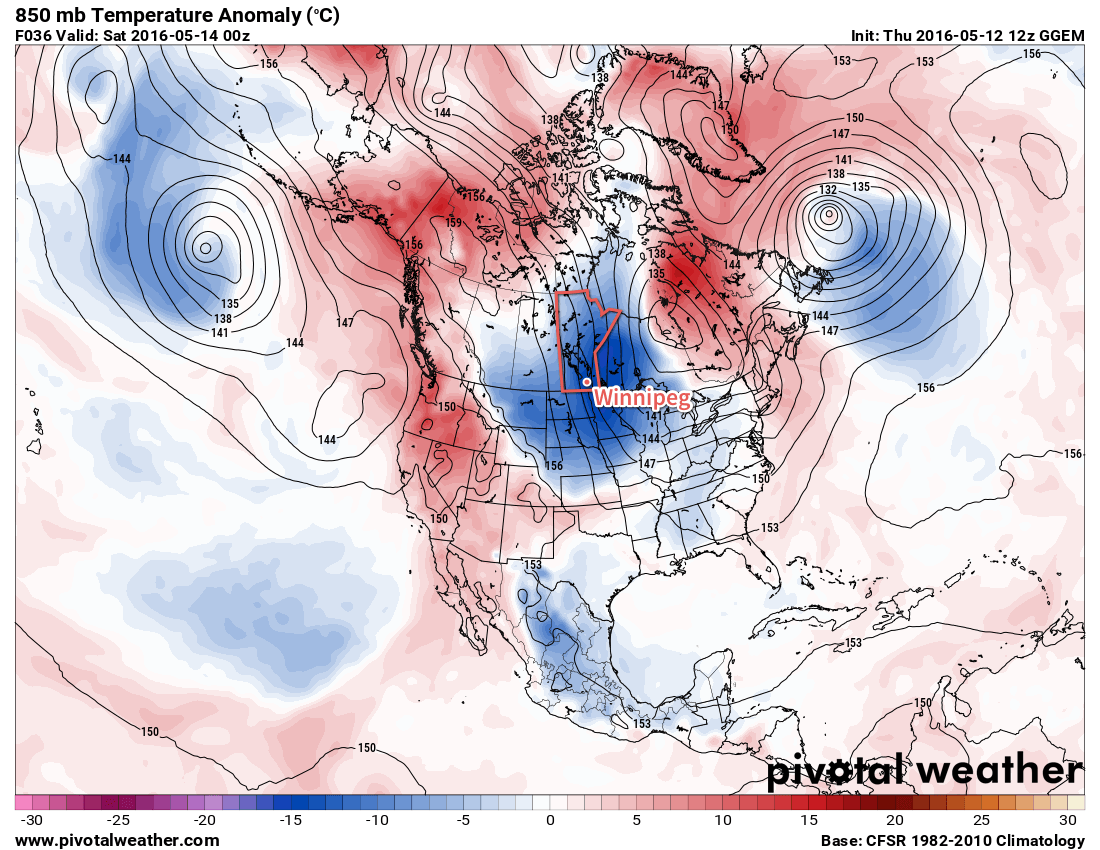
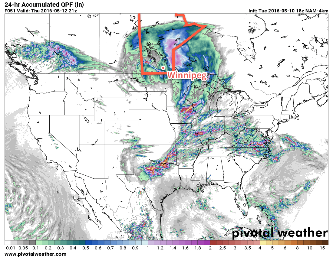
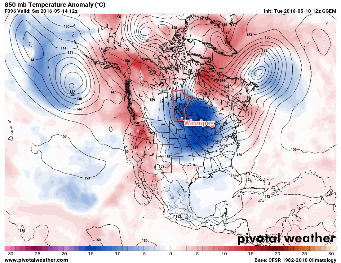
The long range forecast suggests that the remainder of May will generally remain warmer than normal. One interesting feature of the long range forecast that bears watching is the potential for our first notable thunderstorm event of the year. Models have been consistent in bringing a large upper trough into western North America by next weekend, which is expected to draw a warm, moist air mass into southern Manitoba. The exact nature of the thunderstorm threat for southern Manitoba remains quite uncertain, but it appears possible we may see our first thunderstorm event of the year at some point on the long weekend.

Flurries Start Off A Cool Weekend

Today will start off with flurries moving through the Red River Valley, setting the stage for a snap of cool weather that will bring temperatures well below seasonal. While temperatures will rebound slowly through the weekend, it will hardly be beautiful spring weather.

Today will be a rude awakening for many, as cold temperatures combine with a weak disturbance rolling through the region to produce widespread light flurry activity through the Red River Valley. Some places might get lucky enough to see things change over to scattered showers briefly this afternoon, but for the most part, expect some light snow for much of the morning and into the afternoon. Fortunately, the snow won't really stick and no accumulation is expected.

In addition to the snow, the winds will continue to be strong out of the northwest at 40 gusting 60km/h with a daytime high that just barely gets to 5°C.1 Temperatures will dip to near the -4°C mark tonight with clearing skies. Near the core of Winnipeg it's not as likely that there will be a hard freeze, but certainly near the outer edges of the city and into the rural areas a significant freeze is likely so you may want to take precautions if you've any sensitive plants outside already.

GDPS Forecast 850mb Temperature Anomaly
The 850mb temperature anomaly forecast shows a large core of below-seasonal (blue) temperatures over Manitoba today.

Saturday will finally bring out the sun in Winnipeg, but it will continue to be chilly with a daytime high of 9°C under mainly sunny skies. Winds will continue out of the northwest, but be slightly weaker at 20km/h or so. Expect a low near the freezing mark on Saturday night with partly cloudy skies and light winds.

Sunday will see another disturbance moving through the province in the northwest flow. More cloud will move into Winnipeg alongside slightly warmer temperatures; daytime highs are expected to climb into the mid-teens! A band of showers will likely move through in the afternoon, bringing a decent chance of precipitation to most areas in the Red River Valley. Winds will vary through the Red River Valley from light to around 30km/h. Expect a low on Sunday night near 3°C with partly cloudy skies.

Long Range: Climbing To Seasonal

Looking ahead to the start of next week, it appears that temperatures will make a continued climb back towards seasonal, however the with a stubborn upper trough refusing to leave the area, that could end up taking longer than expected. Conditions aren't expected to be too bad with a good mix of sun and cloud and highs in the mid- to upper-teens. There will be a slight chance of showers.

Winnipeg’s seasonal daytime high is currently 19°C while the seasonal overnight low is 5°C.

  1. Nearly 15°C below normal for daytime highs right now in Winnipeg.

Unsettled Transition to A Cool Weekend

An upper-level low tracking across the province today will bring showers to the region and mark the beginning of a transition into cooler weather that will persist through the weekend.

Today will bring another batch of showers to Southern Manitoba as an upper-level low that has brought several days of much-needed rain to Saskatchewan pushes across Southern Manitoba. Much of today will be cloudy for Winnipeg & the Red River Valley until this evening when showers develop underneath the core of the upper low. Much of the precipitation expected today will fall through the evening & overnight, with anywhere from a trace to another 5-10mm possible across the area. There's an outside chance of a lightning strike or two, but no organized thunderstorm threat is expected.

Winds will strengthen out of the south-southeast at 20-30km/h today, with temperatures climbing to around 17°C. As the low passes by tonight, the winds will diminish and shift out of the northwest, making for a damp and chilly night with temperatures dipping to around 6°C.

The high-resolution NAM shows a further 10*mm* or so of rain tonight for Winnipeg.

Any remaining shower activity will taper off on Thursday morning with a slight chance of some more shower activity lingering through the day. Skies will remain mostly cloudy and the wind will pick up to a fairly moderate breeze out of the northwest at 30-40km/h. Temperatures will be cooler with a high near just 11°C. While the cloud will break up a little bit on Thursday night, Winnipeg will likely be stuck with mostly cloudy skies and northwesterly winds at 30km/h. It will be quite chilly with low temperatures bottoming out at 1-2°C.

The cold overnight low on Thursday night combined with a weak disturbance slumping southwards will mean that Winnipeg will see a chance of…flurries on Thursday night into Friday morning.

The clouds will gradually part on Friday and the sun should make an appearance for the afternoon. Temperatures will be well below normal, though, with a high of just 6-7°C and breezy northwesterly winds again at 30-40km/h. Friday night will bring partly cloudy skies, diminishing winds and a low temperature dipping below the freezing mark and bottoming out near -3°C.

850mb Temperature Anomaly valid 12Z May 14, 2016
This plot of 850mb temperature anomalies for Saturday morning shows the below-normal temperatures that will be in place later this week.

The below-seasonal temperatures will persist through the weekend and into early next week before finally beginning to return to normal in the middle of the week.

Winnipeg’s seasonal daytime high is currently 19°C while the seasonal overnight low is 5°C.

May Showers on Tap this Week

After last week’s record breaking heat and overall sunny conditions, our soggy April has quickly turned into a dry May. This week should finally feature some much needed rain, although how much remains to be seen.

Today will be our last hot, sunny day before cooler and greyer conditions build in for the rest of the week. Temperatures are expected to reach the mid twenties over southern Manitoba with a breezy south wind. Skies will likely remain somewhat hazy as smoke from the forest fires over Northern Alberta continues to linger. Enjoy what could be the last hot day for awhile!

Today will feature warm weather once again in southern Manitoba, but low pressure to the south will bring rain on Tuesday and Wednesday.

Tuesday will remain mild, but some rainfall is expected as a strong low pressure system pushes up from the south. Showery rains are expected throughout the day, although it will be hard to make an accurate forecast for how much rain will fall. At this point it appears that 2-6 mm is a reasonable range, although some areas may see no rain, while others see more than 6 mm. Winds will be south-easterly at 30 km/h gusting to 50 km/h, while temperatures sit in the upper teens.

Wednesday will see the low pressure system from Tuesday continue to stick around and bring more rain to southern Manitoba. Accumulations of 2-6 mm will be possible once again on Wednesday, with the same caveat that amounts will vary on a localized basis. Temperatures will remain in the upper teens, with southerly winds of 20-30 km/h.

Long Range

It appears that the rest of this week will be on the cooler side as we experience a brisk northerly flow behind the low pressure system that brought us the rainfall. Models suggest that the remainder of the first half of May will stay normal to below normal in terms of temperature, before warmer conditions return again for the second half of May. Most long range/seasonal guidance suggests that this summer will generally be warmer than normal, although it is notoriously difficult to predict summer weather in the long range!