An upper-level low tracking across the province today will bring showers to the region and mark the beginning of a transition into cooler weather that will persist through the weekend.
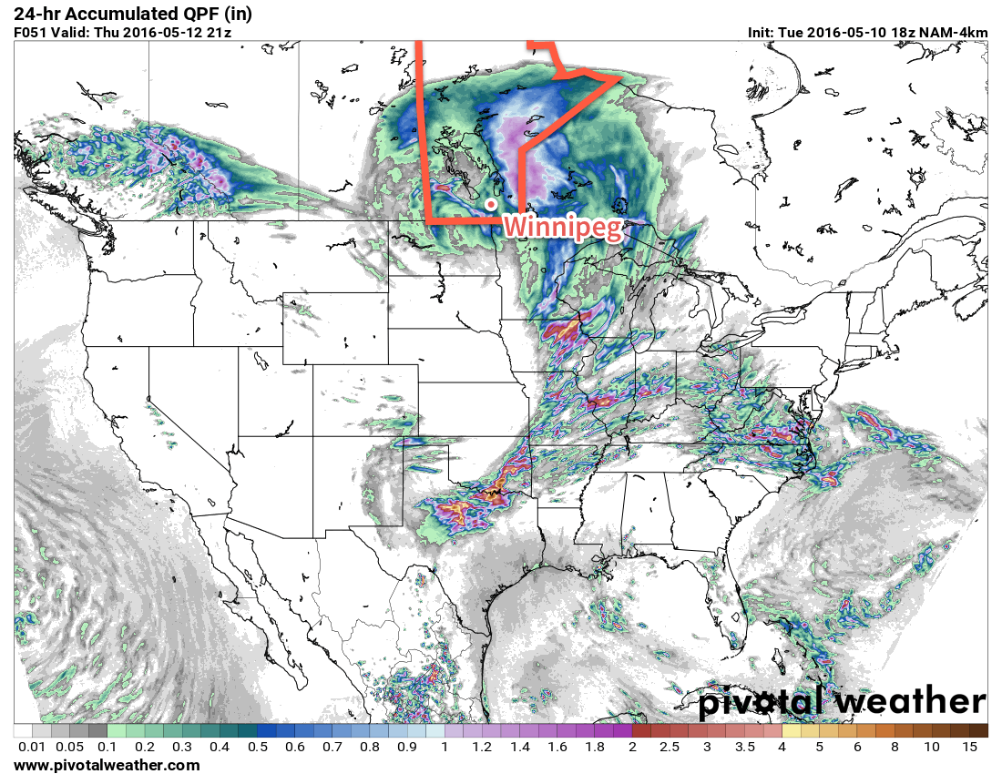
Today will bring another batch of showers to Southern Manitoba as an upper-level low that has brought several days of much-needed rain to Saskatchewan pushes across Southern Manitoba. Much of today will be cloudy for Winnipeg & the Red River Valley until this evening when showers develop underneath the core of the upper low. Much of the precipitation expected today will fall through the evening & overnight, with anywhere from a trace to another 5-10mm possible across the area. There's an outside chance of a lightning strike or two, but no organized thunderstorm threat is expected.
Winds will strengthen out of the south-southeast at 20-30km/h today, with temperatures climbing to around 17°C. As the low passes by tonight, the winds will diminish and shift out of the northwest, making for a damp and chilly night with temperatures dipping to around 6°C.
Any remaining shower activity will taper off on Thursday morning with a slight chance of some more shower activity lingering through the day. Skies will remain mostly cloudy and the wind will pick up to a fairly moderate breeze out of the northwest at 30-40km/h. Temperatures will be cooler with a high near just 11°C. While the cloud will break up a little bit on Thursday night, Winnipeg will likely be stuck with mostly cloudy skies and northwesterly winds at 30km/h. It will be quite chilly with low temperatures bottoming out at 1-2°C.
The cold overnight low on Thursday night combined with a weak disturbance slumping southwards will mean that Winnipeg will see a chance of…flurries on Thursday night into Friday morning.
The clouds will gradually part on Friday and the sun should make an appearance for the afternoon. Temperatures will be well below normal, though, with a high of just 6-7°C and breezy northwesterly winds again at 30-40km/h. Friday night will bring partly cloudy skies, diminishing winds and a low temperature dipping below the freezing mark and bottoming out near -3°C.
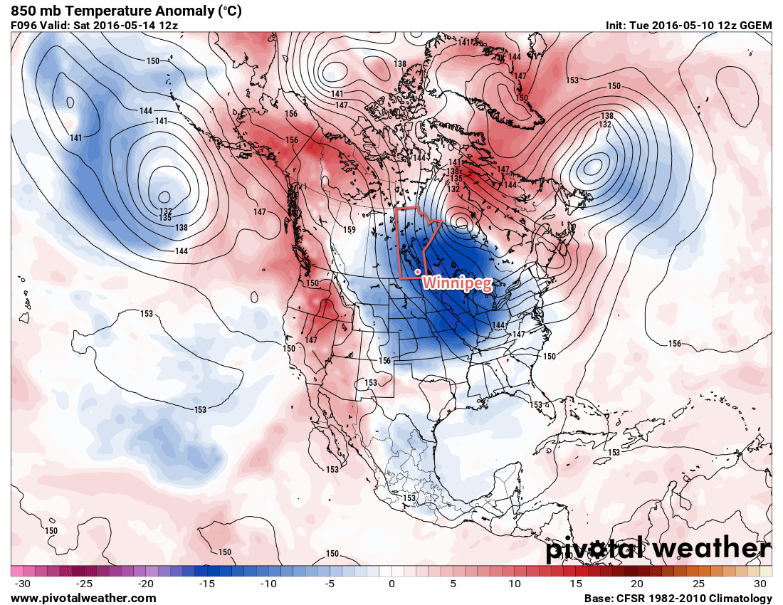
The below-seasonal temperatures will persist through the weekend and into early next week before finally beginning to return to normal in the middle of the week.
Winnipeg’s seasonal daytime high is currently 19°C while the seasonal overnight low is 5°C.