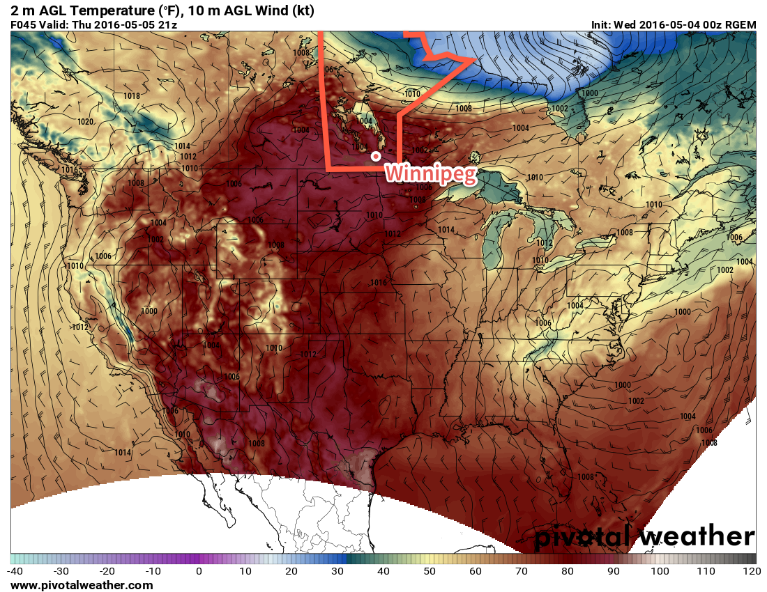
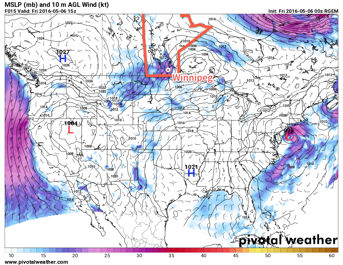
A cold front sweeping through Southern Manitoba this morning will bring an end to the incredible heat that baked the province yesterday and shattered numerous record high temperatures. What moves in behind the front can hardly be called cold, however, as above-seasonal temperatures continue in the region for the coming several days.
May 5th: Records High Temperatures Shattered Across The Province
A very hot and dry air mass moved into Southern Manitoba yesterday and, somewhat predictably, resulted in numerous new record high temperatures as records were broken all over the place. This air mass had broken essentially every single high temperature record in Saskatchewan the prior day[1] and was the source of numerous record high temperatures in Alberta, exacerbating the fire situation that has resulted in one of the largest wildfire disasters[2] in Canadian history in Fort McMurray.
Temperatures rocketed up early Thursday morning with many places reaching 30°C by midday, and by mid-afternoon temperatures of 32-34°C were commonplace over the region. These very warm temperatures resulted in a large number of record high temperatures being broken:
| Location | May 5th High | Previous Record |
|---|---|---|
| Brandon | 34.3°C | 31.7°C (1934) |
| Dauphin | 34.4°C | 31.7°C (1918) |
| Fisher Branch | 34.5°C | 25.5°C (1987) |
| Gimli | 33.8°C | 26.3°C (1987) |
| Gretna | 35.1°C | 26.0°C (2000) |
| Melita | 33.3°C | 28.2°C (1993) |
| Pilot Mound | 33.3°C | 27.8°C (1939) |
| Pinawa | 32.0°C | 27.0°C (1987) |
| Portage La Prairie | 34.2°C | 31.7°C (1918) |
| Sprague | 33.6°C | 32.8°C (1939) |
| Swan River | 34.5°C | 30.0°C (1911) |
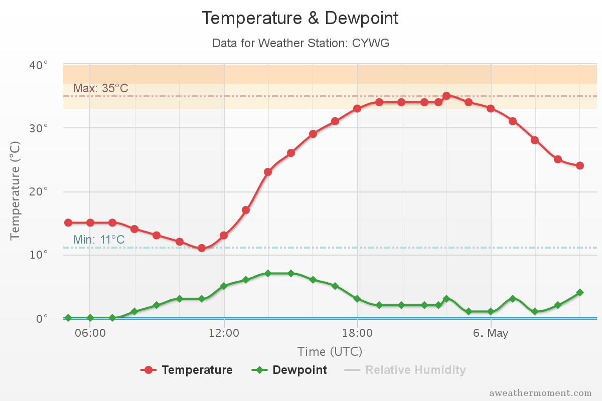
| Winnipeg | 35.2°C | 31.7°C (1926) |
Winnipeg’s official high of 35.2°C marked the earliest date for a temperature 30°C or higher, beating out the more than 140 year old record of May 8th, 1874. Additionally, the difference between yesterday morning’s low of -2.4°C and today’s high marks the 3rd largest spread between a daytime high and the previous day’s overnight low since record began in 1872.[3]
Windy Friday Followed by a Pleasant Weekend
Today will see fairly windy conditions behind the cold front that will sweep through this morning. Gusty winds will strengthen out of the northwest to 40-50 km/h behind the front as temperatures head towards a high of 19°C. Skies will be mixed, but no precipitation is expected.
Winds will taper off this evening as temperatures head towards a low near 6°C under mainly clear skies.
The weekend will be fairly pleasant with mild temperatures as highs on both Saturday & Sunday climb into the low 20’s. Saturday will still be a bit wind with northerly winds to 30-40 km/h, however they should ease for Sunday. Skies will be fairly sunny throughout the weekend with no chances for precipitation!
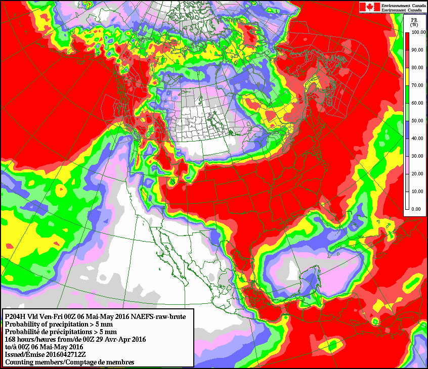
Long Range: Some Rain? Maybe?
Temperatures will continue at near-to-above seasonal heading into next week, with some hints that the weather may become more unsettled.
The general trend in the models is to introduce a very large, slow-moving upper trough early next week over the west coast and to have it gradually move eastwards. Precipitation patterns at this point appear convectively driven over small regions, but also slow-moving which means that moisture may become feast or famine next week. The last thing moisture-strained regions of the Prairies need is prolonged periods of heavy rain, so we’ll be keeping a close eye on how the forecast of this system changes as it approaches!
Winnipeg’s seasonal daytime high is currently 17°C while the seasonal overnight low is 3°C.
-
The bulletin issued by Environment Canada:
A SOUTHWEST FLOW OF VERY WARM AIR OVER THE PRAIRIES HELPED TO SET NEW RECORD HIGHS AT VIRTUALLY EVERY REPORTING SITE IN SASKATCHEWAN TODAY, MANY WITH LONG STANDING RECORDS. THE FOLLOWING ARE DAILY RECORD HIGH TEMPERATURES SET TODAY MAY 4TH AT ENVIRONMENT CANADA MONITORING STATIONS, 27 IN TOTAL.Saskatchewan Record High Temperatures Set on May 4, 2016 Location May 4th High Previous Record Assiniboia 30.2°C 28.3°C (1918) Broadview 29.7°C 27.2°C (1918) Buffalo Narrows 30.0°C 26.0°C (1992) Collins Bay 22.5°C 21.5 (1987) Elbow 31.0°C 27.2°C (1918) Estevan 30.1°C 30.0°C (1939) Hudson Bay 31.1°C 25.6 (1987) Key Lake 28.1°C 22.0 (1987) Kindersley 29.0°C 28.9°C (1918) La Ronge 33.2°C 24.8°C (1987) Leader 31.2°C 29.4 (1936) Maple Creek 29.2°C 27.8·C (1936) Meadow Lake 32.3°C 26.1°C (1992) Melfort 32.4°C 27.2°C (1918) Moose Jaw 31.8°C 31.7 (1918) Nipawin 32.8°C 31.1°C (1949) North Battleford 31.1°C 27.2°C (1897) Prince Albert 32.4°C 27.8 (1918) Regina 31.4°C 29.4°C (1918) Rosetown 31.7°C 27.5°C (1992) Saskatoon 32.6°C 30.0°C (1918) Stony Rapids 27.7°C 22.0°C (1987) Swift Current 29.3°C 28.9°C (1918) Watrous 32.3°C 26.1°C (1977) Weyburn 29.9°C 27.3°C (1926) Wynyard 30.6°C 25.6°C (1987) Yorkton 30.5°C 30.0°C (1930) - At least with respect to the human impact. ↩
- Thanks to AWM contributor Julien for digging those stats up. ↩