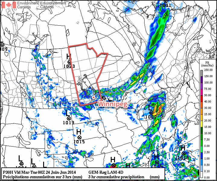
We’ll see cooler weather to start the week alongside some more shower activity as the upper low that has plagued the region for the past week finally makes an exit.
More organized shower activity is expected today throughout much of Southern Manitoba.
Monday
Monday
20°C / 12°C
A mix of sun and cloud with showers.
Today will feature below normal temperatures and a good chance of rain. Shower activity should pop-up relatively quickly during the day as daytime heating destabilizes the atmosphere. High temperatures will be near 20C with a light west wind shifting to northerly in the afternoon.
Tuesday
Tuesday
19°C / 10°C
A mix of sun and cloud with a slight chance of showers.
Tuesday will see temperatures cool a bit further from Monday’s values. High temperatures will be in the upper teens, with a slight chance of showers sticking around. The wind will be breezy and from the north.
Wednesday
Wednesday
22°C / 12°C
A mix of sun and cloud with a slight chance of showers.
Wednesday will see little change from the previous two days. Temperatures will warm slightly from Tuesday, with highs into the low twenties, but a slight chance of showers will remain.
Long Range
We should see temperatures rebound to normal or above-normal values by week’s end. In addition to the warmer weather, models are also indicating that more humid air will return and we may even head into the first multi-day hot and humid event of the summer.
Models also hint at the risk of strong thunderstorms returning by next weekend, but it’s too soon to say for sure.
South Dakota Wessington Springs Tornado – June 18th, 2014
Three members of A Weather Moment team headed out to South Dakota this past Wednesday to chase severe storms and try to catch a tornado. It turned out to be quite the event. Julien has written a summary of what how the chase unfolded.
We left Winnipeg bright and early at 7 am on Wednesday and headed south. Our plan for the day was to target the warm front/triple point in southeastern South Dakota. We reached Fargo by late morning. After getting our internet worked out and had lunch, we continued south to Sioux Falls, South Dakota to reassess things (by then it was mid/late afternoon). We decided to head west a bit to Mitchell first, then Plankinton, SD. It was oppressively humid with dewpoints in the low to mid 20’s and temperatures near 30°C. In fact, as I walked out of the car, my glasses were fogging up! These yielded MLCAPE values around 5,500J/kg resulting in an explosive environment for any storm that formed.
By then, storms to our northwest were strengthening rapidly and rotation became evident on radar imagery. A tornado was also reported by another storms chaser. We were concerned of the possibility that additional storms would fire off south of the existing ones and become dominant. As a result, we decided to wait a little longer. Nothing new was really forming due to a strong cap, so we decided to head west then north of Kimball, SD to view the existing storms. We were impressed! Towers were shooting up extremely rapidly and there was decent structure to the storm. Rotation could be seen in some parts of the storm.
Not too long later, we repositioned north of Plankinton, SD, which was eastward. As we got closer to the storm, two funnels poked out of the trees! It was evident that the one in the distance was a tornado. However, the second funnel was hard to say if it was touching down or not because it was not condensed all the way to the ground. However, it’s impressive seeing 2 funnels simultaneously!
One funnel and a tornado simultaneously, with the one on the left touching down. (Taken by Matt)
We followed the storm eastward and the dominant tornado was not giving up! Even though we were well in the distance far away from the tornado, we could clearly see its circulating winds moving rapidly which was quite impressive. Unfortunately, we did occasionally see debris being picked up. It took several minutes for the tornado to finally rope out and lift… before we witnessed it strengthening and enlarging again briefly. Then it dissipated and that was it for tornadoes for us for the day. After our chase was finished, we had heard that there was serious damage to the town of Wessington Springs, SD however no serious injuries had been reported thankfully.
Stovepipe tornado we observed. (Taken by Matt)
We slowly made our way east to Brookings, SD for the night at a hotel. We left back for Winnipeg Thursday morning before 11 am and reached Winnipeg by around 6 pm or so after stopping by at Longhorns restaurant for a well-deserved tornado steak dinner in Fargo. The next day NWS had done a damage survey of the tornado and rated it an EF-2 tornado, the strongest tornado we had ever witnessed. Overall, it was well worth the trip!
This trough not only produced tornadoes on Wednesday in South Dakota, but also on Monday and Tuesday in Nebraska, including the incredible supercell near Pilger, NE that produced two large wedge tornadoes simultaneously. The upcoming pattern definitely looks calmer with upper flow slacking up in the US Plains; possibly hinting that summer is right around the corner for the region.
This weekend will be marked by scattered shower activity persisting as this week’s stubborn upper low slowly exits the region.
It has been an extremely wet week over the Prairies. Things started off with a system that moved into the region late last week and ended up producing nearly 80% of a month’s worth of rain in just two days for some communities. Here in Winnipeg, another 20-25mm of rain that fell yesterday has put rainfall totals over the last 6 days over 90mm, which is 101% of the average total monthly rainfall for June.[1]
While no significant rainfall amounts are in the forecast for the next few days, we won’t quite be able to shake the wet weather. A laggard of an upper low will slowly work it’s way eastwards into Northern Ontario over the next few days, keeping scattered shower activity over the Red River Valley as it does so.
Friday
21°C / 15°C
Scattered showers. Local amounts 5-10mm.
Saturday
23°C / 15°C
Scattered showers developing.
Sunday
23°C / 14°C
Scattered showers developing.
Today will see some shower activity in the area this morning, then a bit of a break before things warm up and scattered showers redevelop for the midday into the afternoon. Rainfall totals for the day will be highly variable thanks to the nature of the showers, but as a widespread generalization, around 5-10mm could fall in localized areas that end up seeing more shower activity than other areas. The high will be near 21°C with a south or southwesterly wind at around 20km/h.
Some shower activity will persist overnight, likely through much of the Red River Valley, with another 2-5mm falling. The low will be near 15°C.
Saturday and Sunday will be very similar days with highs near 23°C and lows near 14 or 15°C. Both days will see scattered showers developing around midday as the temperature warms up and we hit our convective temperature for the day. The shower activity will likely be more widespread on Saturday than on Sunday, but both days see a fairly likely chance of any one spot getting at least a little wet. Winds will be southwesterly on Saturday at around 20km/h and northwesterly on Sunday again near 20km/h.
A Chance to Dry Out?
It does look like next week will be much dryer than this past week. No precipitation is expected through the first half of the week, but by the second half of the week it looks like another system will begin to work its way into southwest Manitoba and spread eastwards for the weekend. Not much to say about it at this point since it’s a ways out and model agreement is still quite low.
It’s safe to say next week will bring at least a few days to dry out across Southern Manitoba with temperatures climbing towards the upper 20’s by mid-week!
The 1981-2010 average monthly rainfall for June in Winnipeg is 88.9mm. ↩
Although nothing as notable as this past weekend’s rain event is in store, unsettled weather returns for the second half of the week.
Another sizeable low pressure system is making it’s wet presence felt, but this time the hardest hit area will be Southern Alberta where some portions in the foothills may receive as much as 200mm of rain this week. This system will slowly lumber eastwards through the next few days, slowly weakening as it does so but still producing thunderstorms and showers as it goes.
Wednesday: Severe Thunderstorm Risk for Extreme SW Manitoba
Wednesday
25°C / 13°C
More cloud than sun. Warm & breezy.
Winnipeg will see fairly pleasant weather today with mixed skies, likely leaning towards more cloud than sun, and a high near 25°C with a fairly stiff easterly wind at 30-40km/h thanks to a surface trough building southeastwards through North Dakota.
The main upper low, the heart of this large disturbance, will gradually edge eastwards through the day and will trigger thunderstorms, with some severe storms possible, through portions of southern Saskatchewan and southwestern Manitoba. Shower activity will start off the day in much of Southern Saskatchewan, but the southeast portion of the province will likely see things destabilize enough through the day that thunderstorms are likely by mid-to-late afternoon. The storm activity is most likely to initiate through western North Dakota and then build north/northwestward along the surface trough into SE Saskatchewan and into extreme SW Manitoba through the early evening.
There is an organized threat of severe weather with these storms; we’ve gone with a slight risk due to almost every severe weather parameter looking fairly good except lacking in some subtle way. The main threats will be strong winds and large hail, especially out of any storms that develop early and are sustained as discrete supercells. If the storms develop into a cohesive line, the severe threat will be diminished, although non-zero. There will be a very slight chance for tornadoes thanks to excellent low-level shear, low cloud bases, and a vorticity rich environment being advected eastwards by the upper-level low.
Today will bring a slight risk of severe thunderstorms into SE Saskatchewan and SW Manitoba.
The severe storm threat will push eastwards into the Virden & Melita regions of Manitoba in the early evening with the main threats being strong winds and large hail. It does look like the tornado threat should be restricted to the Saskatchewan side of the border. Southwest Manitoba is in for quite a soaking overnight as the storms expand into an area of convectively driven rain; around 15-20mm is likely for most areas south of the Trans-Canada Highway and west of the Red River Valley (RRV), with as much as 40-50mm possible in areas that see thunderstorm activity as well.
As the area of showers pushes eastwards, it will gradually weaken into an area of showers with possible embedded thundershowers. It looks to reach Winnipeg by Thursday morning.
Thursday: Back to Wet Weather
Thursday
23°C / 14°C
Periods of rain. Around 10mm.
Thursday will be a cloudy day with a high near 23°C. Shower activity will be in the region in the morning and lift off to the northwest, however while that happens a new batch of rain will be develop to our south and lift northwards through the RRV. Around 10mm seems most likely through the day across most of the region, although if heavier shower activity ends up developing we may see closer to 15mm here in Winnipeg.
The shower activity will taper off on Thursday evening as it all lifts northwestwards into the Interlake and Parkland regions of the province. Winnipeg will see some clear breaks and a low near 14°C.
Friday: Cold Low Showers
Friday
23°C / 14°C
Mixed skies; showers or thundershowers developing midday.
Friday will see us underneath the upper-level low which essentially means that there will be a bunch of cold air high up in the atmosphere. With mixed skies, we’ll see temperatures increase towards our high of 23°C fairly quickly through the morning. By mid-day, we’ll likely have hit our high temperature and the atmosphere will become quite unstable. Expect widespread shower and thundershower activity through the Red River Vally. Rainfall amounts will be highly variable and dependant on how many showers any one spot sees and how fast things move along.
Overnight, the shower activity will consolidate to right around the upper low on Friday night as it drifts through our region and into Minnesota. The temperature in Winnipeg will drop to around 14°C.