Severe Weather, including Tornadoes Rip through United States
It’s been a rough week in the south-central United States for tornadoes. Monday and Tuesday warranted two consecutive high risk outlooks by the SPC for central Arkansas and Mississippi/Alabama, respectively. The system did continue on further to the Carolinas, but conditions weren’t as ripe for tornadoes. As of Friday evening, NWS had confirmed 67 tornadoes from the outbreak and from these, 11 were of EF-3 strength or higher.
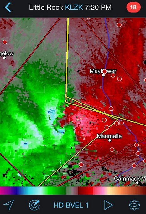
Sunday was predicted to be a big day tornado-wise across Arkansas but cloudy conditions in the morning prevented much daytime heating from occurring. A mesoscale convective system (MCS) had also passed through the region the night prior which could have further disturbed the environment. With that said, the environment did manage to sustain a violent supercell in central Arkansas on Sunday which spawned the EF-4 Mayflower/Vilonia tornado. The tornado was on the ground for a length of 66.5km, at its peak produced winds of 300km/h and had a width of 1.2km. Unfortunately 15 people perished from this tornado.
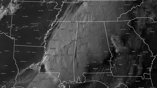
Monday was a threatening day with numerous supercells lined up from southern Tennessee all the way down to southern Mississippi, all a posing threat to drop a tornado because of the volatile environment. The Louisville, MS tornado was one of the most significant one spawned on this day, with an EF-4 rating. It tore through the town killing 9 people and injuring several more. The tornado was on the ground for about an hour, traveling 57km. Another town that took a direct hit on that day was Tupelo, MS. The tornado, which had an EF-3 rating, passed through the northern part of the city taking the life of one person.
Tornadoes were not the only thing that this system produced on Tuesday night as the MCS stalled out over the Pensacola area of Florida producing flash flood conditions across the region. Interstates were underwater, roads got washed out and parking lots full of cars could be seen underwater. Record-breaking amounts were recorded from this event (provided by Jeff Masters blog):
- 144mm of rain in one hour
- 520mm of rain for the event
This weekend the pattern is much calmer across the Southern US and Plains as the atmosphere recharges for the next trough coming ashore next week.