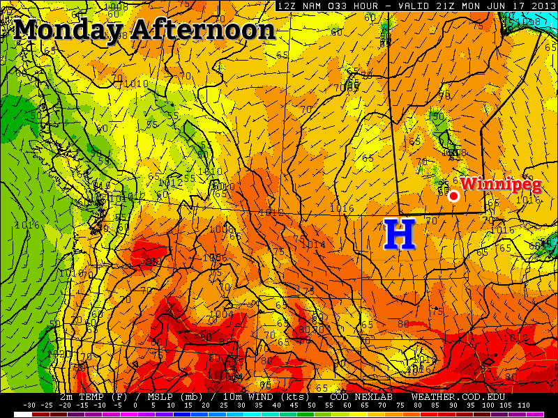
A broad shift in the jet stream is set to bring an influx of moisture from the Gulf of Mexico northwards into Southern Manitoba while a southwesterly flow aloft sets up bringing multiple upper-level disturbances & instability over the region. The increased moisture, combined with the relatively unchanging southwesterly flow will set us up for multiple days with a significant thunderstorm risk over the southern portion of the province.
Wednesday
26°C / 15°C
Afternoon clouds; chance of showers/thunderstorms.
Today’s weather will be dominated by an approaching warm front from Saskatchewan. We’ll might see few showers exiting the Red River Valley this morning – left over from some weak nocturnal convection – with plenty of sun through the morning. The sun will heat things up fairly quickly and there’s a chance we’ll see some showers or thunderstorms develop early-to-mid afternoon as we warm up. Any storms that develop today will not likely become severe; a majority of the shear will be isolated in the upper levels and the complete lack of low-level shear may even be substantial enough to inhibit storm development. We’ll drop to an overnight low of around 15°C as we head into a busy end of the week.
Thursday
25°C / 16°C
More cloud than sun; getting humid. Showers or thunderstorms likely.
Thursday presents Southern Manitoba with plenty of heat and rising humidity as the day progresses. We’ll see a high of nearly 26°C while the dew point climbs into the high teens through much of the Red River Valley by the end of the afternoon. Whether or not that humidity will make it up to Winnipeg will depend on how soon the winds turn from northeasterly to southeasterly; the sooner they do, the more humid we’ll get. The building heat and humidity will create a fairly potent setup for severe storms, however.
By late afternoon CAPE values are expected to climb to 2500–3000J/kg near the international border thanks – in no small part – to the climbing dew points. LI values are forecast to drop to the –8 to –10°C range, indicative of the steep lapse rates aloft and the potent storm potential. Good wind shear will be in place with southeasterly surface winds veering to a strong westerly wind at 500mb. In addition, a shortwave is forecast to eject into Central North Dakota by mid-afternoon and push northeastwards into the RRV by evening, bringing with it enhanced destabilization and lift. One big question mark remains, though. While we have plenty of moisture, instability, shear, and a trigger, the cap may be make or break storms for the day, or rather, the lack of a cap may.
Models are having a hard time determining just how warm it will be in the mid-levels of the atmosphere; some want to establish a cap that will inhibit convection until later in the day, but others keep the environment uncapped which will result in the maintenance of an MCS coming out of Saskatchewan on Thursday morning. In that case, we’d see showers and thunderstorms build into the Red River Valley in the morning and persisting through much of the day. Conditions still look somewhat favourable for the development of isolated strong to severe storms in this scenario, despite the ongoing showers and thunderstorms. If the cap does develop though, the MCS will likely die out to our west and a significant threat for severe thunderstorms would mount in the Southern Red River Valley.
It’s still too early to be too certain on the threat for Thursday as models are still working to resolve the interaction with various shortwaves and the main upper low anchored over the American mountain northwest. For now I’ve extended a slight risk through Southern Manitoba along the International border.
Friday
26°C / 13°C
Mix of sun and cloud; humid.
Friday will end up a fairly hot day with temperatures climbing into the mid-to-upper 20’s with dew points rising to nearly 20°C. The humidity will make it feel closer to the low-to-mid 30’s, so it definitely looks to be one of the first really hot days of the year. Conditions should hold out through most of the day before thunderstorms develop in North Dakota and begin pushing northwards. It’s still too early to tell their exact path which will be heavily dependant on where exactly upper-level features lie. They may end up moving into SW Manitoba, the RRV or the Whiteshell through Friday night.
We’ll have a busy few days ahead so expect plenty of updates in the comments below! Briefly looking ahead to the weekend, Saturday and Sunday both look showery over much of Southern Manitoba with a risk of thundershowers. There will be some breaks here and there, but we’ll take a closer look at that on Friday.


