Arctic air will keep temperatures cool through the weekend with daytime highs some 5-7°C below normal. Scattered flurries will be common through the weekend, while a significant lake-effect snowfall event will impact portions of the Whiteshell and Eastern Manitoba.

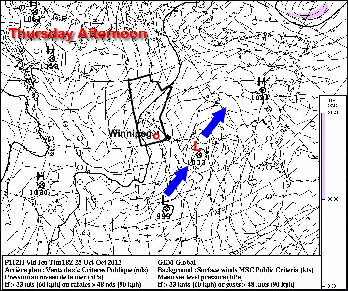
As the low that brought rain to Southern Manitoba the past few days pushes northwards into Hudson Bay, it will intensify quite considerably1 and induce a strong northwesterly flow over the Canadian Prairies. This cold air will likely produce isolated scattered flurries, however the largest effect will be strong lake-effect snow bands, primarily from the basins of Lake Winnipeg. These lake-effect bands will mainly effect the Bisset region and slowly push northwards towards Berens River as the winds back slightly to westerly through the weekend. Substantial amounts of snow are possible with these bands, with the potential for anywhere from 15-30cm of snow possible in areas that see a band have a particularly long residence time over them.
Daytime highs over the next few days will sit within a degree or two of 0°C, with overnight lows near -6 or -7°C. No significant improvement in temperatures is expected until potentially early next week as a low pressure system moves through the Central Prairies and brings ever so slightly warmer air back to the region.
- It’s currently forecast to deepen from a 982mb low this morning to a 967mb low tomorrow morning. ↩