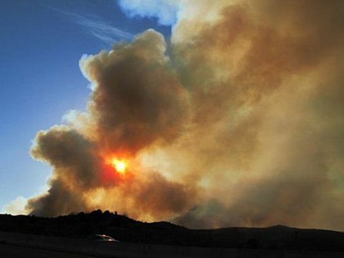
Warm weather will continue over Southern Manitoba this week which, while great news for those of us who enjoy summer-like weather in May, will continue to sustain dangerous fire risk conditions. This news is not welcome to firefighters who are already battling two substantial fires: a 1,300 hectare fire southeast of Steinbach and a 200 hectare fire near Piney, MB.

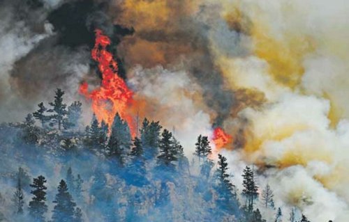
Wildfire burning near Whitemouth Lake. This is one of two large fires crews are battling to contain in southeast Manitoba. Photo credit:
Anonomous CJOB ListenerHot, dry weather is expcted to continue today as Southern Manitoba continues to be flooded with a mild, Pacific flow. We’ll see a daytime high today of 28°C with winds once again out of the west/southwest at 30-40km/h with gusts up to about 50km/h. Dewpoints will remain in the low single digits, which will continue to challenge crews as they try to contain the wildfires.
A cold front will sweep through this evening, however one would be challenged to notice. Winds will shift to the north, but we’ll see overnight lows similar to before as the temperature dips to only 8°C tonight. Very little cloud is expected with this moisture-starved cold front over the Red River Valley, let alone any chance of precipitation. There is a slight chance of a shower or thundershower over the Whiteshell, however if they occur they will be short-lived and produce little rainfall accumulation. It looks like the best chance for any showers is on the Ontario side of the border.
If you enjoy sunshine, the rest of the week will be right up your alley. Temperatures will hover in the low 20’s for Tues/Wed. before a warm front pushes over S. MB and pushes temperatures up into the mid-to-high 20’s for Thursday and Friday. It looks like there may be a chance of showers or thunderstorms as the warm front pushes in on Thursday, however it currently looks like the best support will remain in North Dakota, leaving us with some clouds, but no precipitation. The biggest change with Thursday’s system will be the switch from a Pacific flow to a Gulf flow, which in addition to warm temperatures will also bring moister air to the area, which should lessen the fire risk somewhat.
Pacific Flows vs. Gulf Flows
These two flows are large-scale weather patterns that dictate where the air is coming from and, especially here in Southern Manitoba, are two of the main large-scale flows we deal with in the summer months. Those two words carry with them significant information about the weather and one can make a quick assesment of what sort of weather to expect if you have a basic understanding of the differences.

Diagram of a Pacific flow. Image is from the GEMGLB model, valid this morning.
First, the Pacific Flow. This is what Southern Manitoba is under right now. This flow occurs when there’s a large blocking high over the western United States. Moist Pacific Ocean air flows NE up and over the high and associated ridge into the NW United States and British Columbia (represented by the green arrows in the diagram above). Once it reaches the mainland, it begins to rise up and over the mountains. As the air rises, it cools and water is forced out of it, falling as rain or snow on the upwind side of the mountains (represented by the shaded green area above). Once it reaches the other side of the mountains, the air descends downwards, warming as it goes. What’s left on the leeward side of the mountains is air that’s warmer than it was when it started it’s trek over the rocks, but substantially drier. This air then spreads eastwards over the Prairies (represented by the brown arrows above), bringing pleasantly warm weather, but very dry and often windy conditions as well, usually with dewpoints in the single digits.

Diagram of a Gulf flow. Image is from the GFS model, valid Thursday evening.
A Gulf Flow also brings very warm conditions to Southern Manitoba as well, however it does so not through trickery of thermodynamics, but rather through brute force. This flow develops when a longwave trough is present over the west coast of the United States (as opposed to a ridge). The flow in the lower atmosphere organizes itself to flow from south to north in response, and heat and moisture from the Gulf of Mexico begins its trek up through the Plains of the United States. The longer this flow can stay in place, the further north the heat and moisture can travel; Southern Manitoba usually ends up under the influence of this air mass at least a couple times each summer. What characterizes this air mass? Hot weather, usually in the upper twenties, though often in the low-to-mid 30’s, and high dewpoints, often at least 18°C, but commonly in the 20-24°C range.
Under the influence of a stifling gulf flow, Carman, MB set the record for the highest Humidex value (a ‘feels-like’ for heat) ever recorded in Canada in 2007. On July 25, 2007, the temperature climbed to 34°C with an unbelievable dewpoint of 30°C, which produced a Humidex value of 53, beating out the old record of 52.1 set in Windsor, ON in 1953.
It’s always a good idea to keep an eye on the forecasts when under the influence of gulf flows; given the transport of so much heat and moisture, it is under the influence of these flows that we often see the risk for powerful thunderstorms.
Dewpoint vs. Relative Humidity?
You may notice that we often refer to the dewpoint on our blog, and not to the more commonly used term, Relative Humidity (RH). What’s the difference? There are several:
- The dewpoint is an absolute measurement. Relative humidity is, obviously, relative.
- The dewpoint is reported in °C, and is a measurement of how much water is contained in the air. Relative humidity is reported in % and is a measurement of how much of the water-bearing capacity of the air is being used. As air becomes warmer, it can hold more water.
- The easiest way to understand the dewpoint is simple: how cold would something have to be so that when you put it out in the open air, it would “sweat”.
- When dewpoints are low, the air has little moisture in it, and when they are high, it has more water in it. People often notice the moisture in the air once dewpoints reach around 12-13°C. Once they exceed 16-18°C, many people would actively notice that it was humid, and once the dewpoint exceeds 20°C, many begin to find it uncomfortably humid.
- Conversely, one cannot make any absolute claim with a relative humidity measurement alone, nor does the RH actually let you know if it’s humid or not. A RH reading of 100% only means that the air is holding as much water as it can. There are two major problems with this. The first is that the RH changes through the day, even if the amount of water in the air (the dewpoint), does not. If the day starts off at 8°C with a dewpoint of 8°C, the RH is 100%. If the dewpoint stays at 8°C but it warms up to 21°C, the RH drops to 43%, despite the fact that there’s no more or less moisture in the air. The RH would then climb back towards 100% in the evening as the air cools. The second problem is that a RH of 100% can be extremely deceptive. If the temperature is 30°C and the RH is 100%, one could barely spend any time outside it would be so unbearably humid. Fortunately, this situation is extremely rare. If the temperature is -25°C and the RH is 100%…well it’s certainly not humid out. In fact, RH values are often quite high in winter since as the air cools, it can hold less water, so it uses more of it’s water-carrying capacity with smaller amounts of water.
All that to say that RH is a pretty messy, inconsistent measurement that when presented by itself doesn’t actually tell you much about anything. Dewpoint, on the other hand, is a consistent measurement that quantifies how much water is actually in the air and can tell you something about the weather when presented by itself. And that’s why we prefer to use dewpoint here on AWM.