Heading Into A Heat Wave

Winnipeg will see temperatures soar this week as scorching heat builds into the region.

Winnipeg will see plenty of sunshine over the next few days as an upper ridge builds into western Canada. On Tuesday, a weak low moving through southern Manitoba will bring a few more clouds into the region. As it slumps southwards, it will bring a chance for scattered showers or thunderstorms. The support for thunderstorms will be weak — bulk shear will sit at 20–30 knots and try to offset the limited energy — but there will likely be enough forcing to support a few. Skies will clear out again for Wednesday.

RDPS 500mb Wind and Temperature Forecast valid 21Z Wednesday June 2, 2021
A potent upper ridge will build out of the western United States into the Canadian Prairies this week.

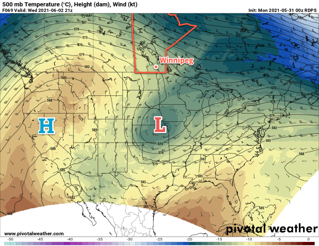
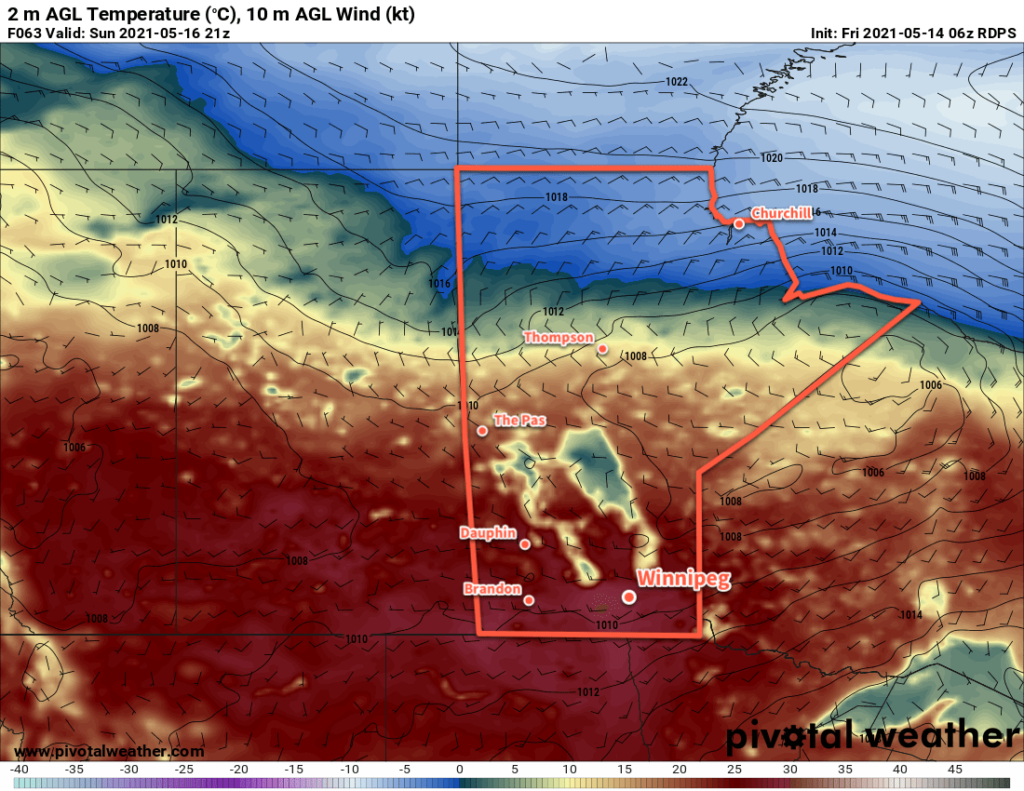
The big story will be the building heat this week. As the upper ridge strengthens over the Prairies, Winnipeg will see daytime highs rise from the low 20s today to around 30 °C by Wednesday. Overnight lows will follow suit increasing into the upper teens by mid-week.

Long Range Outlook

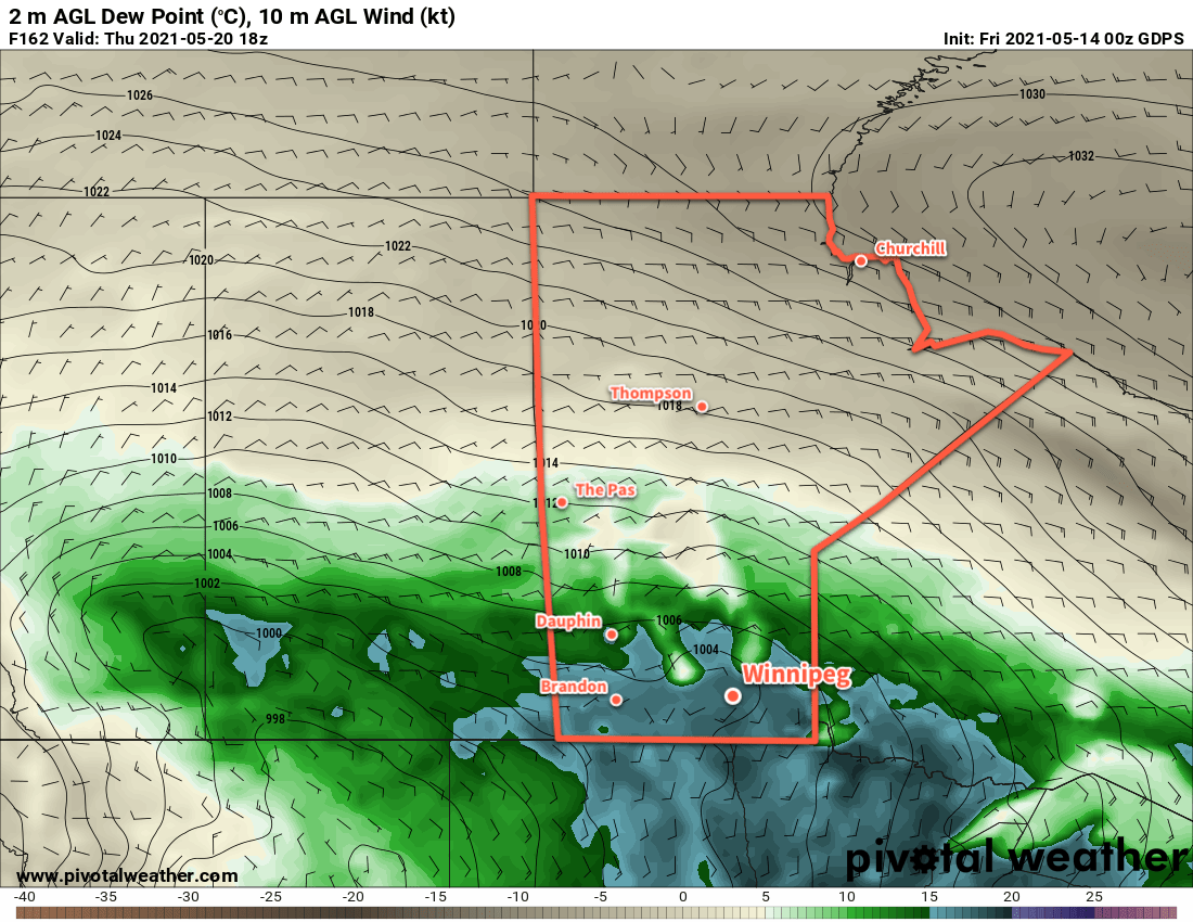
The heat will continue to build through the latter half of the week. Daytime highs should peak on Friday in the mid- to upper 30’s as overnight lows stay in the upper teens. Fortunately, dew points are forecast to stay in the low to mid-teens, so humidex values won’t be a significant component of the heat wave. The hot weather will continue into the weekend, then begin to ease as unsettled conditions develop on Sunday into next week.

Today’s seasonal daytime high in Winnipeg is 22 °C while the seasonal overnight low is 8 °C.

Warm And Occasionally Unsettled Weather Continues

Warm and mostly dry weather will continue in Winnipeg through the weekend.

Another in a series of weak disturbances will move through southern Manitoba today. It will bring mixed skies to the region with another chance of scattered showers this afternoon. Temperatures will be mild with a high near 23 °C and winds will be generally light. With the dry conditions, any showers will be capable of producing locally gusty winds up into the 50–70 km/h range. The cloud cover will break up tonight with temperatures heading to a low near 9 °C.

On Saturday, the region will see light winds with partly cloudy skies. Temperatures will head to a high near 23 °C again. By the evening, an organized low crossing the northern Prairies will push a warm front eastwards through the region. As it passes, it will bring a chance of showers to the region. The rest of the night should see partly cloudy skies and a low near 12 °C. Southerly winds will strengthen to around 20 km/h overnight.

RDPS 2m Temperature Forecast valid 21Z Sunday May 16, 2021
Daytime highs of 25–30 °C will develop over southern Manitoba on Sunday.

Sunday will bring the heat to southern Manitoba. Well into the warm sector of the northern Manitoba low, breezy southwest winds of 30–40 km/h will send highs into the upper 20s. A trough will slump southwards into the region through the afternoon. It will bring a chance of showers with it, and behind it winds should diminish a bit and turn westerly. The region will see a few clouds Sunday night with diminishing winds and a low near 12 °C.

Long Range Outlook

Another organized low will start moving out of central Alberta on Monday, bringing a renewed push of warmer air into southern Manitoba. Temperatures will be very warm through the first half of the week.

By mid-week, the persistent southerly flow will bring a pool of Gulf of Mexico humidity into the northern Plains of the United States, potentially into southern Manitoba as well. As this moisture approaches, forecasts show a deep upper trough moving into western North America. These two features will combine to bring more humid and unsettled conditions to southern Manitoba in the second half of the week.

GDPS 2m Dew Point Forecast valid 18Z Thursday May 20, 2021
Forecasts show a substantial increase of humidity in the latter half of next week with dew points climbing into the upper teens.

The potential exists for significant rainfall, which would be welcome relief for the drought conditions. This unsettled period could also bring the first well-organized thunderstorm risk to the region, but if the forcing is too strong, it will favour broad areas of showers instead.

So after another warm and mostly dry 5 days, the region should see a shift into a more humid and unsettled pattern.

Today’s seasonal daytime high in Winnipeg is 20 °C while the seasonal overnight low is 5 °C.

Warm Weather Ahead

Winnipeg will see daytime highs climb above freezing right through the weekend.

A broad upper ridge of the Prairies will bring plenty of sunshine and warmth to Winnipeg over the coming days. Both Friday and Saturday will bring plenty of sun to the city along with highs near 6 °C. The winds will stay light today, but a low pressure system moving from Saskatchewan into northern Manitoba will bring southerly winds of 40 gusting 60 km/h to the Red River Valley on Saturday. Lows will dip to around -6 °C tonight and just below freezing on Saturday night.

GDPS 2m Temperature Forecast valid 00Z Monday March 8, 2021
Mild temperatures will spread across the Red River Valley on Sunday.

On Sunday, Winnipeg will see mostly cloudy skies as a low and associated trough moves through the province. No notable precipitation will fall over southern Manitoba, but skies should stay mostly cloudy through the day. It will be warm with a high near 8 or 9 °C, but will be a few degrees warmer than that over the western Red River Valley. Winnipeg may climb over that high if the westerly winds arrive earlier in the day or a bit more sunshine materializes. Winds will ease midday into the 20–30 km/h range, then shift westerly as the trough passes.

Winds will ease Sunday night with lows near -2 °C and partly cloudy skies.

Long Range Outlook

Conditions will turn a little more unsettled next week as low pressure system moves out of the Northern Plains into the region. Winnipeg may see some rain or snow on Tuesday, followed by some sun and slightly cooler — but still seasonably mild — temperatures.

Today’s seasonal daytime high in Winnipeg is -4 °C while the seasonal overnight low is -14 °C.

Spring-Like Warmth To Start The Week

A Pacific low will bring breezy westerly winds and temperatures well above freezing to southern Manitoba today.

A Pacific low crossing the province has pushed a warm front through overnight, bringing breezy westerly winds near 30 km/h and a mild air mass to the region. Temperatures will climb to a high near 6 °C this afternoon in Winnipeg with even gustier winds as high as 40 gusting 60 km/h developing. A weak cold front will push through this afternoon, bringing more cloud cover and a chance of a few showers turning to flurries this evening.

The wind will shift northwestwards overnight as it eases and temperatures will dip to a low near -6 °C. Skies will stay partly cloudy.

RDPS 2m Temperature Forecast valid 21Z Monday February 22, 2021
The southern Prairies will see spring-like warmth today.

On Tuesday, Winnipeg will see mostly cloudy skies as an Alberta Clipper drops from Saskatchewan into the Dakotas. Winnipeg shouldn’t see any snow from this system, but areas over the southwest corner of the province may receive as much as 5–10 cm of snow with amounts diminishing heading eastwards into the Red River Valley. Temperatures will warm back up to a high near -2 °C with a light north wind. The cloud cover will break up a bit on Tuesday night as temperatures dip to around -15 °C.

A ridge will move across the province on Wednesday bringing quiet weather to the region. Temperatures will climb to a high near -8 °C with light northwest winds and mixed skies.

Long Range Outlook

Another strong Pacific low will move across the Prairies in the second half of the week, bringing warm and windy weather back to southern Manitoba on Thursday. Heading into Friday, some rain or snow is possible, followed by a strong cold front on Friday night. Colder temperatures will move back in for the weekend with lows potentially dipping back into the mid-minus twenties. The cold weather will be short-lived, though, with near-freezing highs forecast to return early next week.

Today’s seasonal daytime high in Winnipeg is -6 °C while the seasonal overnight low is -17 °C.