Eastern Australia Sees another Coastal Low

Elsewhere in Weather News posts are beginning to sound like a broken record with all the recent flooding stories coming out of Australia. This past week there were yet again significant flash flooding problems across regions of Australia.

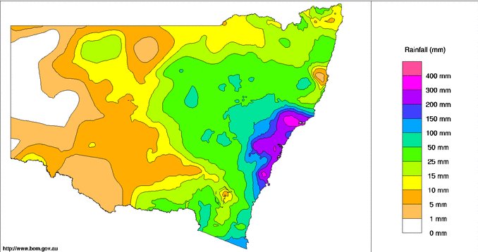
[map zoom=”11″ type=”hybrid” autofit=”1″ disable_scrollwheel=”1″] [pin tooltip=”Last week’s flooding”]Maitland, AU[/pin] [pin tooltip=”This week’s flooding”]Lismore river[/pin] [/map]

Northern New South Wales and southern Queensland were hardest hit this time as a low pressure quickly wrapped up just off the Eastern Coast of Australia – very similar to the setup that occurred last week. Observation sites indicate that there was a large swath of 150-200mm that fell across Northern NSW along the coast in just over 24 hours. With already saturated soils from the past week’s storm that dumped around 50mm in the same area, conditions were primed for flash flooding once the heavier rain bands arrived. Similar to last week’s low featured in EIWN, strong wind gusts of up to 100km/h were also observed.

Surface Map analysis from overnight Thursday shows the east coast low just off Australia's eastern shores and the tropical storm Quang about to make landfall on Western Australia territory. (Source: BoM)
Surface Map analysis from overnight Thursday shows the east coast low just off Australia’s eastern shores and the tropical storm Quang about to make landfall on Western Australia territory. (Source: BoM)

Flash flooding was the main cause of the damage in the region once again, as roads washed out and numerous homes were inundated. The Wilson and Lismore rivers were expected to peak later today at a moderate flood stage, meaning that properties along the banks of the rivers are at risk. In total, six people died from the most recent flood events, five of the six as they attempted to drive through flood waters that covered roads. This brings a harsh reminder to residents that when roads get flooded out it’s best to turn around and not drive through.

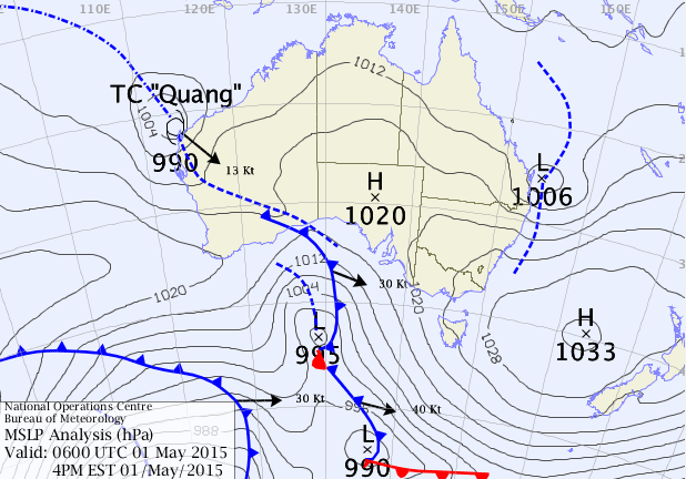
The east coast low wasn’t the only form of severe weather to affect Australia this past week – a cyclone also formed in the Eastern Indian Ocean and strengthened in to a category four over open waters. After substantially weakening due to cooler waters near Australia’s coast the system made landfall on Northwestern Australia’s shores as a tropical storm, prompting officials to issue rainfall warnings in the region. Damage from the storm appears to have been minimal, other than some minor flooding.

Deluge of Rain Falls on Eastern Australia

A persistent area of low pressure off the coast of Eastern Australia is to blame for extreme amounts of rainfall that fell during the mid-week.

[map autofit=”1″ disable_scrollwheel=”1″] [pin]Sydney[/pin] [pin tooltip=”Maitland”]Maitland, Australia[/pin] [pin tooltip=”Dungog”]Dungog, Australia[/pin] [/map]

An upper level low that was cut-off from the main jet stream to the south was the reason for the slow movement of the surface low. Sydney and surrounding regions were hardest hit from the storm where over 300mm fell in some areas in less than 24 hours. Dungog and Maitland, towns north of Sydney, received some of the highest amounts in the region; 312mm fell in Dungog in 24 hours and 301mm fell in Maitland in the same amount of time. Sydney received 225mm during a two-day span – relatively speaking, this is a significant rainfall for them. According to the Australian Bureau of Meteorology this was the most rain Sydney has received during two-day period in more than a decade. What made conditions even worse was that winds howled to 80km/h in Sydney and over 130km/h in three separate regions on the east coast of Australia. The high winds made for swells of over 6m out at sea.

The state of New South Wales is pictured with one-week rainfall totals. Bright pink shaded areas are areas that saw over 300mm of rain fall throughout the week.

Due to the high winds and flooding rains, power to 215,000 people was knocked out in the region. In addition to that, creeks quickly became dangerous, fast-flowing rivers in the Dungog region. Several houses in Dungog were washed away due to the floodwaters and unfortunately four people perished.  There were also 150 water rescues that had to be executed. As of Friday morning where were still a few thousand people isolated by floodwaters that cut off main roads. In total, 12 communities were officially declared a natural disaster area by the government – insurance companies estimate the damage to be around 100 million dollars.

Since then the soggy weather has continued, off and on, throughout the end of the week. With another system and associated cold from arriving from the west today, the chance for rain continues – amounts will be nowhere near the ones that were observed this past week, however.

Elsewhere in Weather News: March 21st, 2015

Maritimes Experience a Winter to Remember

With spring now in place Maritime residents would expect to see more forgiving weather than they have been experiencing this past winter. However, this has not been the case this past week. The East Coast has been hit with another strong coastal storm that brought blizzard conditions and large amounts of snow Tuesday-Wednesday. A fairly deep low pressure system was anchored just off the coast and drew in some cold air in behind – conditions right for a blizzard.

[map autofit=”1″ disable_scrollwheel=”1″] [pin]Halifax, NS[/pin] [pin]Saint John, NB[/pin] [/map]

Halifax was especially hit hard by this storm with a general 35cm falling in the city, with some higher amounts reported. These combined with winds that gusted up to 113km/h to create blizzard conditions. Schools, businesses and government offices were forced to shut down and no public transit was running. Currently, Halifax has a whopping 93cm of snow on the ground which almost doubles the old record of snow on ground of 51cm in 1967 for today (records for snow on ground have been kept since 1955 in Halifax). Saint John, NB even had more snow than that on the ground after the storm – 169cm of snow was on the ground Thursday.

Sidewalks in Halifax are getting quite narrow after the most recent snowstorm. (Source: Twitter/@HadynWatters)

Unfortunately, yet another system is set to affect the Atlantic Provinces as another strong trough makes its way towards the East Coast. The storm will really ramp up later this afternoon – numerous types of precipitation will be in play, with mostly rain near the shoreline, transitioning to mixed types and finally heavy snow as you head further inland. The highest snowfall amounts are expected to be around 40-50cm where it will be all snow, and as much as 20mm of rain could fall in Halifax. City crews have begun clearing city drains to limit the flooding that could take place if most precipitation falls as rain in Halifax.

In other news, Australia has been hit with another strong cyclone this week. The cyclone had a fairly small inner core, but still managed to bring winds of up to 170km/h near Cooktown and a decent storm surge to the coast. Thankfully no injuries were reported with the storm and it is currently in the dissipating stage over northern Australia.

Elsewhere in Weather News: January 10th, 2015

Bushfires Rage across Southern Australia

Dangerous wildfires flared up in the tinder-dry Adelaide region of Southern Australia early this past week, forcing residents to evacuate their homes.

It is not known what started the large bushfires, but weather conditions were the primary factor as to why the wildfires were able to spread so quickly. Long-term drought which has reached severe levels in the region was the first cause for concern that bushfires were possible. This past week’s summer-like weather was what caused the risk to turn into reality as temperatures rose anywhere between the mid-30s to as high as 42.5°C in the region. These temperatures combined with strong, dry (northerly) winds blowing from central Australia was all that was needed to fuel the fires. In total, a few thousand people had to be evacuated and about 40 houses and 12,500 hectares were lost from the bushfires even though nearly 2,000 firefighters battled the flames. The good news is that no severe injuries were reported and firefighters were able to save nearly 1,000 houses in the region.

Picture taken last Sunday outside Adelaide of the bushfires. (Source: Matteo Barr // @Matteobarr)

Since mid-week fires have been under control, mainly due to more favourable weather conditions. A trough of low pressure brought both rainfall and cooler temperatures. The bushfire season is typically most severe from December to March in Southern Australia as temperatures soar and rainfall is scarce (January average of 25mm). Weather in the Adelaide region looks to remain fairly tame as the trough of low pressure lingers and brings overcast skies with occasional showers and cooler temperatures.