Winnipeg will see its first shot of bitterly cold Arctic air as a ridge of high pressure builds into the region this week.
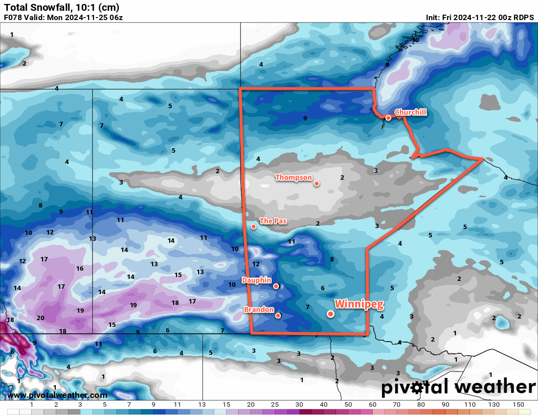
With the system that brought 15 to 20 cm of new snow to Winnipeg on its way out, the next system to shape the weather in the region will be an Arctic High building into the province from the north.
Before it gets here, though, a weak disturbance will move through the region today. It will bring a little bit of light snow, perhaps another 2–4 centimetres, today and then sweep a strong cold front southwards.
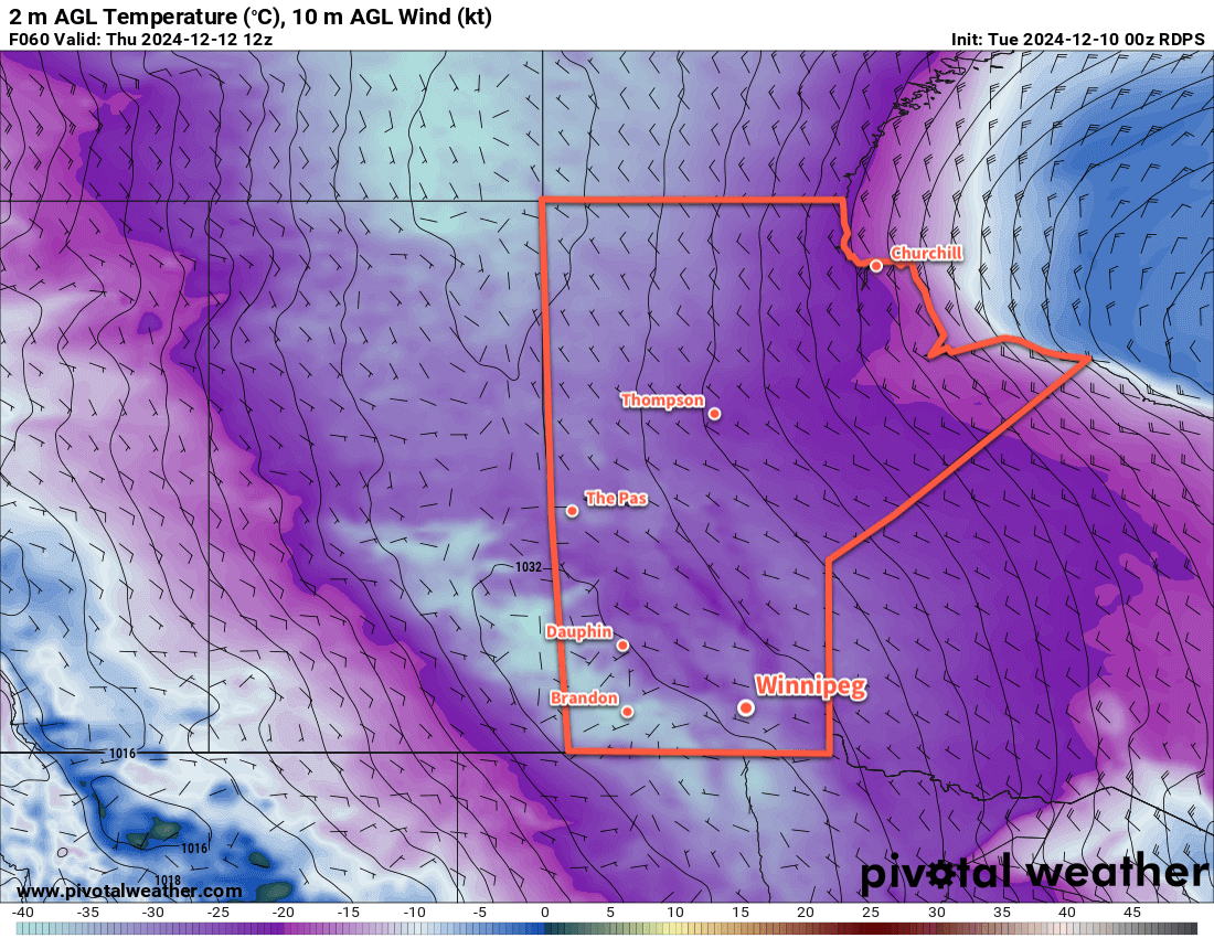
Temperatures will plummet behind the front as northerly winds of 30–40 km/h drive Arctic air southwards. A seasonable high near -10 °C today will quickly be forgotten as skies clear tonight and temperatures head to a low in the mid-minus 20s.
The Arctic High will be in full force through the rest of the work week. With plenty of sunshine, daytime highs will struggle to climb into the -25 to -20 °C range with overnight lows dipping back into the -25 to -35 °C range. Wind chill values will likely get close to -40 at times on Wednesday night and Thursday night.
Long Range Outlook
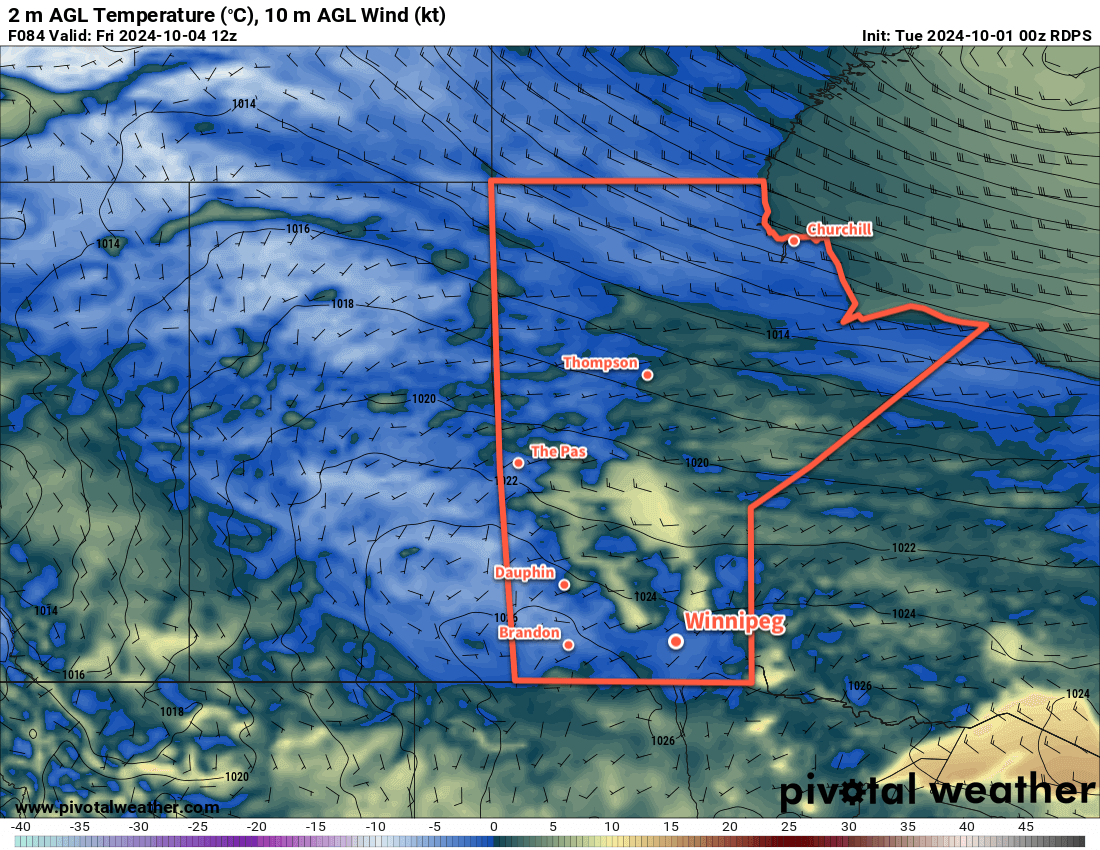
Temperatures will begin to moderate on Friday as the high begins to weaken and the core of coldest air moves out of the region. Daytime highs should climb back above -20 °C but breezy southerly winds will have a bite to them and produce wind chills that make it feel much worse.
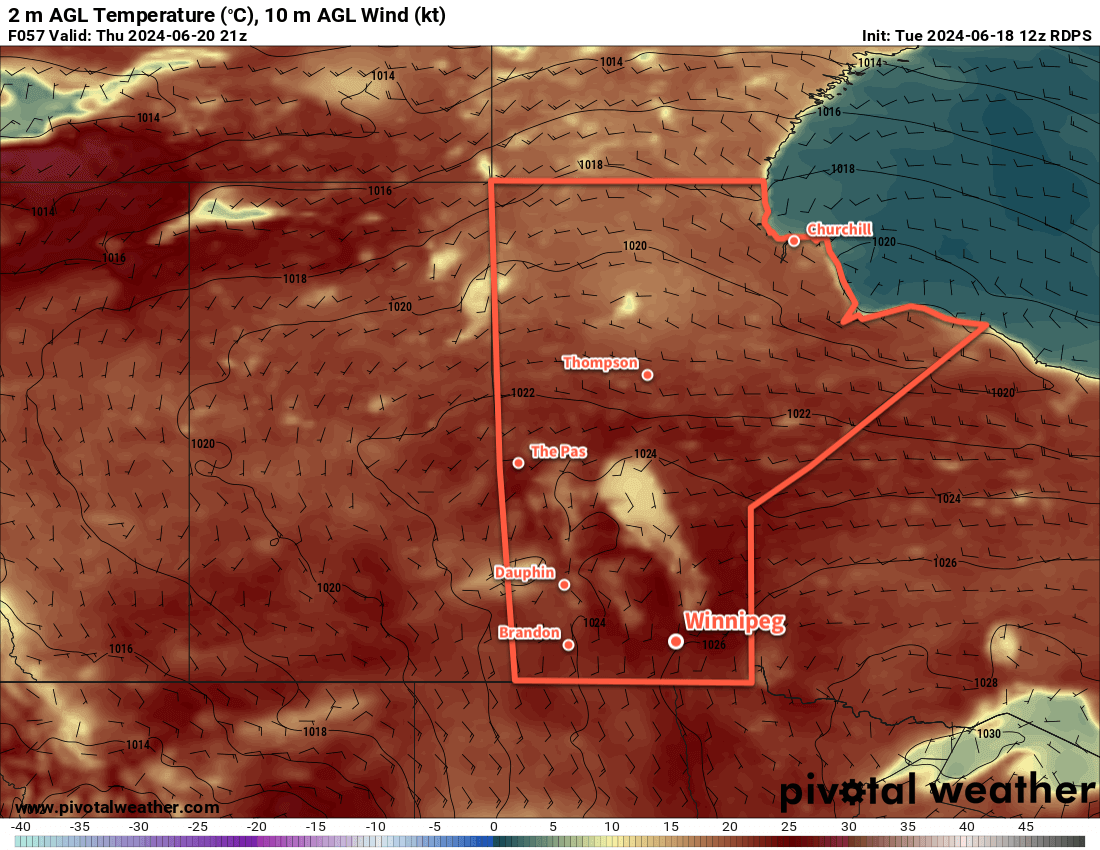
Temperatures will climb back to seasonal values for Saturday and continue warming on Sunday. The region will likely see mixed skies through the weekend.
A bit of snow is possible later Sunday into Monday ahead of colder temperatures slumping back into the region.
Today’s seasonal daytime high in Winnipeg is -9 °C while the seasonal overnight low is -18 °C.