Heat Continues

The hot weather will continue into this week, with some of the hottest weather of the season on Monday and Tuesday.

Monday Afternoon Temperatures in Southern Manitoba

Monday

Monday

Mainly Sunny
33°C / 15°C

Monday will be a hot, but decreasingly humid day. The morning and early afternoon may be on the humid side, but a westerly wind and mixing of drier air from aloft should remove a fair amount of moisture from the air by late afternoon into the evening. Highs on Monday will be in the low thirties, with nice sunny skies.

Tuesday

Tuesday

Mainly Sunny
33°C / 12°C

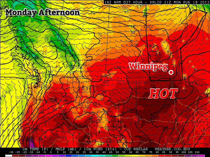
Tuesday will again be hot, but not humid. Another plume of hot air coming off the Rockies will allow temperatures to climb into the low and maybe even mid thirties over Southern Manitoba. Just south of the border there may be the potential for upper thirties temperatures in the Fargo and Grand Forks areas. Depending on how far north this plume of warm air pushes, actual temperatures may be slightly warmer or cooler than suggested above. Again, no rain is expected.

Wednesday

Wednesday

Mainly Sunny
24°C / 10°C

A strong cold front will push through on Tuesday night, setting up significantly cooler conditions for Wednesday. No significant weather is expected with this front, owing to a dry airmass ahead of it, although a stray shower or weak thunderstorm cannot be ruled out. Highs on Wednesday will only be in the low to mid twenties. The wind will be gusty and from the north-west.

Long Range

Beyond Wednesday it looks like warmer weather will return once again, with temperatures in the upper twenties, or maybe low thirties, looking possible from late this week into next weekend. Summer appears to be making a long term stay.

Nice Holiday Monday, but Then it Gets Ugly

The last day of the long weekend will be quite nice, but then conditions will turn ugly for Tuesday as a strong cold front pushes through.

Monday will be a Generally Pleasant Day in Southern Manitoba

Monday

Monday

Mix of Sun and Cloud. Chance of Showers.
25°C / 14°C

Today will be fairly nice in Southern Manitoba. Afternoon temperatures will be in the mid twenties under a mix of sun and cloud. The atmosphere will be a bit unstable later in the day, meaning that some isolated showers or thunderstorms may develop. These showers and storms are most likely to occur along and north of the Trans-Canada, though some areas south of the highway will still stand a slight chance of seeing an isolated cell move through. Wind speeds will be light, so overall it will be a quite a nice day in those areas that don’t see any showers or storms move through.

Tuesday

Tuesay

Rain early, then Decreasing Cloudiness
18°C / 5°C

The weather will be in transition on Tuesday as a strong cold front blows through early in the morning, setting up unseasonably cool weather for much of the week. There will likely be some showers, or perhaps even thundershowers, associated with this front as it passes through. However, amounts don’t look to be particularly high. In total, amounts will probably range from about 5 to 15mm, with locally higher amounts. Once the rain clears the region on Tuesday morning, temperatures won’t recover very much. Highs on Tuesday will only be in the mid to upper teens with a stiff northerly wind. Obviously Tuesday will be an unpleasant day, certainly not what we’d hope for in early August.

Wednesday

Wednesday

Increasing Cloudiness. Chance of Showers.
19°C / 9°C

Wednesday will be another cool day in Southern Manitoba from start to finish. Early morning temperatures will be in the mid single digits, with a recovery to the upper teens or perhaps twenty degrees by afternoon. Unfortunately, the atmosphere will quickly destabilize with daytime heating, prompting numerous showers to develop by afternoon. By this point you can probably recognize that this week isn’t going to be very nice.

Long Range

Medium range weather models suggest that the remainder of the work week will stay cool and showery. In the longer range models suggest we may begin to see temperatures trend back towards normal by next weekend, but that is still a bit far away to get overly excited about.

Elsewhere in Weather News: April 27th, 2013

Fairly Calm Week

It has been relatively quiet weather-wise across the globe this week with no significant events affecting heavily populated areas. However, there were still some extreme weather events that took place, although more localized.

This past Thursday, a cold front pushing south across Hong Kong and parts of south-east China dropped excessive amounts of rainfall, triggering flood concerns. The front had significant warm and moist air to work with as it slowly moved south towards the South China Sea. Several reports came in from south-eastern China showing 50mm of rain in a 24 hour period, concerning residents of increased flood risk this weekend and into next week thanks to another low pressure through making its way into the region.

In other news, isolated severe storms pushed through the state of Louisiana Wednesday. The long cold front extended from Southern Ontario all the way down to Louisiana; where dynamics were most favorable for severe storms midday Wednesday. A weak tornado even touched down in Keeling, a suburb of New Orleans, causing power outages and downing trees. After the storms moved through, 32,000 people in the area were left without power, but it has since been restored. There is a chance for more severe weather in the same area on Sunday and severe weather in the Plains region early next week. Following those events, there isn’t any indication of severe weather until at least next weekend as moisture gets flushed out. What comes after that remains to be seen as there is much uncertainty between weather models.

Dewpoints

Surface dewpoints (in Fahrenheit) Wednesday morning. Cold front is clearly visible and the circled area ahead of the front in Louisiana had the highest tornado potential. (Source: Twisterdata)

Weather Roller Coaster

This week will be a bit of a meteorological roller coaster as our temperatures climb up, then fall rapidly back down again.

GEM-Regional predicted rainfall total for Monday

GEM-Regional predicted rainfall total for Monday

Monday looks to be the warmest day of the week with above freezing temperature of 1 or 2C expected in Southern Manitoba. Some light rainfall is expected in south-eastern parts of the province out ahead of a cold front. This may lead to icy conditions on Monday night as temperatures drop below zero behind the front. Winnipeg will be right on the edge of this area of rain, so the city isn’t expected to see more than a millimetre or two of rain at most. In fact most models take the area of rain just south-east of Winnipeg, so the northern part of the Red River Valley may end up with no precipitation at all. Temperatures will plummet on Monday night in the wake of the cold front with values dipping down into the minus double digits by Tuesday morning.

High temperatures will remain down in the minus teens in Southern Manitoba on Wednesday, with most areas in the -11 to -14C range. A weather system emerging from the mountains in Alberta will develop a southerly flow over Manitoba on Tuesday night. As a result, Tuesday night will be characterized by increasing warm air advection, allowing for warmer air to filter into Southern Manitoba during the overnight period. We will continue to experience warming on Wednesday as a stiff south wind continues to bring in warmer air. Unfortunately, the wind will be very strong, making conditions much less comfortable than the temperature alone would indicate. Highs on Wednesday will be in the low to mid minus single digits in Southern Manitoba, but wind chills values will be in the -10 to -15 range due to the strong south wind.

Another cold front will move through on Wednesday night or Thursday, setting up a chilly end to the week. No significant precipitation is currently in the forecast for Southern Manitoba this week as the main storm track remains to our north and west.