The “Meteorological Cliff”

After a week of relatively pleasant, albeit somewhat sloppy, weather in Southern Manitoba we’re headed for a kind of meteorological cliff. Our weather will change dramatically this Friday, as colder and snowier weather moves in.

Location of the

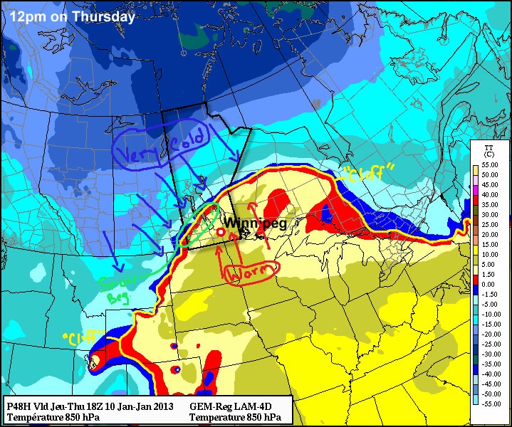
Before we head off this cliff, our weather will remain very nice. High temperatures on Wednesday will be in the low minus single digits in Southern Manitoba. There may even be a few zero degree readings in south-western sections of Manitoba late in the day as warmer air surges into Manitoba. On Thursday we should reach our warmest temperatures of the week with values in the low (positive) single digits expected. Some of the traditional warm spots in Southern Manitoba may reach values slightly warmer than that. The daytime hours of Thursday will be fairly nice in most of Southern Manitoba, but conditions will begin to change in the afternoon in western areas as snow begins to move in.

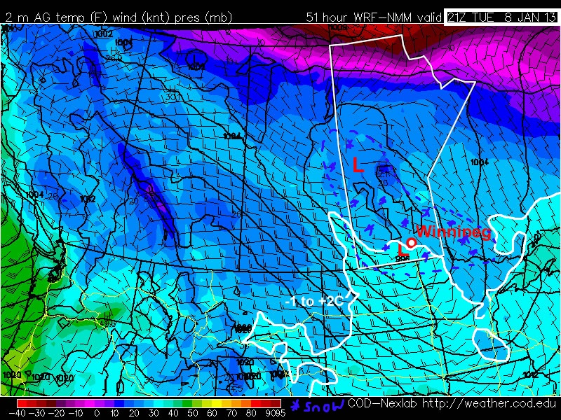
Our trek off the meteorological cliff will begin on Thursday night, as snow develops over Southern Manitoba. The snow is expected to begin on Thursday afternoon (or early evening) in Western Manitoba, eventually moving spreading through the remainder of Southern Manitoba by late Thursday evening or very early Friday morning. Total accumulations from this initial batch of snow will generally be in the 2 to 5cm range in Southern Manitoba. By Friday morning temperatures will have fallen into the mid minus teens over much of Southern Manitoba. Snow is expected to taper off from west to east in Southern Manitoba on Friday morning, with south-eastern sections seeing snow linger the longest. The second wave of snow moves in on Friday night. This wave will be generated as a strong Colorado Low system moves up from the south. At this point it appears that this secondary wave of snow will bring another 2 to 4cm to Winnipeg and another 4 to 8cm to south-eastern Manitoba. It is entirely possible that the amounts from this secondary area of snow could be higher or lower than listed above. Depending on where the system ends up tracking Winnipeg could end up with more snow, or perhaps none at all. However, I do believe south-eastern Manitoba will receive some snow during this time period, though again it could be more or less than I have listed above.

Location of the

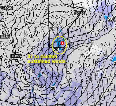
A secondary concern will develop on Friday as strong north winds develop in response to the intensification of the Colorado Low. At this point it appears that northerly winds of 40km/h gusting to 60km/h, or maybe even 50km/h gusting to 70km/h on a more localized basis, will materialize on Friday. This could create significant travel difficulties as blizzard conditions, or near blizzard conditions may develop as these very strong winds interact with the fresh snow. It is too early to say exactly how bad things may get, but this is certainly something that will need to be monitored closely over the next few days. Please continue to check back with A Weather Moment for further updates on this developing weather story.

After this Colorado Low passes by, conditions will turn calm, but cold. At this point most models keep us in very cold air for basically all of the next ten days. Arctic air doesn’t make a habit of moving around very quickly, so it is likely that we’ll remain in this arctic air mass for an extended period of time. There may be some warmer days here and there, but those details are not yet known with any certainty.

Enjoy these last couple warm days, as winter is quietly waiting to push us off the meteorological cliff.

A Break From Winter

This week will feature a much needed break from winter, as temperatures soar to well above seasonal values.

Surface Temperatures

Temperatures on Monday will reach the mid minus single digits in Southern Manitoba. There will be a fairly stiff west wind in place throughout the day though, which will make conditions considerably less comfortable than they would otherwise be. On Tuesday we’ll have our first shot at the 0C mark this week, as a low pressure system brings in a warm surge of air from the west. Unfortunately there may be some snow on Tuesday associated with the low pressure system. Amounts will not be particularly high, probably no more than a few centimetres in most areas. Despite the small amounts there could be travel difficulties as the snow is likely to be wet in nature and could present icing issues.

On Wednesday temperatures will remain warm, with highs just slightly below the freezing mark in most areas. We’ll have our best shot at getting above zero on Thursday as a big push of warm air moves into Manitoba from the south-west.

At this point it appears that this warm spell will end on Friday, with a low pressure system passing to our south prompting another arctic air mass to descend into Southern Manitoba. This system may bring a decent snowfall to portions of Southern Manitoba on Friday as well, though it is too early to discuss the details of it. In the longer range most indications suggest that we are in a for a very cold period through the middle of January, with a significant arctic air mass settling over the Prairies. With that in mind, there is all the more reason to enjoy this week’s pleasant “break” from winter.

Cold and Calm

This week will start out cold and fairly benign. Our next chance for snow will come midweek.

Warmer air will be advected into Southern Manitoba on Tuesday night

Warmer air will be advected (moved in via wind) into Southern Manitoba on Tuesday night

After another cold morning on Monday, temperatures will warm up a bit during the day. Highs on Monday afternoon should be in the low to mid minus teens, a significant improvement from Sunday’s minus twenties, but still chilly. The wind will be a bit breezy from the south on Monday, but wind chills values won’t be significantly colder than the air temperature (except in open areas). A weak low pressure system will pass through Southern Manitoba on Monday night, bringing some cloud cover along with it. As a result, temperatures on Monday night will be warmer than those on Monday morning as the cloud prevents heat from escaping from the surface. Unfortunately, temperatures won’t increase much on Tuesday, as we only see temperatures rise a few degrees from the morning lows. Our next little warm-up will begin Tuesday night as an approaching low develops a southerly flow over Southern Manitoba allowing temperatures to rise overnight.

As the low moves into (or just south of) Manitoba on Wednesday, it will bring our next chance for snow. At this point models suggest we may see as much as 5 to 10cm from this system, or perhaps as little as 2cm. Additionally, there are indications that we may see another weak system pass by on Thursday, bringing another small bought of snow. At this point it is too early to say how much snow to expect from these systems, but 5 to 10cm in total for both looks like a good initial “guess”. More information about the potential for snow will be available as the week progresses.

Cold Start to the Week

This week will start off feeling a lot more like winter, as temperatures drop well below normal.

A high pressure system will bring cold conditions to Southern Manitoba on Monday

A high pressure system will bring cold conditions to Southern Manitoba on Monday

Temperatures this morning will be more like those you’d expect in late January, not late November. This morning’s cold temperatures will moderate somewhat by afternoon, with highs in the mid minus teens expected – not exactly November weather! Luckily some cloud cloud should move in during the afternoon hours, allowing Monday night to be significantly warmer than Monday morning. In fact temperatures may rise a bit on Monday night, up into the -6 to -10C range, in association with a weak low pressure system passing through. This low will bring a few flurries to Southern Manitoba overnight, with accumulations of no more than a centimetre or two expected. Unfortunately, another high pressure system will build in behind this passing low, bringing colder temperatures again for the daytime hours of Tuesday. Temperatures will begin falling back into the minus teens on Tuesday morning as cooler air spills in from the north-west. Tuesday night will be another cold one, with lows back down around the -20C mark. It looks like another small warm-up is on the way for Wednesday as yet another passing low pressure centre allows temperatures to climb back up into the minus single digits.

There remains some uncertainly in terms of how the late week period will play out. Models generally agree that we will stay below-normal for Thursday and Friday, but exactly how cold is not entirely clear. There have also been hints of a more active storm track setting up through Southern Manitoba from next weekend into the following week, something to watch as this week progresses.