Cool, Cloudy Conditions Here For A While

Winnipeg will continue to see cool temperatures and variable cloudiness with no major pattern change in sight.

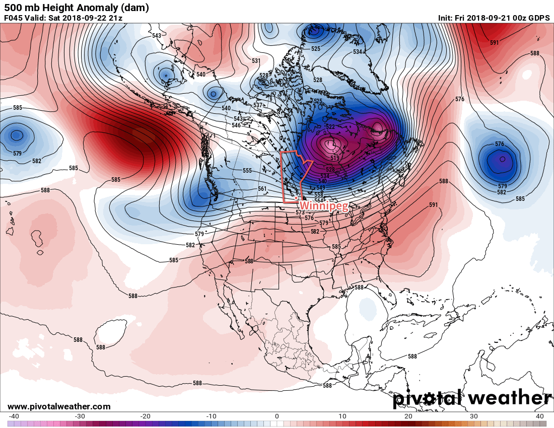
The shift to late October weather isn’t going anywhere, all thanks to a prominent “Rex Block” over the eastern Pacific. This feature has built a potent upper ridge over the Pacific which results in a large upper trough downstream: over the Prairies. This has, and will continue to, allow Arctic air to spill southwards and remain in place longer than we typically see at this time of year.

That said, today will be a cold one in Winnipeg. Breezy northwesterly winds of 20 to 30 km/h behind a cold front that moved through overnight will keep temperatures cool. With a high of just +4°C, Winnipeg will remain over 10°C below seasonal today. Skies will be mostly cloudy; a few sunny breaks are possible, but plenty of stratus cloud will remain in the region and streaming off of the lakes.

Lake-effect snow and/or rain showers will stream off of Lake Manitoba and Lake Winnipeg today.

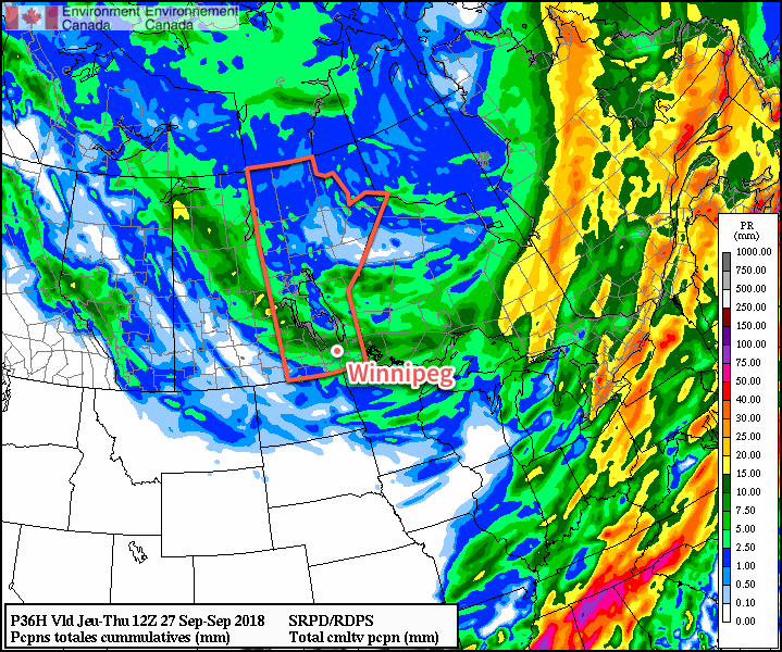
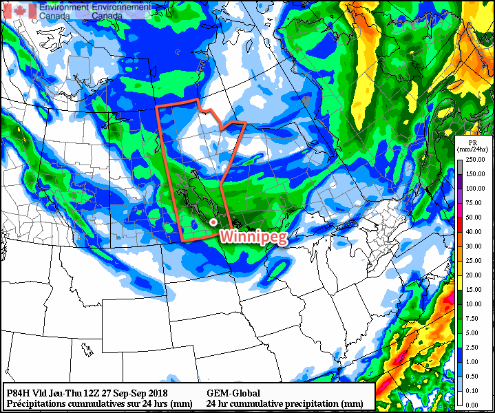
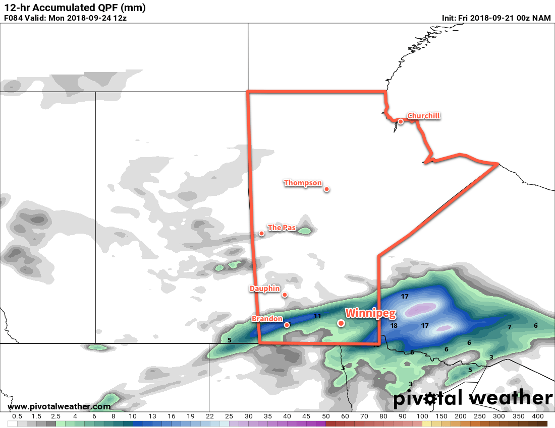
Through the morning, Lake Manitoba will be producing a narrow band of snow that will drift southeastwards off the lake. There’s a chance that Winnipeg may see a bit of rain or snow from this band a bit later in the morning. The lake-effect precipitation should taper off midday as the winds shift a bit more westerly.

Skies will clear tonight as a ridge of high pressure moves across the province. Winnipeg will see its first hard freeze of the season with temperatures dropping below zero this evening and reaching around -4 or -5°C by Saturday morning.

Saturday will bring slightly warmer temperatures back to Winnipeg as the Arctic ridge slides off to the east. Temperatures will climb to a high near 9°C with mixed skies developing for the afternoon. Winds will remain light at 10 to 20 km/h. A trough of low pressure moving through in the evening will bring a chance of rain showers to the city. Skies swill slowly clear through the night as temperatures drop to a low near +1°C.

The Red River Valley will see its first widespread, major freeze of the year on Friday night into Saturday morning.

Winnipeg will see some sunshine Sunday morning, but more cloud will move in for the afternoon. Temperatures will only climb to around 6°C. Skies will remain cloudy on Sunday night with temperatures dipping to a low near 0°C.

Long Range Outlook

Unfortunately, little change is on the horizon. Next week looks set to bring variable cloudiness alongside a couple chances for some rain. Daytime highs are forecast to remain 10°C or less all through next week with overnight lows near or just below freezing.

Winnipeg’s seasonal daytime high is currently 15°C while the seasonal overnight low is 4°C.

Unsettled Slide Towards Colder Temperatures

Winnipeg will see plenty of chances for showers through the remainder of the week as temperatures slowly and steadily fall.

A Mackenzie Low tracking across the province today will spread showers across the Red River Valley. Winnipeg should see the rain start midday with an initial batch of organized rain giving way to off and on showers through the remainder of the afternoon. Temperatures should reach a high near 10°C with a west-southwest wind of 20 gusting 40 km/h. Other than perhaps a bit of sun this morning, skies will be mostly cloudy for much of the day.

Another disturbance moving through overnight will bring Winnipeg a chance of more showers. Behind it, a northerly flow developing over southern Mantioba will begin ushering in a much cooler air mass. The combination of the northerly wind and cold air will likely produce some lake-effect showers towards Thursday morning. Temperatures should dip to a low near 4°C with west-northwest winds between 10 and 20 km/h.

Thursday will bring mostly cloudy skies to Winnipeg (again) with a continued chance of showers. Northwesterly winds of 20 gusting 40 km/h will keep temperatures cool; Winnipeg’s high should reach only 9°C. There will be a continued chance for some general rain showers through the day as well as a chance for some more organized showers or drizzle in the lee of the lakes. The chance for showers will persist overnight as a cold front slumps southwards through the province. Temperatures will head to a low near +2°C, which may mean that if there are any heavier showers along the cold front, they may become mixed with snow towards Friday morning. Don’t worry, though, it’s unlikely any of it would stick.

Much of southern Manitoba will see rain showers over the next 36 hours.

Marked by the passage of that Arctic cold front, Friday will be an even cooler day. Temperatures will only reach a high near 5°C with mostly cloudy skies and a chance of showers. Breezy northerly winds will also likely support streamers off of the Lakes. All in all, a somewhat unpleasant fall day on tap.

Friday night will bring mixed skies to the region, but enough clearing should take place that temperatures will likely dip below freezing to a low near -3°C. If this happens, it would be the first widespread hard freeze in the Red River Valley this fall.

Long Range Outlook

Unfortunately, the below-seasonal temperatures show no signs of abating over the next week or two. The large-scale weather pattern is forecast to remain fairly stagnant, with only a hint at a chance for some slight moderation in temperatures early next week.

NAEFS 8-14 Day Temperature Anomaly Forecast — Valid October 3 to 10, 2018

That said, there continues to be good consensus in the extended range models that the region will end up seeing generally below-seasonal temperatures well into mid-October. Looks like fall is here to stay!

Winnipeg’s seasonal daytime high is currently 15°C while the seasonal overnight low is 4°C.

More Cold and Wet Weather Ahead

Unfortunately, there’s no significant change in the weather pattern ahead and the unseasonably cool, wet weather will be sticking around for a while yet.

Despite temperatures remaining below seasonal values, today will feel comparatively warm with a high near 10°C. Unfortunately, a northwesterly breeze near 20 km/h and mostly cloudy skies will continue to make things feel rather chilly outside. The cool temperatures and northwesterly winds will combine in the afternoon to produce a few scattered showers this afternoon. Later in the day, there may even be some lake-enhanced showers in the lee of the lakes as the winds align and combine with the cool temperatures. The chance for an isolated shower will continue overnight as the temperature dips to a low near +3°C.

Winnipeg may see a bit of sun on Tuesday, but skies should remain mostly cloudy overall. Temperatures will climb to a high near 13°C with light winds. The cloud will thicken up as a weak upper disturbance moves through in the evening, bringing another chance of showers to the region. The cloud will break up towards Wednesday morning as temperatures drop to a low near +1°C.

A low pressure system will bring a swath of rain across southern Manitoba beginning on Wednesday

On Wednesday, any morning sun that manages to poke out will be fairly quickly covered up by advancing cloud cover arriving from the northwest. A low pressure system will drop from northern Saskatchewan into the Interlake through the day. Its approach will develop south-southwesterly winds of 30 gusting 50 km/h over the Red River Valley with light rain spreading southwards out of the Interlake in the afternoon. Temperature should climb to a high near 12°C before the rain cools things off. The cloud will break up overnight as the rain taper off and temperatures head to a low near +4°C. Winds will be lighter out of the west.

Long Range Outlook

No significant relief is on the way from the unseasonable chill that has descended on the Prairies. More showers are possible Thursday and Friday with cool temperatures as the region remains entrenched in a northwesterly flow.

NAEFS 8-14 Day Temperature Anomaly Forecast — Valid October 2-9, 2018

The weekend looks to bring more settled conditions this weekend. Unfortunately, a low pressure system forecast to move across the Prairies on Monday looks poised to usher in a massive Arctic ridge. If this ends up happening, it would bring even colder weather to kick off the first week of October. Yuck!

Winnipeg’s seasonal daytime high is currently 16°C while the seasonal overnight low is 4°C.

Cool and Unsettled Conditions Continue

A large Arctic vortex over Hudson Bay will keep cooler air entrenched over Manitoba right through the weekend.

Today will be the sunniest, warmest day Winnipeg will likely see for a while. Cloud cover from the rain overnight will break up this morning, leaving Winnipeg with sunny to partly cloudy skies. Temperatures will remain below-seasonal with a high of 13°C after northerly winds taper off in the morning.

Two primary features will define the weather from Friday evening onwards through the weekend: a large Arctic high building southeastwards through the Prairies and a nearly stationary front over the northern United States. This front will have several upper-level disturbances slide along it, bringing cloudy and occasionally unsettled conditions to southern Manitoba.

GDPS 500mb Height Anomaly Forecast valid 21Z Saturday September 22, 2018
An unseasonably strong vortex over Hudson Bay will continue to keep Winnipeg entrenched in a cooler air mass.

Friday night will see plenty of cloud cover build back into southern Mantioba. On the upside, this cloudy blanket will help prevent temperatures from dropping too much; Winnipeg should see a low near 6°C tonight. A clipper-like disturbance will speed across western Manitoba and the Interlake overnight, bringing a rain swath of 5-10 mm along its track. Further south in Winnipeg, a few showers are possible in the evening. Later in the evening, light rain with lesser accumulations may pass through the region, right through Saturday morning.

Speaking of Saturday it’ll  be a lousy day. Winnipeg will see a well below-seasonal high near 7°C with moderate north-easterly winds near 30 gusting 50 km/h. Skies will remain mostly cloudy through the day.

Winnipeg will see mixed skies on Saturday night. The breaks in the cloud will allow temperatures to cool off. sending overnight lows down to a chilly +2°C. This is close enough to freezing that any areas that see any prolonged clearing through the night will see the risk of patchy frost.

The cloud thickens back up again on Sunday as the next disturbance approaches the region. Winnipeg and the Red River Valley will see the chance for some light, scattered showers through the day, followed by organized rain moving through on Monday night. Wind will be out of the east near 20 km/h as temperatures climb to a high near 7°C.

NAM 12hr. QPF valid 12Z Monday September 24, 2018
More rain is possible on Sunday night as another disturbance moves through the region

Rain is forecast to move through the Red River Valley on Sunday night with temperature remaining steady near 7°C.

Long Range Outlook

Unfortunately, next week won’t start off much better. Plenty of cloud will remain in the region next week with daytime highs continuing well below seasonal values. Ensemble guidance has good confidence that Winnipeg will continue to see below-seasonal daytime highs right through the end of the month.

Winnipeg’s seasonal daytime high is currently 17°C while the seasonal overnight low is 5°C.