Unfortunately, there’s no significant change in the weather pattern ahead and the unseasonably cool, wet weather will be sticking around for a while yet.
Despite temperatures remaining below seasonal values, today will feel comparatively warm with a high near 10°C. Unfortunately, a northwesterly breeze near 20 km/h and mostly cloudy skies will continue to make things feel rather chilly outside. The cool temperatures and northwesterly winds will combine in the afternoon to produce a few scattered showers this afternoon. Later in the day, there may even be some lake-enhanced showers in the lee of the lakes as the winds align and combine with the cool temperatures. The chance for an isolated shower will continue overnight as the temperature dips to a low near +3°C.
Winnipeg may see a bit of sun on Tuesday, but skies should remain mostly cloudy overall. Temperatures will climb to a high near 13°C with light winds. The cloud will thicken up as a weak upper disturbance moves through in the evening, bringing another chance of showers to the region. The cloud will break up towards Wednesday morning as temperatures drop to a low near +1°C.
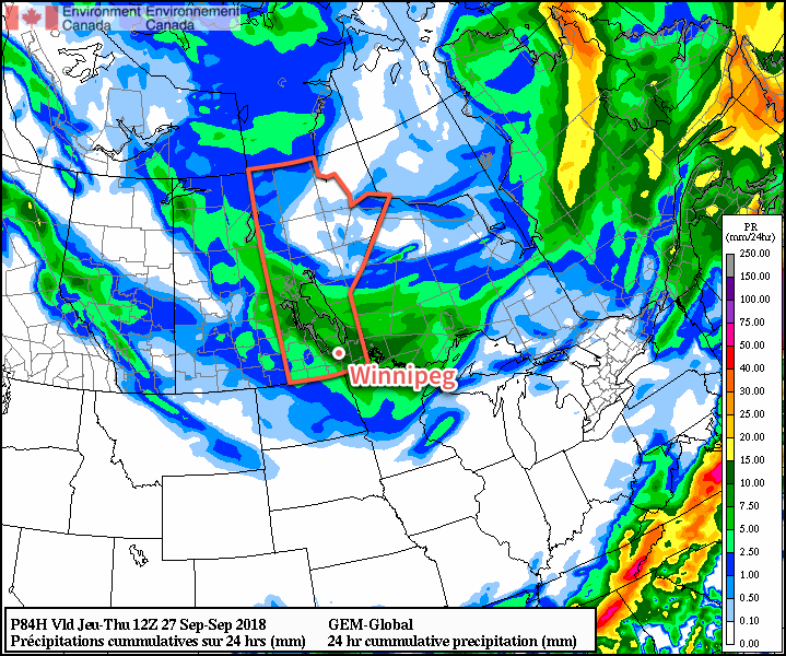
On Wednesday, any morning sun that manages to poke out will be fairly quickly covered up by advancing cloud cover arriving from the northwest. A low pressure system will drop from northern Saskatchewan into the Interlake through the day. Its approach will develop south-southwesterly winds of 30 gusting 50 km/h over the Red River Valley with light rain spreading southwards out of the Interlake in the afternoon. Temperature should climb to a high near 12°C before the rain cools things off. The cloud will break up overnight as the rain taper off and temperatures head to a low near +4°C. Winds will be lighter out of the west.
Long Range Outlook
No significant relief is on the way from the unseasonable chill that has descended on the Prairies. More showers are possible Thursday and Friday with cool temperatures as the region remains entrenched in a northwesterly flow.
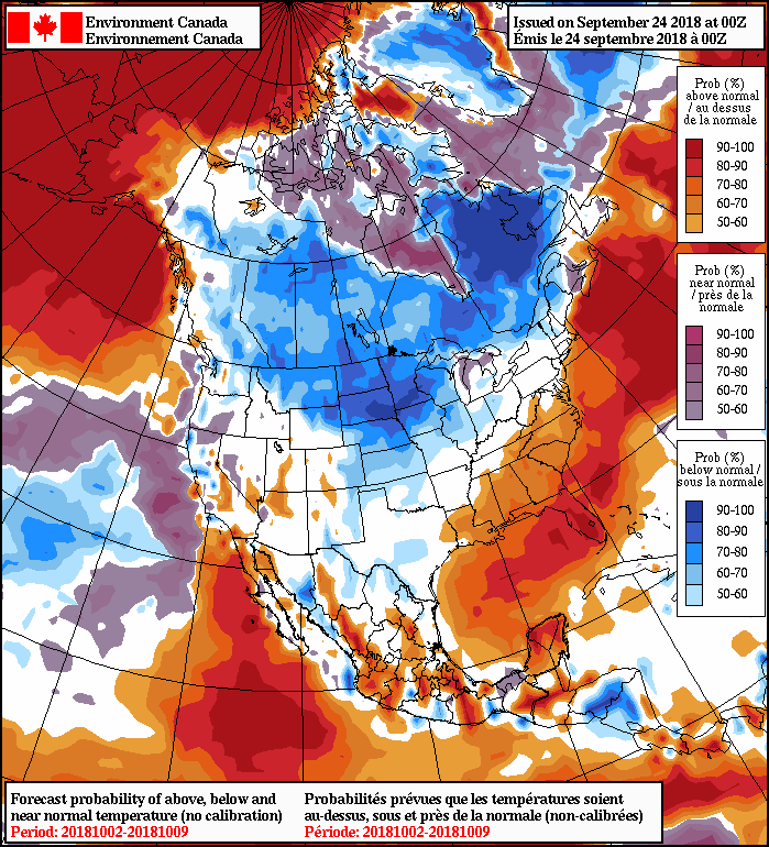
The weekend looks to bring more settled conditions this weekend. Unfortunately, a low pressure system forecast to move across the Prairies on Monday looks poised to usher in a massive Arctic ridge. If this ends up happening, it would bring even colder weather to kick off the first week of October. Yuck!
Winnipeg’s seasonal daytime high is currently 16°C while the seasonal overnight low is 4°C.