Cool And Cloudy To Start The Week

The week will start cool and cloudy for Winnipeg, but sunshine and seasonal temperatures will return mid-week.

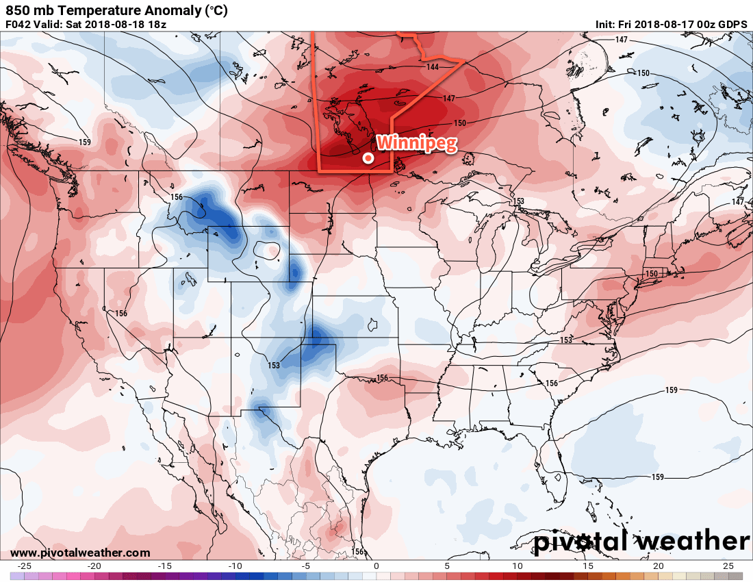
Much cooler weather will be in place across southern Manitoba to start the week as an Arctic high slowly builds southwards. Temperatures will struggle to reach just 16°C in Winnipeg today, made worse by a northerly wind near 30 km/h. Skies will remain mostly cloudy today; just as quickly as last night’s low pressure system exits the region, the next one is on its way. The cloud cover will thicken back up this afternoon as a low pressure system moves into the eastern Dakotas.

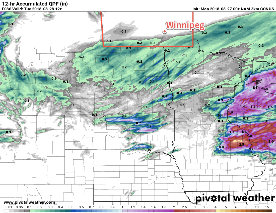
By evening, the Red River Valley will likely see some light rain move in that will gradually work eastwards overnight. Amounts will be a bit tricky given that copious amount of dry air spreading southwards from the Arctic high will produce an abrupt edge to the rainfall. At this point, it looks like amounts will be negligible over the Red River Valley. Winnipeg will likely remain north of the rain, but the southern Red River Valley could see “as much as” 2-4 mm. Temperatures will dip down into the 8-10°C range tonight.

Tuesday will bring sunshine back to the region as begin to clear out for the afternoon. Temperatures will once again be cool with a high near 18°C, but light winds will make for a more pleasant day than Monday. A bit of cloud might work back into the region in the evening, bringing a slight chance of a showers as a weak upper trough swings into the region. On Tuesday night, Winnipeg should see partly cloudy skies with the upper trough continuing to give a chance of showers. Temperatures should dip to a low near 8°C.

Rainfall will move through North Dakota and southern Manitoba on Tuesday night, but large amounts of dry air moving in from the north will result in a sharp drop-off in accumulations on the Canadian side of the border.

Seasonal temperatures will return on Wednesday as the Arctic ridge exits and warmer air moves in from the west. Under partly cloudy skies, Winnipeg should see temperatures climb to a high near 24°C. Winds will pick up out of the south to around 20 km/h. Temperatures will be much warmer Wednesday night with a low near 13°C, aided by southerly winds of 20-30 km/h.

Long Range Outlook

The remainder of the week looks fairly nice with seasonal to above-seasonal temperatures and variable cloud cover. The next chance for rain looks to be Friday night as a weak cold front pushes across the province.

Winnipeg’s seasonal daytime high is currently 23°C while the seasonal overnight low is 10°C.

Hot And Hazy Start to the Weekend, Cool End

An approaching low pressure system will bring hot and hazy weather to Winnipeg before a cold front passing Saturday brings a risk of thunderstorms and ushers cooler conditions back into the region.

Winnipeg will continue to see hazy skies today as the over 500 fires that have led to a state of emergency in British Columbia continue to send plumes of some eastwards into the Prairies. The thickest smoke has left the region and winds aloft should keep the main smoke track further north across the central and northern Prairies. Plenty of haze and stagnant high-level smoke will remain in the area with some limited visibility restrictions.1 The significant thinning of the smoke will let the sun shine much more strongly and send daytime highs in the region up into the low 30s. Winds will be out of the south at just 10 to 15 km/h.

Winds will increase out of the south to around 20 km/h tonight as temperatures dip to a low near 15°C under mixed skies.

Saturday should be a scorcher of a day…assuming the smoke can stay away. If we see the sun, then temperatures will soar to a high near 33°C with winds out of the south-southwest at 30 gusting to 50 km/h. Winnipeg will see partly skies in the morning, then a bit more cloud in the afternoon. Some forecasts show some elevated convection developing on Friday night and spreading across portions of western Manitoba and the Interlake. If that does form, it will likely remain north of Winnipeg but will bring some cloud and chances for showers to portions of the province through the morning hours.

A low pressure system crossing the Prairies will likely bring unseasonably warm conditions to the region on Saturday

A cold front will push through the Red River Valley late in the afternoon and through Saturday evening, bringing with it the chance for some showers or thunderstorms. At this point, there looks to be minimal chances for severe weather with under 1000 J/kg of MLCAPE forecast and bulk shear values near 20 kt.

The potential pitfall for Saturday’s forecast will be if thicker smoke once again moves into the region. It’s hard to tell at this point whether or not it will. Most guidance suggests it will primarily remain further north, but cold fronts can concentrate smoke ahead of them, so we’ll simply have to wait and see. If thicker smoke ends up returning, temperatures will be cooler and the chances for showers or thunderstorms diminish.

For Saturday night, Winnipeg will see winds diminish and temperatures head to a low near 16°C with a slight chance of showers continuing overnight.

Sunday will bring mostly cloudy skies to the region as an upper trough swings through. A small chance for showers is likely to continue into the morning, followed by clearing skies through the afternoon. Temperatures will be much cooler with a high near 23 or 24°C as northerly winds of 30 gusting 50 km/h move into the region. Temperatures will head to a low near 12°C on Sunday night under clear skies.

Long Range Outlook

Southern Manitoba will be under a northwesterly flow through the first half of next week which should bring clearer skies and near-seasonal temperatures. An upper-level ridge will push eastwards mid-week, bringing warmer weather back to the region alongside the potential for more smoke.

Winnipeg’s seasonal daytime high is currently 25°C while the seasonal overnight low is 12°C.

  1. Many places in the air mass we’ll find ourselves in today saw visibilities of 8 to 16 km through the day yesterday.
GDPS 2m Temperature Forecast valid 18Z Friday August 3, 2018

Warming For The Weekend

Winnipeg will see a single day of cooler than normal temperatures before they begin to soar back to 30°C and above for the weekend.

Temperatures will be cool today in Winnipeg as a high pressure system moves through the province behind the cold front that passed through on Tuesday morning. The high will clear out any remaining cloud and bring very light northeasterly winds to the region. Winnipeg should see a high near 22°C, followed by a low near 10°C tonight.

Thursday will be a transition day for Winnipeg. Near-seasonal temperatures will return to the region as a low pressure system develops over the western Prairies. This developing low will bring moderate southerly winds back to the region, drawing a more summer-like air mass northwards out of the American Plains. Winnipeg will see mixed skies with a high near 27°C, but that southerly wind increasing to 40 gusting 60 km/h will put a bit of a damper on things. Much of southern Manitoba will see a chance of showers or thunderstorms Thursday evening into the overnight as the low pressure system approaches. Winds will ease a bit into the 20 to 30 km/h range as temperatures head to a low near 18°C.

By Friday, Winnipeg will be back into full-fledged summer mode. The city will see partly cloudy skies as temperatures climb to a high near 32°C. Winds will be lighter than on Thursday, out of the south at just 15 to 25 km/h. Temperatures will remain warm on Friday night with a low near 19°C.

Long Range Outlook

The warmth that moves in on Friday will mark the beginning of a prolonged period of above-seasonal temperatures.

NAEFS 8-14 Day Temperature Anomaly Forecast — Valid August 8 to 15, 2018

Broad upper-level ridging will develop over the coming week as the subtropical high moves into the central United States. This will sustain a broad dome of very warm air that will easily be spread into our region. Winnipeg will see highs in the low 30s this weekend, followed by upper 20s to mid 30s next week. Lows will remain warm in the upper teens.

Rain-wise, forecasts are showing a high probability of dry conditions. That said, thunderstorms are tricky things, and several upper disturbances rippling through over the coming weeks will bring a few chances for showers or thunderstorms.

Winnipeg’s seasonal daytime high is currently 26°C while the seasonal overnight low is 13°C.

Hot Start Followed By Big Cool Down

After a hot start to the week today in Winnipeg, a cold front passing on Tuesday will usher in much cooler conditions.

Temperatures will soar above 30°C today in Winnipeg as a broad area of low pressure moves through the region. A west-southwest flow will send highs up to around 31°C with comfortable humidity levels. Skies will remain mainly sunny, and those aforementioned winds will only be around 20 km/h. Temperatures will remain mild tonight with a low near 18°C.

Tuesday will bring more cloud to the region and near-seasonal temperatures. Temperatures will climb to around 27°C before a cold front drops through the region. The front will bring increasing cloud and begin cooling off temperatures. There will be a chance for some showers or isolated thunderstorms in the afternoon, but low moisture and dynamic support will limit the rainfall potential. Winds will be notable with northerlies up to 30 to 40 km/h moving in for the afternoon.

A sharp cold front will sweep southwards through the Red River Valley on Tuesday afternoon.

A high pressure system moving into the region will bring significantly cooler temperatures on Tuesday night wth lows heading back towards 10°C. Winds will gradually diminish to around 10 to 15 km/h on Tuesday night.

Wednesday will see mixed skies gradually clear, but temperatures will be markedly cooler with a high near 21°C. Winds will be light out of the north-northeast as the high moves through. Expect another cool night on Wednesday night with a low near 11°C and light winds.

Long Range Outlook

Temperatures will return back towards seasonal values for the remainder of the week, but forecasts are indicating that unsettled conditions will return to the region. A few disturbances moving through will bring the chance of showers or thunderstorms back to the region Thursday night through Friday.

Winnipeg’s seasonal daytime high is currently 26°C while the seasonal overnight low is 13°C.