Cool and Unsettled Conditions Continue

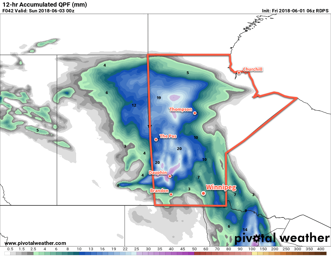
Temperatures will remain seasonably cool in Winnipeg through the weekend with several chances for rain as a slow-moving low pressure system moves through the region.

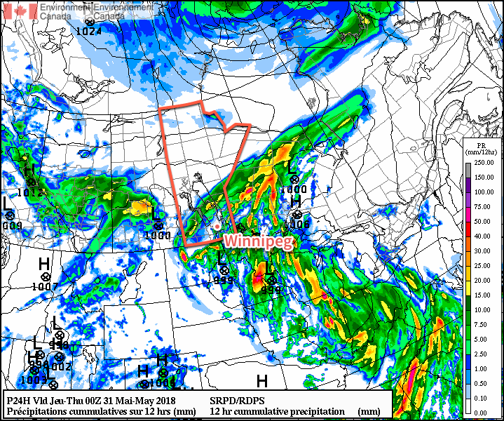
Winnipeg will see mainly cloudy skies today with a breezy easterly wind keeping temperatures seasonably cool with a high near 17°C.  There will also be on-and-off chances for rain today as the city remains along the eastern flank of an area of showers and thunderstorms moving through western Manitoba and the western Red River Valley. By mid-afternoon the showers should push north of the city, leaving Winnipeg with cloudy skies for the remainder of the day.

Winnipeg finds itself along the eastern edge of a band of showers streching across the western Red River Valley this morning

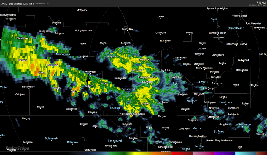
Overnight, the city will see a chance of more showers or thunderstorms as the slow-moving low crosses the Red River Valley. The best chance for any precipitation will be after midnight. The breezy winds will continue out of the east near 30 km/h with temperatures dipping to a low near 13°C.

Saturday will bring more cloud and a chance of some light showers to the city. It will be another cool day with a high of just 16°C. Southeasterly winds near 30 km/h in the morning will shift to westerly at 10 to 20 km/h in the afternoon. The cloud will begin to break up Saturday night as winds pick up out of the northwest to 30 km/h. Temperatures will dip to a low near 7°C.

Much of Manitoba will see rain and/or showers on Saturday

Sunday will finally bring the sun back to the region as the clouds clear out. Winds will remain out of the northwest at 20 to 30 km/h and temperatures will reach a high near 19°C. Winnipeg will see a few clouds Sunday night with a low near 8°C.

Long Range Outlook

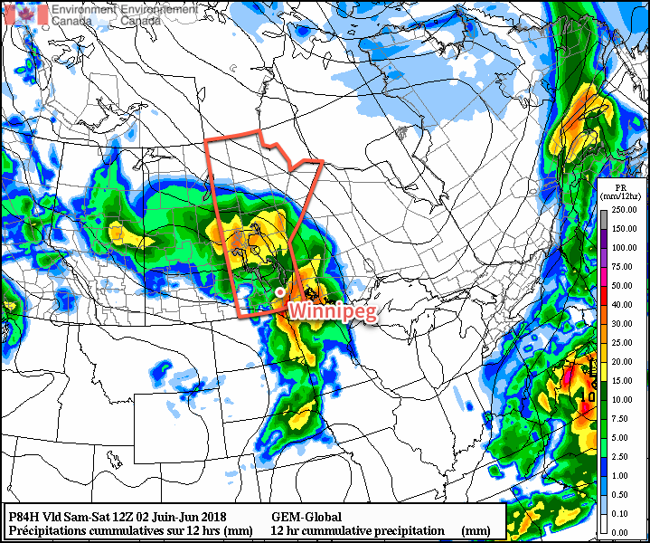
Next week will bring temperatures closer to seasonal values. Tuesday into Wednesday look to bring a slight chance of some showers or thunderstorms, otherwise conditions look quite pleasant.

Winnipeg’s seasonal daytime high is currently 22°C while the seasonal overnight low is 9°C.

Cooler, Showery Weather On The Way

Winnipeg will see significantly cooler temperatures through the remainder of the week as mostly cloudy skies bring more chances for rain.

A low pressure system passing through North Dakota will bring substantially cooler conditions than seen over the past few days. As it tracks eastwards, northerly winds of 20 to 30 km/h will develop in Winnipeg, ushering in cooler temperatures from the north and limiting the daytime high to about 22°C. Skies will remain cloudy with showers and thunderstorms developing midday through the afternoon. Much of the precipitation will end up to the south and east of Winnipeg, leaving the city with just a chance of showers or thunderstorms.

Winnipeg is forecast to be on the northwestern edge of today’s showers and thunderstorms

The northerly wind will continue at 10 to 20 km/h through the night. Temperatures will dip to a low near 14°C under cloudy skies.

Thursday will bring a lull in the scattered precipitation to the Red River Valley. A flat pressure pattern over the region will bring northerly winds of 10 to 20 km/h to Winnipeg and a high again near 22°C. Winds will shift easterly overnight as the next low approaches the region. Lows should reach around 12°C on Thursday night.

Friday will bring showers back to the region as a low pressure system lifts northeastwards out of the Dakotas. High temperatures will reach around 20°C, kept lower by easterly winds sourced from a high pressure system over Hudson Bay. As the low lifts north through the day, showers or thunderstorms will develop over southern Manitoba. This system then looks likely to support an area of showers and thunderstorms through Friday night.

Several forecast models are showing a high likelihood of showers and thunderstorms developing over the Red River Valley on Friday night

A warm front lifting northwards will keep temperatures warmer on Friday night. Winnipeg should see a low near 15°C with southeasterly winds of 20 to 30 km/h.

Long Range Outlook

The showers are forecast to taper off Saturday morning, then clearing will work into the Red River Valley. The remainder of the weekend looks pleasant with partly cloudy skies and slightly cooler than seasonal highs near 20°C.

Winnipeg’s seasonal daytime high is currently 22°C while the seasonal overnight low is 8°C.

Unsettled Weather Returns To Winnipeg On Tuesday

Winnipeg will see another beautiful, warm start to the week, but another low pressure system pushing northwards out of the United States will bring showers and thunderstorms back to the region for Tuesday and Wednesday.

Under the influence of a broad area of high pressure, Winnipeg will see beautiful conditions today with plenty of sunshine and a high temperature near 28°C. Winds will be light and humidity will be comfortable, leaving little to complain about! Later in the afternoon, a bit of cloud will begin spreading into the Red River Valley as a low pressure system begins moving into North Dakota.

Temperatures will remain mild tonight as warmer, humid air begins building into the province as the North Dakota low continues to approach. Temperatures in Winnipeg will drop to around 17°C with winds picking up out of the south to around 30 km/h. A few showers or thunderstorms may develop and move through the region overnight.

Winnipeg will see humidity levels increase on Tuesday as dew points climb into the upper teens; combined with a high near 29°C, humidex values are forecast to reach into the mid-thirties. The morning will bring mixed to cloudy skies as any nocturnal convection finishes moving through, then Winnipeg and the Red River Valley will see a few sunny breaks through the early afternoon.

RDPS 2m Dew Point Forecast valid 18Z Tuesday May 29, 2018
Humid conditions will return to Winnipeg and the Red River Valley on Tuesday

As the heat and humidity builds, showers and thunderstorms will likely develop across much of southern Manitoba in the afternoon. Triggered by the incoming disturbance from North Dakota, the showers and thunderstorms will spread northeastwards through the night. There is a small chance some of these thunderstorms could be severe with large hail being the primary threat. There are indications that a few areas may see some training thunderstorms with local rainfall accumulations of 25-50 mm.

Wednesday will be a much cooler day in Winnipeg with high temperatures only near 22°C. While this is significantly cooler than the city has seen over the past while, it’s in fact near-seasonal for this time of year. Skies will remain mostly cloudy with a good chance of showers as the low centre itself moves through the region. Some breezy northwesterly winds will move in through the afternoon, picking up to around 30 km/h.

Skies will remain mostly cloudy on Wednesday evening with northwest winds near 20 km/h and a low near 14°C.

Long Range Outlook

Winnipeg will see a break from the heat through the remainder of the week with near-seasonal temperatures forecast. Skies look cloudier than not, with generally unsettled weather returning for the end of the week into the weekend.

Winnipeg’s seasonal daytime high is currently 22°C while the seasonal overnight low is 8°C.

Summer Heat On The Way

Winnipeg will see temperatures in the upper 20’s for much of the week as the season’s first humid spell builds into the region.

Temperatures will be hot in Winnipeg over the next three days. Daytime highs near 29°C will be in place through Wednesday and are about 7-8°C above seasonal. Overnight lows will rise dramatically over the next few days as southerly winds bring humidity northwards into the province.

This increase in humidity will be one of the most significant changes this week. For the past several weeks, dew point temperatures have remained at relatively low values. This week, dew points are forecast to rise into the low teens on Tuesday, then further into the upper-teens on Thursday. This will be the first occurrence of relatively humid conditions this year.

RDPS 2m Temperature Forecast valid 21Z Tuesday May 22, 2018
Temperatures across southern Manitoba will climb towards 30°C on Tuesday afternoon.

Besides warm, the next few days will be pleasant. Winds will be a bit breezy out of the south today at 20 to 30 km/h, then will ease to the 10 to 20 km/h range for Tuesday and Wednesday. Winnipeg will see sunny skies today, but the region will see a bit more cloud with mixed skies on Tuesday. On Wednesday, Winnipeg should see partly cloudy skies. The southern Red River Valley will see more cloud as it spreads out of North Dakota ahead of a low pressure system moving towards the region.

Long Range Outlook

More extensive cloud cover will build into the Red River Valley on Thursday as a low pressure system moves into the region. This disturbance will bring a good chance of showers or thunderstorms Thursday night through Friday. A cold front looks to sweep through late Friday, beginning to clear the cloud and humidity out of the region.

The weekend is looking pretty great with seasonably warm highs in the mid- to upper-20’s and plenty of sunshine.

Winnipeg’s seasonal daytime high is currently 21°C while the seasonal overnight low is 7°C.