One More Damp Day, Then May Ends With Nicer Weather

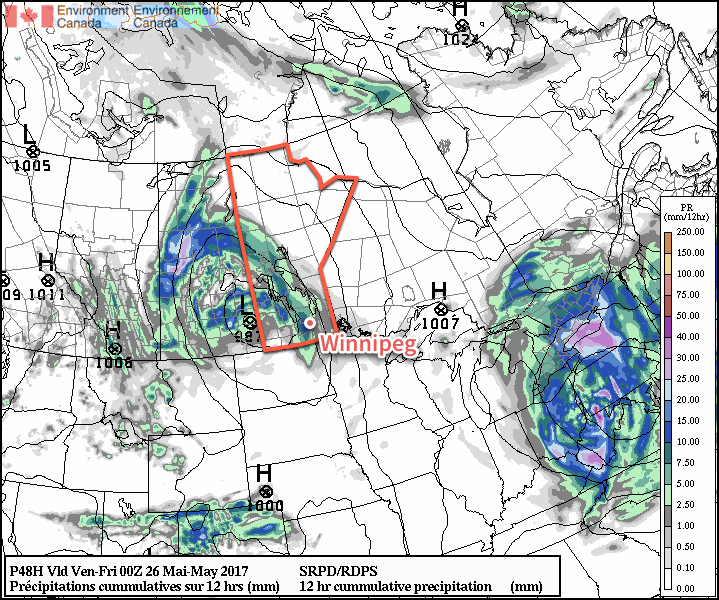
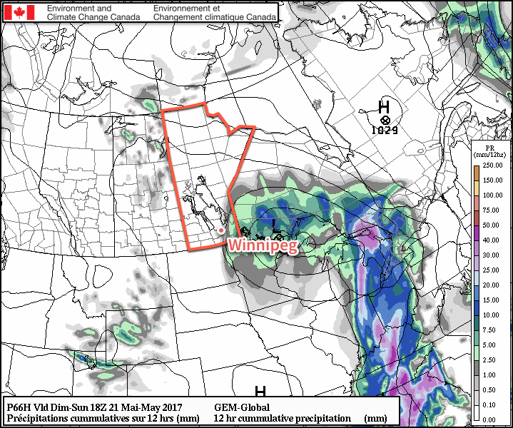
Winnipeg will be under the influence of the storm system that has been bringing showers to southern Manitoba the past couple days for one more yet, but then a return to more pleasant weather will quickly return for the end of May!

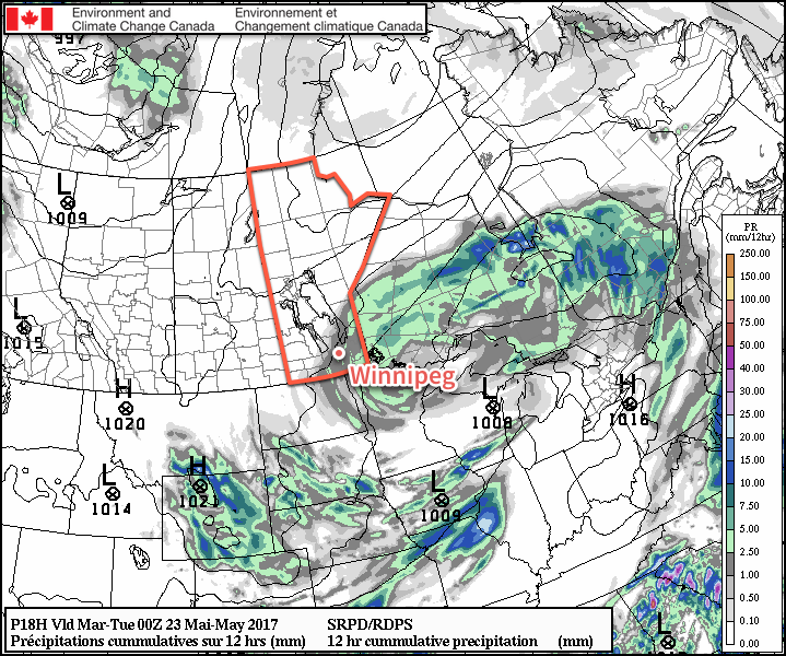
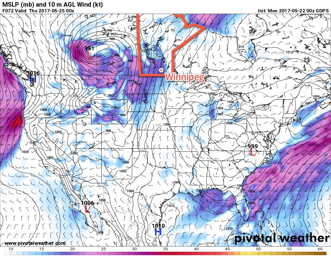
More showers are on the way for Winnipeg today as moisture continues to stream southwards through the province on the back-side of the storm system that moved through over the weekend. Breezy northwesterly winds of 30 gusting 50 km/h will make today’s high of just 11°C feel rather dreary. The chance for showers will continue tonight, although it won’t be quite as likely, as temperatures drop to a low near 6°C.

More showers are expected across much of Manitoba today and tonight.

Sunshine will return to Winnipeg on Tuesday as skies clear for the afternoon. There will be a slight chance of showers in the morning as one more little disturbance ripples through, but as skies clear midday temperatures will warm up to a high near 18°C. The wind will continue to be gusty out of the northwest, but the sunshine should make for a much more pleasant afternoon. Skies will completely clear out by evening as winds taper off and Winnipeg heads to a low near 8°C.

Wednesday will be a beautiful day to end the month on; sunny skies with a high near 24°C are on the way with light winds of just 10-20 km/h out of the west. The low will be relatively mild on Wednesday night at around 10°C.

Long Range

The remainder of the work week looks pleasant with continued sunny to mixed skies and highs in the low 20’s. A system will approach Manitoba on Friday, but at the moment guidance suggests it will remain to the south and west. There is general agreement that next week may turn more unsettled once again, so we’ll be keeping an eye on that as the week progresses.

Winnipeg’s seasonal daytime high is currently 22°C while the seasonal overnight low is 8°C.

Mixed Bag For Second Half of the Work Week

Winnipeg will dodge the worst of a major storm system that will slam Alberta and portions of Saskatchewan with strong winds and rain; comparatively, things will be quite pleasant!

A major storm is developing over Alberta today that will bring 30-50 mm of rain to the province alongside winds gusting over 100 km/h. This system will spread eastwards and bring significant weather to Saskatchewan later today, but will begin to weaken as it approaches Manitoba overnight. While Winnipeg will be spared from the brunt of this storm, some breezy and unsettled weather is still on the horizon.

First up, today will be a warm and windy day as moderate southerlies develop ahead of the Alberta storm. We should see fairly sunny skies, but winds will pick up out of the south-southeast to 30-40 km/h with gusts to 60 km/h through the morning and early afternoon. Temperatures will be near-seasonal with a high of 21°C.

The winds will continue out of the south-southeast tonight at around 30 gusting 50 km/h as cloud cover pushes in late overnight. Temperatures will drop to a low near 11°C.

Thursday will bring cloudy skies to the region as a trowal1 moves through the region. Whether or not Winnipeg will see rain is still somewhat uncertain; support for it definitely tapers off as the feature moves into the Red River Valley, but it will likely be able to sustain a band of rain or showers that will move through mid-day. A second batch of showers is possible in the early evening as the low pressure system moves into the Interlake.

More recent model runs are beginning to show accumulating rainfall in the Red River Valley on Thursday

While the winds will be breezy first thing, they should diminish through the morning as the low approaches. Temperatures will reach a high near 18°C. Temperatures should dip to around 12°C on Thursday night with the cloud cover breaking up.

Friday will bring mixed skies to Winnipeg & the Red River valley with a high near 19°C. It should stay dry, with any showers to our east and north. Winds will be out of the west at 15-25 km/h. It looks like skies should be fairly clear on Friday night as temperatures dip to a low near 9°C.

Long Range

The mixed bag continues this weekend with Saturday likely bringing a fair amount of sunshine and highs near the 20°C mark, but things take a turn on Sunday with highs dropping into the mid-teens as showers slump southwards out of northern Manitoba. With breezy northwesterly winds, it will likely be a relatively unpleasant day. The unsettled weather may persist into Monday, but then the remainder of next week looks pleasant with dry conditions and highs in the low 20’s.

Winnipeg’s seasonal daytime high is currently 21°C while the seasonal overnight low is 7°C.


  1. Trowal stands for “trough of warm air aloft” and is the warm air rising around a low pressure system from the occluding frontal wave. 

Rain Today Gives Way to Sunny & Seasonal Weather

The reprieve from yesterday’s 10-20mm of rain that fell across the Red River Valley will be short-lived as another disturbance will move through the region today and bring more wet weather. Fortunately, things will improve quickly with clouds clearing out for Tuesday and Wednesday alongside a rebound to seasonal temperatures.

It will be another cool one in Winnipeg today with mainly cloudy skies and intermittent showers as a disturbance slumps southwards from the Interlake, bringing another couple millimetres of rain to the region. Temperatures will top out at just 12°C today, kept down by the cooler air mass and brisk northerly winds that will develop a bit later this morning to around 30 gusting 50 km/h. The rainy weather will finally taper off late this afternoon into the early evening, and Winnipeg will be left with cloudy skies and northerly winds of 15 to 20 km/h as temperatures dip to a low near 8°C.

Light rainfall accumulations are expected across portions of Southern Manitoba today.

Tuesday will be a much nicer day with skies clearing in the morning and then temperatures climbing to a high near 19°C. Winds will remain out of the north to northeast at 15-20 km/h. Expect a low near 9°C on Tuesday night under clear skies with light winds.

Wednesday will bring more pleasant weather to the city with mainly sunny skies and a high near 21°C. Winds will increase out of the south from calm to around 30 km/h through the day.

Long Range

Conditions will turn more unsettled through the second half of the week as a major storm develops over Alberta and track eastwards.

A very potent low pressure system will develop in Alberta on Wednesday, bringing very strong and potentially damaging winds with it. This system will track eastwards and weaken through the second half of the week.

As it does so, Winnipeg will see a few chances for precipitation Thursday through Saturday, but it really seems like we’ll avoid the worst of this system. We’ll be keeping an eye on it as it develops and begins to push towards the region.

Winnipeg’s seasonal daytime high is currently 21°C while the seasonal overnight low is 7°C.

Warmer, Cloudier Conditions Arrive for the Weekend

After a couple windy and seasonably cool days, temperatures are set to warm slightly towards near-seasonal values. Unfortunately, the sun will end up rather elusive through the weekend as a low pressure system lifting northwards out of Texas pushes towards Manitoba and spreads cloud into the region.

Despite a rather cool start to the morning, temperatures will rebound nicely today as the ridge of high pressure responsible for the cool, windy weather the past few days begins pushing off to the east. With light winds, Winnipeg will warm up to a high near 18 or 19°C under plenty of sunshine for much of the day. By mid- to late-afternoon, cloud cover will begin to push into the region from the south, spread northwards from a low pressure system heading towards Minnesota from Texas.

Winds will remain light on Friday night as temperatures drop to a low near 7°C under mixed to mostly cloudy skies.

Saturday will bring mostly cloudy skies to Winnipeg and the Red River Valley with temperatures climbing to a high near 18°C. Winds will remain light once again, making for a relatively pleasant day despite the lack of sunshine. Temperatures drop back down to around 8°C on Saturday night under cloudy skies.

Milder weather will push back into Manitoba for Friday and Saturday

Sunday will finally bring southern Manitoba under the influence of the low pressure system from Texas as pushes northeastwards through Minnesota. This system has a high chance of bringing some rain to southeastern Manitoba, but further west in the Red River Valley there exists a bit more uncertainty.

The bulk of the precipitation associated with this system will fall in Ontario, however it’s quite likely there will be a band of rain wrapping around the back-side of the low that impacts southeastern Manitoba. The biggest question is how far west that rain will be able to wrap around. The best indications at the moment is that the Whiteshell, Sprague, and areas primarily south of Steinbach and east of the Red River will see some rain, with areas further west in the Red River Valley having just a chance of showers. For the areas that do see rain, amounts should be light, with just around 2-4mm expected.

Some rain is expected to wrap-around a low pressure system into southeastern Manitoba on Sunday


Otherwise, temperatures will rise to a high near 17°C in Winnipeg while winds increase out of the north to 20-30 km/h. The chance for rain will taper off through the afternoon, then Winnipeg will head towards an overnight low of 8°C on Sunday night under mixed to cloudy skies.

Long Range

Much of the same is expected into the first half of next week. Monday will likely continue to bring fairly cloudy conditions with a very slight chance of a shower as temperatures climb to a high in the 15-20°C range. Tuesday into Wednesday should see things settle down with near-seasonal temperatures, but then the pattern may switch to slightly more unsettled, bringing in some chances for precipitation through the latter half of the week into the weekend.

Winnipeg’s seasonal daytime high is currently 20°C while the seasonal overnight low is 6°C.