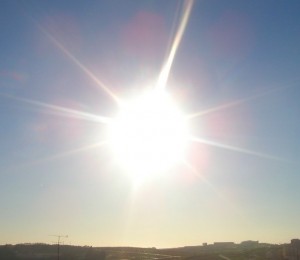
Pleasant Start to the Weekend

After a few days that threatened storms for the Red River Valley, we’re heading out the other side with most communities seeing little to no rain. Steinbach is a notable exception, with over 100mm of rain falling1 through a rather unusual rainfall event early Wednesday morning which produced significant overland flooding2.

24hr. Precipitation Totals valid Sunday Evening

24 hour accumulated precipitation from Friday Saturday evening to Sunday evening.

A pleasant start to the weekend is ahead, with no chance of showers until Saturday evening and overnight. Today we’ll see mainly sunny skies as our temperatures rebound from yesterday’s system up to a high near 26°C. The overnight low tonight will be around 15°C. Warmer air pushing in aloft will allow temperatures to climb higher on Saturday and Sunday, with daytime highs close to 30°C expected. Humidity will remain relatively low for Saturday, however things may get a little uncomfortable on Sunday as dewpoints begin to climb closer to the 20°C mark.

On Saturday a disturbance entering the province will generate some showers and thunderstorms over SW Manitoba through the late morning and afternoon hours. The (thunder)showers will spread eastwards through the evening and overnight, however it’s currently looking like the bulk of precipitation will occur through the Interlake. The northern half of the Red River Valley looks to have a decent chance of seeing some sort of precipitation, however the odds look very slim that the southern half will see anything.

We’ll see increasing cloud Sunday afternoon as the back side of this system prepares to swing through Sunday night. As it does, there will again be a chance of showers for Winnipeg and, as it looks now, the eastern RRV. We’ll be sure to provide updates in the comments as this system approaches.

new TWTR.Widget({
version: 2,
type: ‘list’,
rpp: 30,
interval: 30000,
title: ‘July 2nd, 2012’,
subject: ‘AWM Storm Chase’,
width: ‘auto’,
height: 500,
theme: {
shell: {
background: ‘#3c3c3c’,
color: ‘#eeeeee’
},
tweets: {
background: ‘#eeeeee’,
color: ‘#2c2c2c’,
links: ‘#489ce1’
}
},
features: {
scrollbar: true,
loop: false,
live: true,
behavior: ‘all’
}
}).render().setList(‘WeatherInThePeg’, ‘awm-team’).start();

Hot Weather Continues

More warm to hot weather is expected for this week. Our hot spell continues…

The sun

You’ll be seeing a lot of this again this week.

High temperatures through the first few days of the week are expected to be in the mid to upper twenties in Southern Manitoba. No irriguous weather is in the forecast for this period, save for perhaps some rain this morning from a passing thunderstorm complex and a chance for some more showers late this afternoon and through the evening as a bit of cooler air filters southwards on the back-side of the low exiting the province today.

As we move into late week models hint at the potential for another heat wave. The generally accepted definition of a heat wave in North America is three or more consecutive days with high temperatures of 32C or greater (90F or greater). Temperatures of this magnitude may be possible from Thursday through Saturday of this week. In addition, dew points are expected to rise through the latter half of this week, which when combined with the hot temperatures will produce humidex values in the low-to-mid 40s! Since this forecast extends fairly fair into the future weather-wise, it may change somewhat as the week progresses.

As has been the case for much of the last month, long range modelling shows no end in sight to our hot weather. It looks like July should end just as it started – HOT!

More Showers Than Thought?

A few systems are expected to bring chances for showers and thunderstorms to Southern Manitoba over the next few days as the upper ridge takes a few days longer to build in than previously thought.

30-Day Rolling % of Normal Precipitation for the Canadian Prairies

30-day % of normal precipitation for the Canadian Prairies. This map depicts the increasing drought conditions over much of the Red River Valley, with most areas only seeing only about 60% of the normal amount of precipitation over the last 30 days.

Offering a slight bit of relief to the dry conditions over the Red River Valley, an area of rain blossomed in North Dakota overnight and has pushed into Southern Manitoba this morning. Amounts are generally expected to be between 5-10mm along the International Border with amounts dropping off quickly to the north. This system will push into NW Ontario by late morning and skies will clear out behind it. Under sunshine our temperatures will soar to nearly 30°C in the afternoon.

The subtropical ridge that was previously progged to push into the Southern Prairies has instead decided to stay more or less where it was for a few extra days, which will leave us with a more zonal flow through this weekend. Fortunately, this means that we’ll have more chances for precipitation than previously thought.

The next chance for rain will come on Saturday afternoon/evening as a shortwave that will move across Saskatchewan today slumps southeastwards across the Interlake and Red River Valley. A couple showers and thunderstorms are likely to fire up underneath the shortwave as it crosses the RRV in the late afternoon. Currently all the convective parameters look to be fairly middling, so I don’t expect any severe weather to occur. Saturday will have a daytime high of 28°C before clouds move in in the afternoon. The low on Saturday night will be around 15°C.

Sunday should be a sunny day with a high near 28°C.

The next chance for rain will be Monday night as a shortwave slumps down the upper ridge that will build into the Western Prairies over the weekend. After that, it looks like the ridge will continue building into the Eastern Prairies, bringing us sweltering hot temperatures ove 30°C by the end of next week.

One Last Shot at Some Rain

Another frontal system tracking across Southern Manitoba today will bring one last shot at precipitation before the sub-tropical high begins to edge northwards and push us back into a hot, dry pattern.

15Z GEM-REG Analysis

Analysis of the GEM-REG model for this morning. The red and blue lines represent warm and cold fronts, respectively.

A cold front that brough severe thunderstorms and numerous tornadoes to Saskatchewan yesterday will push across the Red River Valley late this morning into the early afternoon. What sort of weather we’ll see from this depends highly on how much sunshine we’re able to see beforehand.

A rather large MCS will slowly decay as it moves through SW Manitoba this morning on approach to the Red River Valley. Some uncertainty exists as to what this system will do, however, and the result is dramtically different outcomes.

The NAM wants to keep this system quite progressive and push it eastwards fairly consistently. Under this solution, we’ll see a cloudy morning with some showers and thundershowers pushing through late morning/early afternoon. There’s a chance that rain could be fairly heavy under some of the thundershowers. Westerly winds would build in this afternoon flushing out the moisture in the Red River Valley and returning us to much more comfortable dewpoints in the low teens.

The growing trend in allh the other models, though, is for this system to stall out for a while over SW MB / extreme western RRV. If this is indeed what happens, things could be a little more interesting. Should the sun be able to poke through even a bit, that heating combined with the high surface dewpoints (should be in the 20-23°C range tomorrow morning) would build our CAPE values into the 2000 – 3000 J/kg range. That, combined with good deep shear and a SE wind at the surface veering to SW aloft, could provide an environment favorable for strong storms. The main threats would be heavy rainfall due to the slow-moving nature of the system (this threat would be centralized over the Western Red River Valley), strong winds and large hail. Stronger winds pushing in on the backside could favor the development of a squall-line type feature, but if they’re late to the party, a few isolated supercells certainly aren’t out of the question.

My take on all this? I think we’ll see some middle-ground solution play out. I think we’ll have a chance at seeing a bit of sun this morning, and by late morning some showers and thunderstorms will start pushing through the RRV. One can’t ignore the potential that exists for strong convection, and in that regard I would agree with the SPC’s “See Text” analysis for ND into Southern MB. The potential is there, but I wouldn’t say it’s likely. I hope that many places across the RRV see some rain as this front comes through, because it may be our last chance for a while…

8-14 Day Temperature Anomoly Outlook

NAEFS 8-14 Day Temperature Anomoly Outlook. The large area of red over the Canadian Prairies indicates a high probability of warmer than seasonal temperatures through the 8-14 day time period.

After this system, the sub-tropical high will begin to build northwards again, pushing plenty of heat into Southern Manitoba. Daytime highs will remain in the high 20’s to low 30’s through much of the next 7-10 days, with nary a drop of rain in sight for the Red River Valley. After many places have gone two weeks without any measureable precipitation, perhaps not the best of news.

We’ll keep a close eye on the storms this morning and post updates in the comments as the system develops!