Summertime temperatures are on the way back to Winnipeg, but they’ll be bringing more haze and smoke from the B.C. wildfires with them.
Winnipeg will see temperatures climb back above seasonal values today as a warm front approaches the region. Winnipeg should see a high near 29°C under sunny skies, but haze may move back into the region this afternoon. Winds will be out of the southwest near 20 km/h. Temperatures will head to a low near 16°C under clear skies tonight.
Thursday will bring more warm weather to Winnipeg with temperatures reaching a high near 30°C, likely with hazy conditions. Winds will be out of the south at 15 to 25 km/h. Skies will begin sunny, but a trough approaching from the north will bring increasing afternoon cloud. This trough will stall out near Winnipeg late Thursday, bringing a chance for some scattered showers or thunderstorms Thursday afternoon into the evening. Temperatures will dip to a low near 16°C once again.
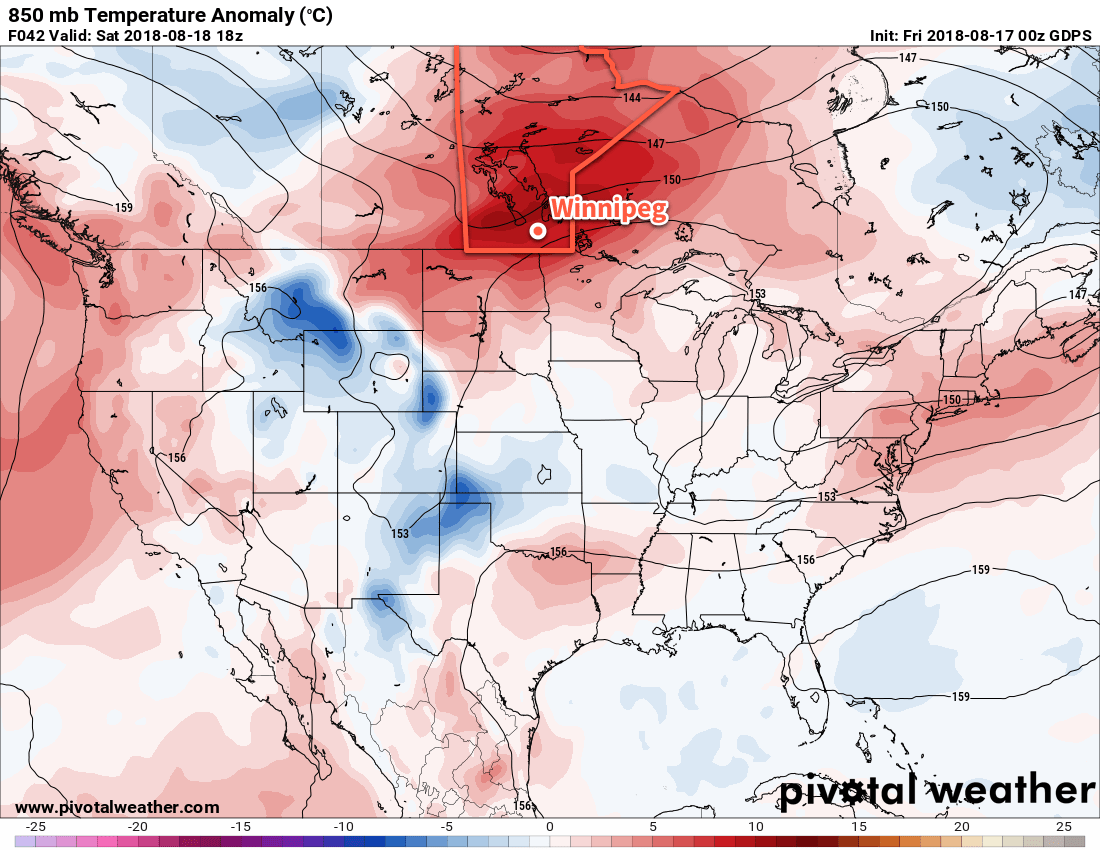
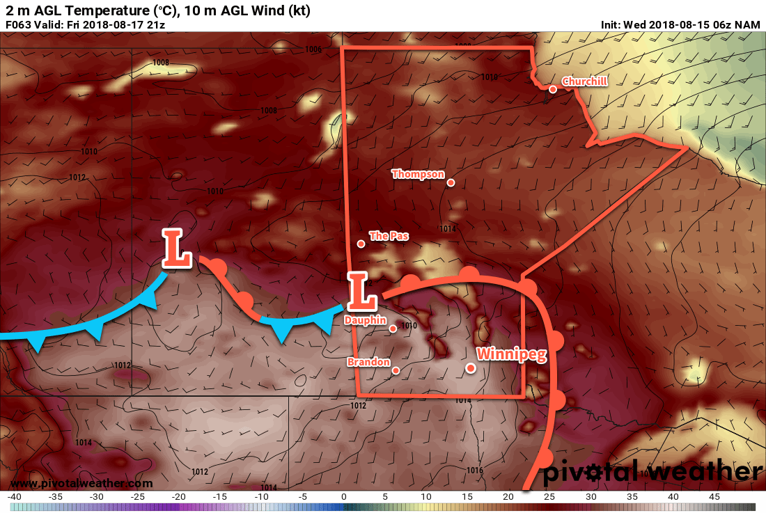
Friday will see a low pressure system approach the province from the west. This low will keep much of southern Manitoba in a warm air mass, but the approach of this low will also likely bring thick smoke to portions of southern Manitoba. At this point it appears it will likely remain north of Winnipeg, spreading across WestMan and the Interlake. Winnipeg will probably see some hazy conditions, but the significant impact to air quality should remain further north for Friday. Temperatures will be warm again with a high in the upper 20s, perhaps creeping into the low 30s. Winds will continue out of the south-southeast at 15-25 km/h. Winnipeg should see just a few clouds. More cloud cover will begin working into the region overnight as temperatures dip to a low near 15°C.
Long Range Outlook
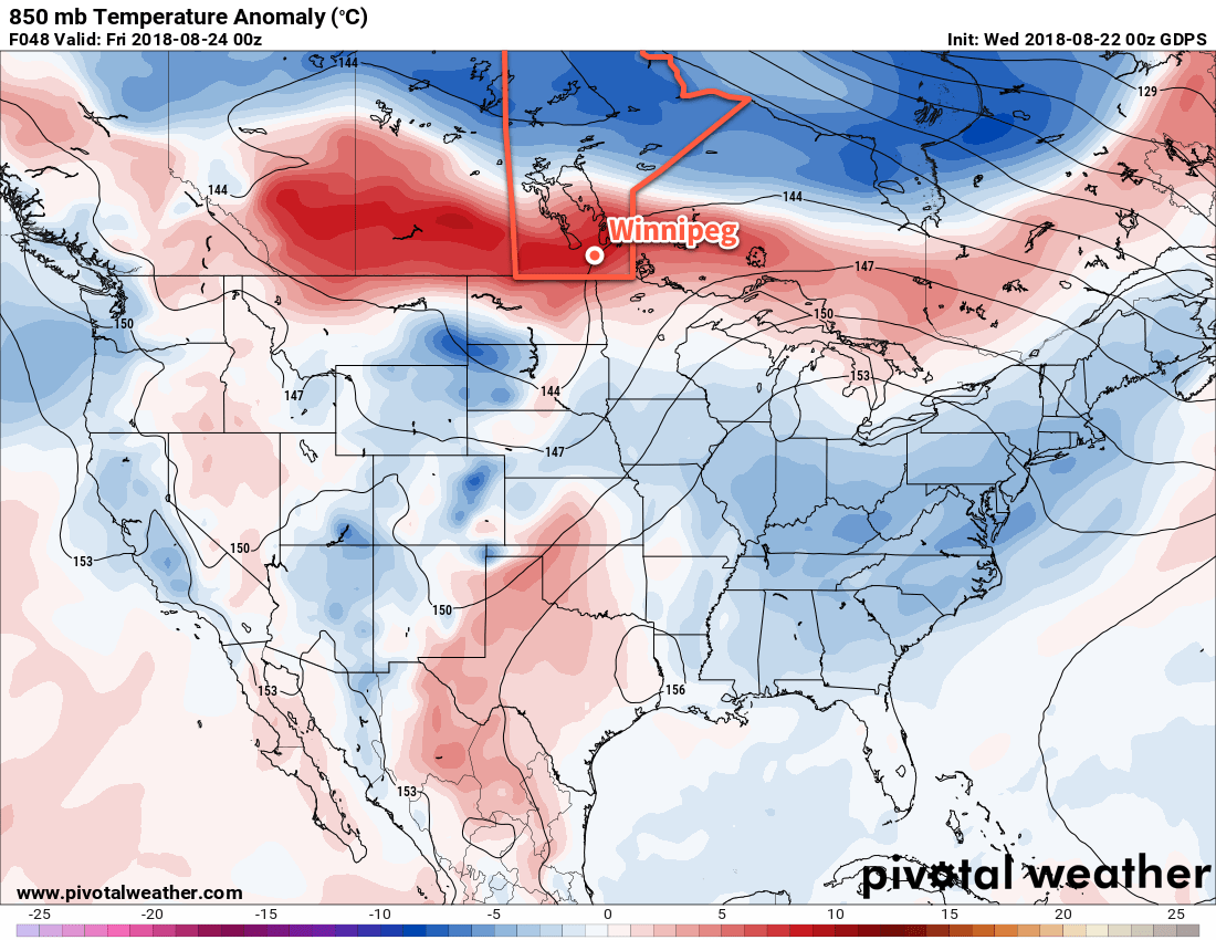
Thicker smoke will move through southern Manitoba this weekend as the low pressure system moves through and draws it southwards. A cold front passing on Saturday morning will likely usher in the worst – whatever exactly that ends up meaning – of the smoke. The weekend will bring cooler conditions with variable cloudiness, but rain still looks elusive.
There are some indications that we may move into a more unsettled pattern to start next week that could bring some much-needed rain to the region, but for now we’ll just have to wait and see how things pan out.
Winnipeg’s seasonal daytime high is currently 24°C while the seasonal overnight low is 11°C.