Southern Manitoba’s non-winter just keeps rolling along. Our record warm January will end just as it started – unusually mild. Although there may be an unwelcome surprise to end the month as well…
GEM Temperature Forecast – Tuesday, January 31, 2012
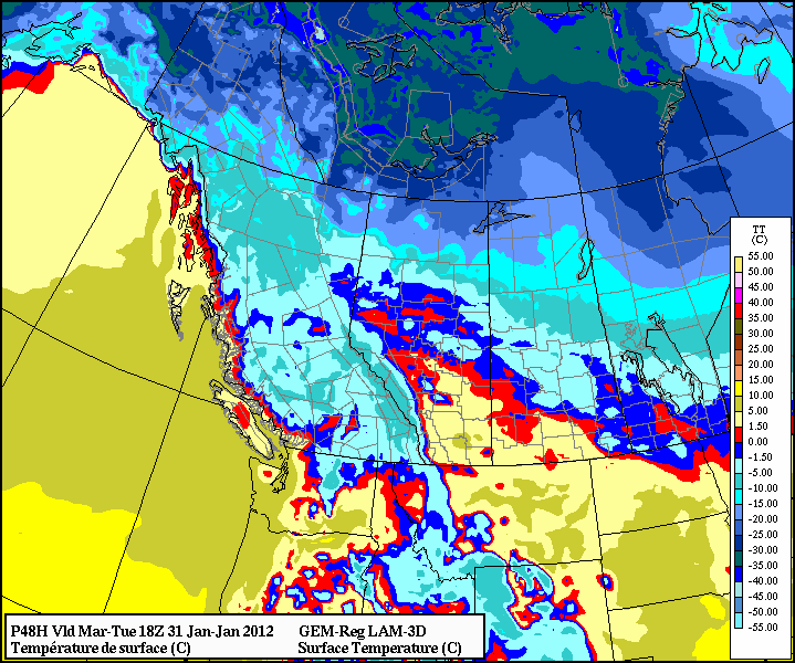
The last few days of January are expected to feature high temperatures near zero degrees. Monday and Tuesday should be near to or slightly above zero in much of Southern Manitoba. Wednesday is not in January, but it is also expected to be quite warm with highs close to zero.
Surface Pressure Map – Tuesday, January 31, 2012
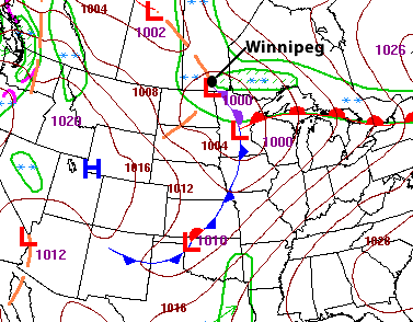
This warm weather may come at a cost though. During the late hours of Sunday night and early hours of Monday morning snow was falling in many parts of Southern Manitoba. Overnight accumulations were generally light, mainly 2 to 4cm or less. However, the bigger concern for snow will come Monday night and Tuesday. An Alberta Clipper type system is forecast to emerge from the Rockies on Monday. This system will then quickly dive southward on Monday night. Currently the potential for snow with this system is very uncertain. Weather models are predicting anywhere from 0cm to 15cm. As a result, it is very tricky to pin down a more precise snowfall range at this time. As a rough guideline, I will suggest that most parts of Southern Manitoba will see 3 to 6cm of snow with this system. However, bear in mind that we have low confidence in this forecast. The map above shows the expected location of the low pressure system on Tuesday morning (6am). As the exact track and intensity of this system becomes clearer we will provide further updates.
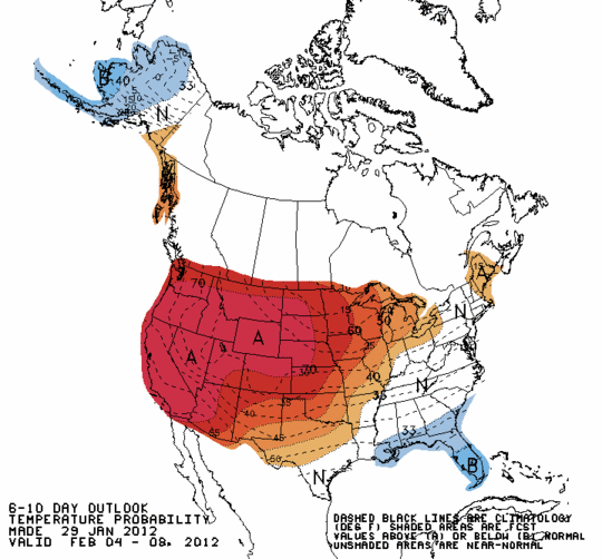
Climate Prediction Center Outlook – February 4-8
On a different note, long range modelling shows warm weather persisting through the first 7-10 days of February. The Climate Prediction Centre outlook, seen above, indicates that much of the United States and Southern Canada will be warmer than normal to begin the next month. Many people have been asking where winter has gone…your guess is as good as mine.
Elsewhere in Weather News
Iggy Thrashes Indonesia, Spawns Tornadoes
Tropical Cyclone Iggy has spawned over the eastern Indian Ocean and has brought with it powerful thunderstorms and tornadoes. As the rain season is peaking in Indonesia, chances of a tropical storm increase greatly and could potentially bring with it powerful tornadoes affecting the region.
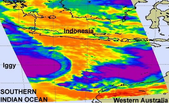
Iggy bringing storms to Indonesia on January 26th. IR – cloud tops satellite picture. (Source: NASA and Earthsky).
In total, 22 Indonesian districts experienced damage from the tornadoes, several with significant devastation including Java and Bali, the hardest hit areas. Unfortunately, the tornadoes damaged more than a thousand houses, killed as many as seven people and injured fifty more as it knocked down trees and overturned boats by the shoreline.
Iggy is forecast to move to the south-east, sliding by Australia’s western coast and bringing with it heavy rains, strong winds and possibly more tornadoes. As very warm waters lie to its south-east, Iggy will also strengthen as it moves towards Australia, with the possibility of the cyclone reaching category 2 (winds of 150k/h near the core) by the time it’s all said and done.
Strong Cold Front Pushes through Dixie Alley, US
As the southern states continue to get beat down, yet another powerful system has pushed through the Dixie Alley bringing with it… yes you guessed right, more tornadic supercells! Most of the tornadoes were concentrated in the Mississippi, Arkansas and Alabama regions; where on the evening of January 22nd, optimal conditions were in place for long-tracked supercells. In total, about 30 tornadoes and more than 150 cases of high wind gusts were reported during this unusually strong system that spanned from Chicago to the Gulf of Mexico. The system then moved on to Georgia where a couple tornadoes were again reported from the same system the next morning.
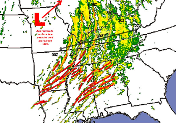
Time lapse (Sun, Jan. 22, 7pm thru 7am) RADAR imagery where rotation was detected. (Source SPC, G. Carbin)
The region finally caught a break from the parade of storm systems passing through this past weekend with a ridge of high pressure that built itself behind the front. Calm weather in the region is expected to last at least until Wednesday evening, where there is another system on the horizon.
Elsewhere in Weather News has been provided by Matt