After a few sunny days, snowier weather will return to Southern Manitoba as a slow-moving system tracks from Southern Saskatchewan into Southern Manitoba along the international border. For today, we’ll see skies cloud over this morning, but we’ll still have beautiful conditions, with highs through the entire RRV sitting within a degree or two of 0°C and winds dying off by early afternoon.
Tonight will mark a transformation to a snowier pattern, however, as a complicated series of shortwaves begin to march across the Prairies associated with a strong upper low.
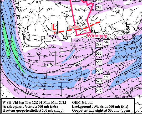
As the Colorado low that has brought severe winter weather to the Northern Plains progresses eastwards, an upper low will be pushing into Southern Alberta and inducing troughing eastwards across the Southern Prairies. As this troughing occurs, a series of smaller shortwaves will lift northwards and track across Southern Manitoba.
Tonight, an area of light snow will develop along the RRV in North Dakota and slowly lift northwards into Winnipeg. This area of snow will slowly fizzle out over the region before being replaced by a more organized area of snow that will push across Southern Manitoba as the main low tracks across the Southern Prairies. By Thursday night, we’ll be back under steady snowfall.
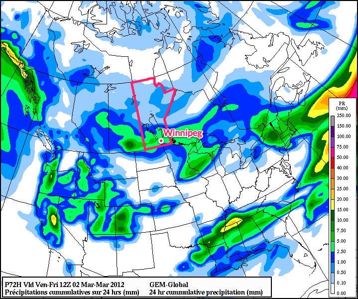
The entire system will exit the region overnight on Friday. Snowfall totals west of the Trans-Canada highway will be general amounts near 5cm. Areas in the RRV and east into the Whiteshell will see more, with widespread accumulations of 5-10cm and localized amounts potentially reaching as high as 12-13cm. These amounts are estimates right now, and we’ll certainly see how things shape up over the next day and a bit.
After this system clears out we’ll have a bit of an unsettled weekend with the potential for some light flurries as a weak low pressure system tracks through Central Manitoba. The next potential for snow comes on Monday as another powerful low pressure system tracks through the Prairies. More on that on the weekend!