RDPS 2m Temperature Forecast valid 21Z Friday November 1, 2019

Cloudy Conditions Ahead

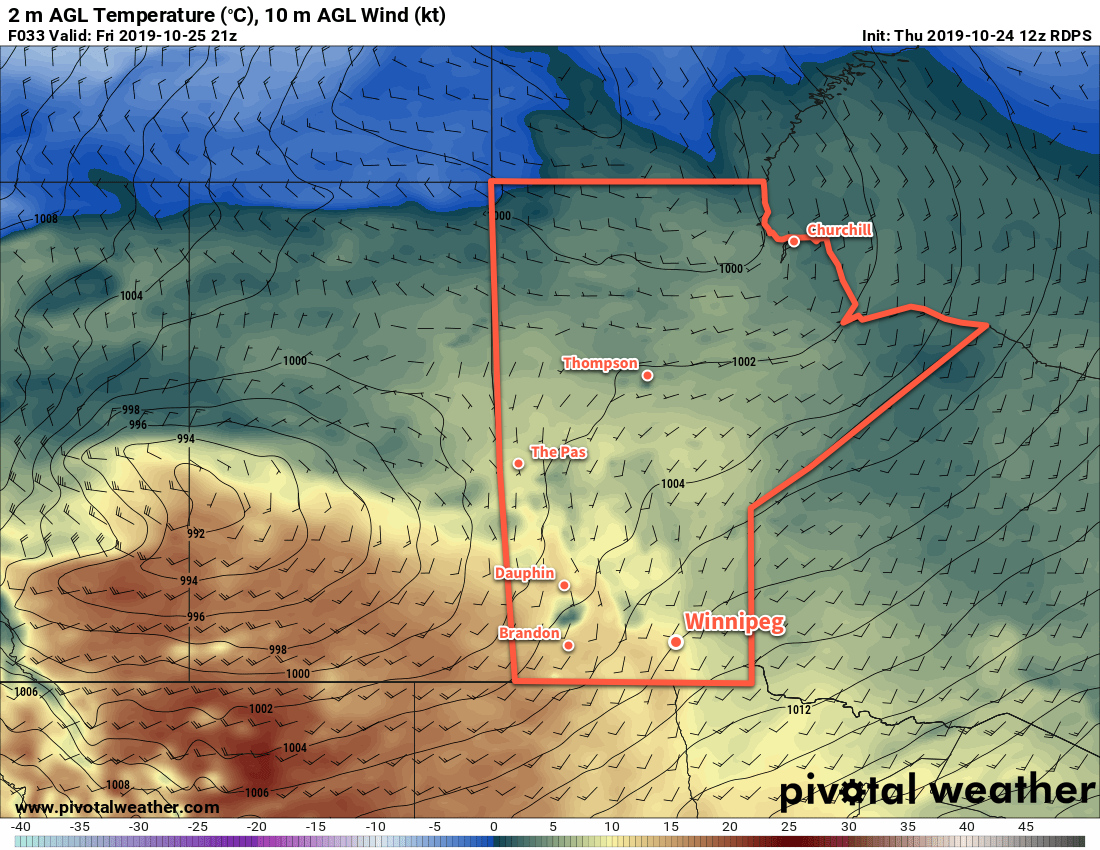
A series of disturbances moving through Manitoba will keep temperatures near the freezing mark through the weekend with plenty of cloud cover.

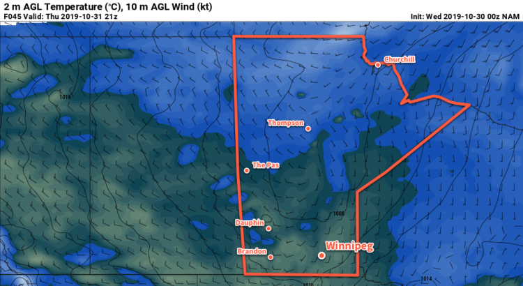
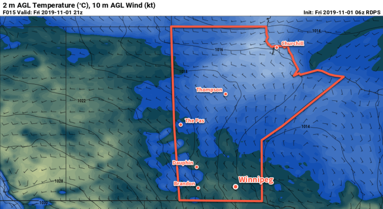
Winnipeg will see light snow today as a broad upper low moves through the region. Accumulations will be low and temperatures mild with a high near +1°C. Winds will be noticeable, though, picking up out of the northwest to around 30 gusting 50 km/h. The snow will taper off this evening leaving the city with mixed skies overnight and a chance of flurries. Temperatures will dip to a low near -5°C with winds out of the northwest at 20 km/h.

Saturday will bring mainly cloudy conditions to the city as the winds ease and the cloud cover remains trapped under a ridge moving through the province. Temperatures will once again climb above freezing to a high near +2°C. While there might be a sunny break or two through the day, the clouds will thicken back up overnight as another weak low moves across the province. Temperatures will dip to a low near -3°C with a chance of flurries on Saturday night.

Winnipeg will see cloudy skies on Sunday with a northerly wind of 20 to 30 km/h in the morning that eases later in the day. Temperatures will be a tad cooler with a high near 0°C. More flurries are possible on Sunday night as another low pressure system crosses through the province. Temperatures will dip to a low near -3°C with northwest winds again strengthening to around 30 km/h.

Long Range Outlook

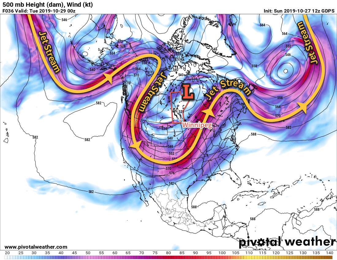
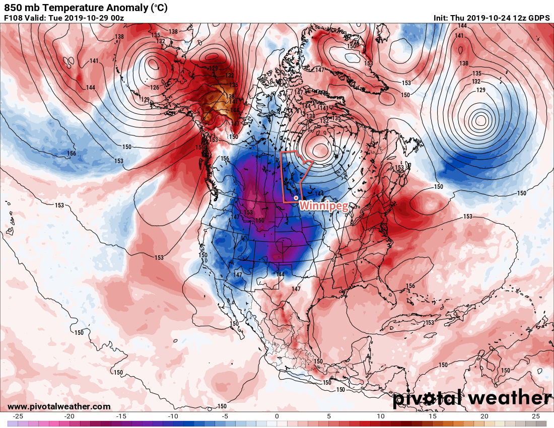
Unfortunately, that last low looks like it could be a bit of a doozy with a strong cold front that ushers a much colder Arctic air mass in to the province. By mid-week, the region could be seeing daytime highs in the low minus single digits and overnight lows in the mid-minus teens. No significant snowfall will occur with the transition into the colder air mass.

Today’s seasonal daytime high in Winnipeg is +3°C while the seasonal overnight low is -6°C.

NAM 2m Temperature Forecast valid 21Z Thursday October 31, 2019

Cool Temperatures Continue with Occasional Snow

Below-seasonal temperatures will persist in Winnipeg through the rest of the work week. Skies will continue to be cloudier than not with a couple chances for some more light snow.

The city will see a mix of sun and cloud today as the upper trough responsible for yesterday’s cloud and flurries rotates off to the east. Temperatures will stay cool with a high near -1°C but winds won’t be too much of a bother at around 15 km/h out of the west. There is a chance of a scattered flurry, but nothing as intense as some of yesterday’s snow. If there are any snowflakes, it’s expected to be very light. Winds will shift to the south tonight as the next system approaches from the northwest. The city should see a low around -8°C with increasing cloud cover.1

Mainly cloudy skies will be in place on Thursday as a warm front pushes into the Red River Valley. Temperatures will climb back above freezing to a high near +3°C, but winds will also pick up out of the south into the 20 to 30 km/h range. The day should stay snow-free, but by late in the afternoon an area of light snow will begin pushing into the region from the northwest. Winds will shift northwesterly on Thursday night with light snow likely through much of the night. Accumulations will be minimal with just 1 to 2 cm in the forecast. Temperatures will dip to a low near -2°C.

Winnipeg will continue to be under a northwesterly flow on Friday with winds of 30 gusting 50 km/h. Fortunately, the passing low pressure system will have kicked out the core of the coldest air, so temperatures won’t be too bad. The city should see a high near +1°C. That said, skies will stay cloudy through the day with scattered flurries possible. There may also be some more lake-effect snow in the lee of the lakes. The winds will gradually ease on Friday night. Skies will be mixed to mostly cloudy through the night with temperatures dipping to a low near -4°C.

Long Range Outlook

Temperatures will rebound close to seasonal values through the weekend with variable to mostly cloudy skies. Some flurry activity will be possible through the weekend, but no significant snowfall is in the forecast.

Today’s seasonal daytime high in Winnipeg is 4°C while the seasonal overnight low is -4°C.

  1. That number could be a tad warmer if the clouds move in earlier in the night, or a tad colder if they stay away until closer to sunrise.

Arctic Outbreak Brings Clouds & Flurries

An outbreak of Arctic air across the Prairies will bring seasonably cold temperatures and scattered flurries to Winnipeg.

Winter weather has arrived in Winnipeg, courtesy a potent upper low over the eastern Prairies. This low has altered the upper-level air patterns, sending the jet stream diving into the southern United States. This has allowed colder Arctic air to spread southwards through the Prairies and into the northern United States. The result: a prolonged period of seasonably cold weather for Winnipeg.

A potent upper low over Manitoba has pushed the jet stream into the southern United States.

Winnipeg won’t be dealing with record-breaking cold by any stretch, but it will be the first sustained period of chillier winter conditions this season. Temperatures will struggle to reach the freezing mark through the first half of the week with highs generally in the -2 to 0°C range. Overnight lows will largely depend on how much cloud lingers through the overnight periods, but will generally sit near -5°C to star the week and fall close to -10°C mid-week.

Winds will start the day out of the west near 20 km/h and gradually ease to light in the afternoon as a weak low moves into the region. Winds will pick up out of the west-northwest on Tuesday into the 20 to 30 km/h range as the low exits the region. The winds should keep up through the night, then ease to around 15 km/h on Wednesday.

The city will see variable cloudiness over the next few days, although generally speaking skies will be mixed to cloudy with a few sunny periods possible here and there. Today, the clouds should thicken up through the afternoon as the low moves into the region. There will be a good chance of flurries with the cloud cover later today, persisting into the night. Temperature profiles through the night may end up supporting light snow that lasts right through the night. Accumulations would still be low, but there could be a greater impact on visibilities and road conditions.

Skies will stay mostly cloudy on Tuesday with a good chance of flurries through the day. The cloud cover will likely begin to break up a bit on Tuesday night. Winnipeg will see mixed skies on Wednesday, clearing later in the day into the overnight period. The clear skies overnight will lead to the cooler low expected mid-week.

Long Range Outlook

The upper low over the region will weaken and shift northeastwards in the second half of the week. A huge swell of warmth won’t return though; most models continue to keep the region in a strong northwest flow.

This likely means a slight warming trend, although below-seasonal temperatures likely persisting right through the weekend into next week. The northwest flow will also likely bring more disturbances through the region, meaning more cloud cover and chances for snow.

Today’s seasonal daytime high in Winnipeg is 6°C while the seasonal overnight low is -4°C.

Two Days Of Seasonal Weather, Then A Prolonged Cold Snap

Winnipeg will see breezy conditions with seasonably mild temperatures today, but a cold front passing through on Saturday will usher in an extended period of markedly cooler weather.

A low pressure system crossing the Prairies will finally bring seasonal temperatures back to southern Manitoba today. With a brisk southerly wind increasing to 30 gusting 50 km/h, temperatures will climb to a high near 11°C. Morning sunshine will give way to mixed skies, but things should stay dry with no precipitation in the forecast. The low will continue to advance towards the province tonight, keeping skies mixed and maintaining the southerly winds. Winnipeg should see a low near 7°C.

The city will still see seasonal temperatures on Saturday, but the day will be much less pleasant as a cold front sweeps through early in the morning. Temperatures will hover near the overnight low of 7°C then begin cooling later in the day. Winds will be breezy out of the west-northwest near 30 gusting 50 km/h and skies will be mostly cloudy. Again, no precipitation is forecast. Skies will stay cloudy on Saturday night with a northwest wind near 20 km/h and a low of -1°C.

RDPS 2m Temperature Forecast valid 21Z Friday October 25, 2019
An approaching low will bring seasonably mild temperatures to Winnipeg today, but a prolonged stretch of cooler conditions will quickly move in behind it.

Sunday will bring cloudy conditions to the city with temperatures remaining steady near 0°C. This will mark the beginning of a prolonged cold snap that will entrench the city in below-normal temperatures for the next week. The northwest winds will gradually ease through the day and into the evening. Some flurries will be possible in the city as the cold air and northwest wind will bring a chance of lake-effect snow off of Lake Manitoba. Temperatures will head to a low near -4°C on Sunday night with mostly cloudy skies.

Long Range Outlook

Unfortunately, a long stretch of cold weather is on the way for Winnipeg. Arctic air will plunge southwards through much of North America through the week as a significant upper-level trough develops.

GDPS 850mb Temperature Anomaly Forecast valid 00Z Tuesday October 29, 2019
Temperatures will stay well below-seasonal next week for much of the western portions of Canada and the United States.

The result will be a week of variable cloudiness, temperatures struggling to reach 0°C, and several chances of accumulating snow.

Today’s seasonal daytime high in Winnipeg is 7°C while the seasonal overnight low is -3°C.