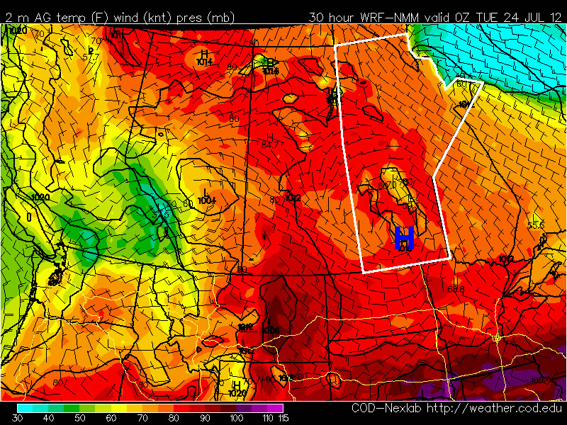
This week will be another hot one in Southern Manitoba and indeed all over Western Canada. The potential for thunderstorms during the week may temper the heat somewhat.
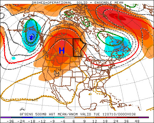
A large ridge of high pressure will reside over Western Canada this week
The weather forecast for this week will be rather tricky. What we do know for sure is that it will be hot all week, with high temperatures being near 30C every day. However, what is somewhat unclear is the risk of thunderstorms during the week. Let’s start with the easy part – the heat.
Temperatures will start out the week in the upper twenties or near thirty on Monday and Tuesday in Southern Manitoba. Humidity levels should remain low on these day making conditions hot, but not excessively so. By Wednesday high temperatures should be be in the low thirties with the humidity making it feel closer to 40. It currently appears that temperatures for late week will remain around the 30C mark, with humidity levels remaining elevated.
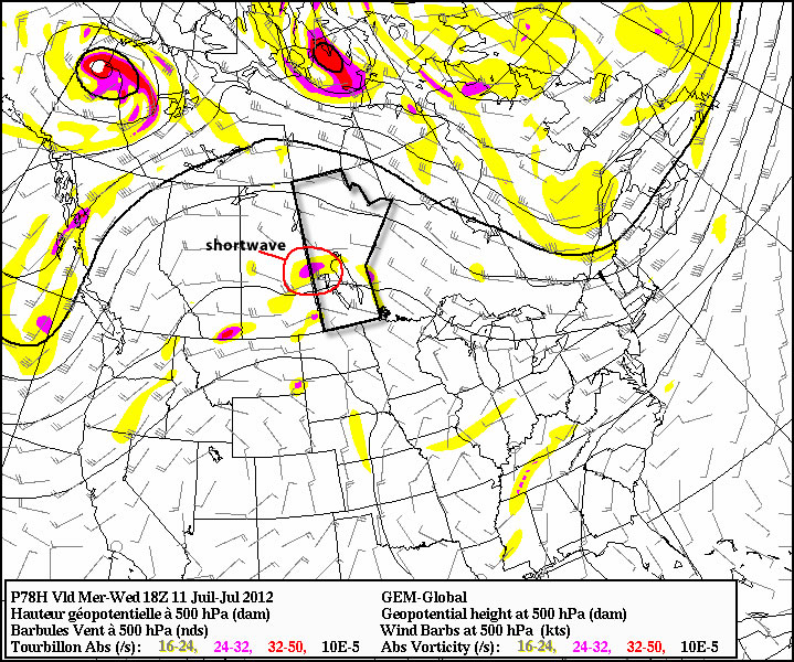
A shortwave will move toward the Eastern Prairies on Wednesday, potentially helping to trigger thunderstorms
The presence of heat and humidity over the Prairies this week will cause the atmosphere to become unstable, creating the risk of thunderstorms on many days. Unfortunately, the thunderstorm forecast is not entirely certain. The issue is that a large region of high pressure, such as the one we’ll be under, does not typically promote widespread thunderstorm activity. In fact high pressure usually suppresses convective activity. It looks like this ridge will not be very good at suppressing thunderstorms, which complicates the forecast significantly.
At this point it looks most likely that Southern Manitoba will see thunderstorms mainly during the second half of this week, from Wednesday onward. During that time period the atmosphere will be most unstable and there will be some weather features moving through the region which may trigger storms. The jet stream has weakened significantly over the Prairies as of late, meaning that most storms will be non-severe in nature. Heavy rain will likely still be a concern though due to slow storm motion. Some severe storms will also be possible just simply due to the instability present in the atmosphere. Although stronger storms will certainly be less widespread than weaker ones. As the week progresses we’ll have to reassess the thunderstorm risk one day at a time.
While my forecast for this week might seem a bit equivocal, that will just be the nature of the weather in the short-term. Unfortunately thunderstorms are just simply unpredictable a frustrating but unavoidable aspect of mother nature.