Milder Temperatures on the Way for Winnipeg

Temperatures will warm dramatically through the second half of the work week, reach near-freezing values on Friday.

Before the warm weather arrives, though, is one more cold day. Winnipeg will see a seasonably cool high of -17°C today as an Arctic ridge exits the region. Skies will be sunny and winds will be light out of the west. Warmer temperatures will begin working into the region tonight with southerly winds picking up into the 20 to 30 km/h range. Temperatures will dip to a low near -25°C.

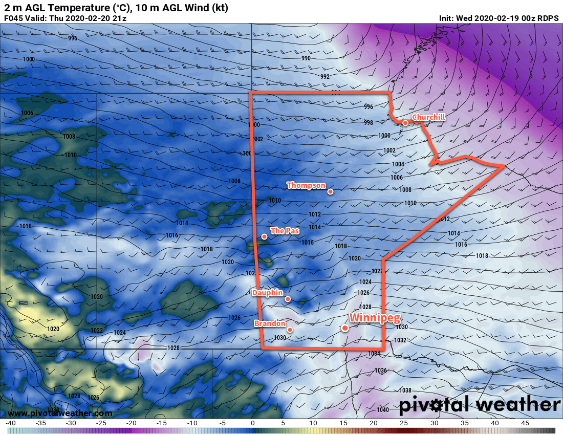
Thursday will be a breezy day with south-southwest winds near 30 gusting 50 km/h. The wind will be even stronger near the western escarpment of the Red River Valley where downsloping winds will reach 40 gusting 60 km/h. Winnipeg may see a bit of cloud in the morning as some passes by mainly to the north of the city, but overall the city will see mainly sunny skies through the day.

RDPS 2m Temperature Forecast valid 21Z Thursday February 20, 2020
Temperatures will begin to warm on Thursday, but won’t reach their potential until winds shift more westerly on Thursday night.

Temperatures will climb to a high near -9°C by the end of the day, held back slightly by cold air in the return flow from the high. Winds will remain breezy and shift slightly more westerly overnight. As soon as that westerly component to the wind shows up, temperatures will rise up to around -6°C.

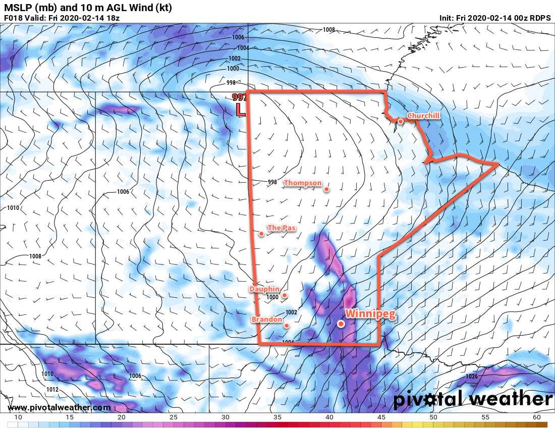
Winnipeg will see plenty of sunshine on Friday with winds gradually tapering off. Temperatures will warm a bit more with a high near -2°C. Skies will stay clear on Friday night with temperatures dipping to a low near -8°C.

Long Range Outlook

More warm weather is ahead for the weekend with temperatures near the freezing mark and partly cloudy skies. The warm weather will stick around for Monday, then increasing cloudiness will accompany a cold front that will move through the region later in the day. Temperatures will return to slightly cooler than seasonal values for the rest of the week with highs around the -10°C mark.

Today’s seasonal daytime high in Winnipeg is -7°C while the seasonal overnight low is -18°C.

Windy Friday Marks A Brief Warm-Up

Winnipeg will see howling southerly winds today as warmer temperatures build back into the region. Unfortunately, they’ll be gone nearly as quickly as they arrive.

Milder temperatures are spreading towards the Red River Valley today as a low pressure crosses the northern Prairies. The cold air in the Red River Valley won’t exit without a fight, though, with strong southerly winds formed between the tight pressure gradient between the approaching low and departing Arctic high. Winnipeg will see southerly winds of 40 to 50 gusting 70 km/h this morning, producing wind chill values of -35 to -45 this morning. Temperatures will slowly climb through the day alongside increasing cloud. The winds will be strongest midday, then gradually ease to 30 gusting 50 km/h through the afternoon. By the time the sun goes down, Winnipeg’s temperature should reach around -10°C with cloudy skies.

The winds will ease tonight with temperatures remaining climbing a bit more to -8°C under cloudy skies. There’s a chance the region will see a few flurries through the night.

RDPS 10m Wind Forecast valid 18Z Friday February 14, 2020
Strong southerly winds will be move through the Red River Valley on Friday morning.

On Saturday, the cold front associated with the northern Prairies low will push through southern Manitoba. Before it arrives, temperatures will continue near seasonal values with cloudy skies. It will push through midday, ushering in northwest winds of 30 to 40 km/h that will clear skies out and send temperatures falling to around -17°C. Winds will ease in the evening as another high moves into the region. Temperatures will dip to a low near -27°C on Saturday night.

Sunday will see sunshine become mixed with a few clouds and temperatures climb back to around -16°C. A southerly wind will develop in the afternoon as the return flow on the rear flank of the departing high moves into the region. Winds won’t be nearly as strong as seen on Friday. On Sunday evening, more cloud will push into the region as a weak low moves through. With the system moving through on Sunday night and all of the cloud it brings, temperatures should actually rise a bit through the night to about -13°C by Monday morning.

Long Range Outlook

There continues to be agreement that after some variable temperatures to start next week, a notable push of warm air will work into the region for the latter half of the week. With this, daytime highs are forecast to climb back to around 0°C and stay there for at least 4–6 days. There continue to be no major snowfall events in the forecast.

Today’s seasonal daytime high in Winnipeg is -8°C while the seasonal overnight low is -19°C.

Arctic Outbreak Grips The Prairies, Improvement By Weekend

Temperatures have plummeted in Winnipeg with the arrival of an outbreak of Arctic air. Fortunately, the cold snap will be short-lived with a return to seasonal temperatures by the weekend.

A sprawling Arctic high will move through the Prairies today and tomorrow, keeping temperatures well below seasonal values. North winds of 30 gusting 50 km/h will combine with temperatures in the low minus twenties this morning to produce extreme wind chill values of -40 to -45. ECCC has an extreme cold warning in effect for dangerous wind chills that are in place across most of the province this morning.

Wind chills will moderate through the day as the high approaches and winds ease. Temperatures won’t recover much, though, with a high of only -24°C expected in Winnipeg. On the bright side, the city will see plenty of sunshine today.

Temperatures will dip to a low near -30°C tonight with westerly winds up to 15 km/h. Wind chill values will likely drop back below -40 overnight.

RDPS 2m Temperature Forecast valid 09Z Thursday February 13, 2020
Temperatures will fall below -30°C tonight across parts of the southern Prairies.

More sunshine is on the way for the city tomorrow with a high near -20°C. Winds will be light through the day, shifting from westerly to southerly as the high works its way across the province. Temperatures will fall to a low near -24°C on Thursday night with winds increasing to 30 km/h through the night.

Milder temperatures will gradually work into the region on Friday, but as is common with these transition days, it will be windy. The Red River Valley will see southerly winds of 40 to 50 km/h through most of the day with mostly cloudy skies.

GDPS 10m AGL Wind Forecast valid 18Z Friday February 14, 2020
Moderate southerly winds will develop over the Red River Valley on Friday morning.

By the time the sun goes down, temperatures should reach around -10°C, then increase further to around -8°C for the night as winds shift to the west.

Long Range Outlook

Winnipeg will see seasonal conditions on Saturday, then another cool snap will move into the region for Sunday and Monday. It won’t be nearly as bad as today’s Arctic outbreak, though; highs are forecast to be around -15°C. Through the rest of next week, most models agree in a general trend towards another spell of mild temperatures for the second half of the week.

Today’s seasonal daytime high in Winnipeg is -9°C while the seasonal overnight low is -19°C.

Arctic High Barreling Towards Southern Manitoba

A series of low pressure systems will bring mild temperatures and light snow to southern Manitoba over the next couple days. Then bundle up, because bitter cold will crash through the Prairies into southern Manitoba.

A low pressure system passing through the region will bring cloudy skies with light snow to Winnipeg today. The city will see about 2 cm of snow before it tapers off later this afternoon. Temperatures will be seasonably mild with a high near -6°C. Winds will be breezy this afternoon, picking up to northwest to 30 gusting 50 km/h behind a weak cold front. Skies will clear out this evening with temperatures dipping to a low near -13°C. Winds will ease and shift westerly, but some breezy conditions will continue to be possible along the escarpment of the western Red River Valley.

On Tuesday, more cloud will build into the region as the next low rapidly approaches. The city will see mixed skies becoming cloudy later in the day. Winds will pick up to 30 gusting 50 km/h out of the southwest, sending temperatures to a high near -3°C. The low will pass through in the evening, bringing snow into the region and ushering in a powerful cold front.

After a few hours of light winds late in the day, northerlies will strengthen to 40 gusting 60 km/h overnight. Light snow will move into the region in the evening and persist through much of the night. Although only around 2 cm of snow will fall, the strong winds may still produce some areas of reduced visibility in blowing snow. Temperatures will plummet through the night, reaching a low near -26°C on Wednesday morning. Dangerous wind chills of -40 or colder are possible overnight into Wednesday morning.

RDPS 2m Temperature Forecast valid 00Z Wednesday February 12, 2020
A powerful cold front will surge southwards through the province on Tuesday night, ushering in a bitterly cold Arctic air mass.

Skies will clear on Wednesday as the Arctic high moves into the region. Temperatures will barely recover with highs of just -24°C expected. Northwesterly winds of 30 to 40 km/h will continue for much of the day, not easing until the latter parts of the afternoon into the evening. Temperatures will head to a low near -31°C on Wednesday night with dangerous wind chills of -40 or lower possible again.

Long Range Outlook

The cold weather will stick around for Thursday, then seasonal temperatures are forecast to return after a windy Friday. The weekend will bring near-normal temperatures and variable cloudiness with no significant snowfall expected.

Today’s seasonal daytime high in Winnipeg is -9°C while the seasonal overnight low is -20°C.