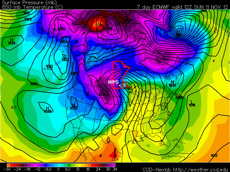
There will be a very slight chance of showers today as a low pushes across the Interlake region, however the bigger news will be this weekend, when a powerful Colorado Low ushers in winter over Southern Manitoba.
A low pressure system track through the Interlake today will bring 10-15cm of snow through Central Manitoba, north of the track of the low. Through southern Manitoba, there will just be a slight chance of a shower through the afternoon and evening as most areas see a mainly cloudy day with a high near 3 or 4°C. There’s a slight chance to see some sun across many areas this morning, however the likelihood of fog development in any clear areas may mask the chance for sunshine.
Thursday will bring some sunshine and a windy morning, with winds gusting out of the N/NE to 30 or 40km/h behind the system, but should lighten into the afternoon. Temperatures will be cooler than late, with highs only around -1 or 0°C.
By Friday, we’ll begin to feel the impact of the Colorado Low. Winds will begin to pick up out of the northeast as snow begins pushing into SW Manitoba. Snow will make it’s way into the Red River Valley overnight, with steadier snow developing Saturday morning. Disagreement still exists amongst the model runs as to where the heaviest snowfall will be, however the NAEFS (North American Ensemble Forecast System) has been startling consistent over the past few days with painting the heaviest snowfall right over Winnipeg.
The NAEFS is showing significant confidence in areas in Southwest Manitoba (Melita, Pilot Mound, Virden and Brandon) regions seeing more than 10cm of snow, with a decent likelihood of people west of the Red River seeing ≥ 10cm as well. North of the Trans-Canada highway, it looks like from Portage to Winnipeg has a sizeable chance of seeing greater accumulations, as well as into the Southern Interlake.
Snow will taper off on Sunday, however significant accumulations will likely have developed in it’s wake. Current indications are that the SE corner of the Red River Valley will see the least snow, and accumulations will increase as you head west and north. In addition to the snow, gusty winds to 50 or 60km/h will push into the Red River Valley as well, producing widespread reductions in visibility due to falling and blowing snow. System-total precipitation looks to be 15-25mm, which when taking into account the expected SLR (snow-to-liquid ratio) of around 10:1, would result in a total of 15-25cm of snow. General estimates for accumulated snowfall by the end of the weekend for a few select sites are:
- Winnipeg: 15-20cm
- Steinbach: 10-20cm
- Morden/Winkler: 15-25cm
- Portage la Prairie: 15-25cm
- Brandon: 10-20cm
- Pilot Mound: 15-25cm
- Sprague: 5-15cm
- Victoria Beach: 10-20cm
- Gimli: 10-15cm
We’ll have more updates on the track of this system as the week progresses. Monitor EC’s Weather Office site for forecasts and any watches or special weather statements as the week progresses. Although the exact timing and intensity of this system may be difficult to pin down, it’s a safe bet to say that driving conditions will likely be extremely poor with ice-covered roads and low visibilities in blowing snow. Conditions in North Dakota will also be quite poor as well this weekend. If you have plans to travel by car/truck this weekend, be sure that you’re prepared for the hazardous weather that will be present. Always carry a winter survival kit in your vehicle if you must travel during winter storms.


