Today’s post will be short as I’m occupied with some family-related business.
Moderate snow pushed into the Red River Valley yesterday evening, bringing reduced visibilities and slippery conditions. Snow will continue through much of the day before tapering off.
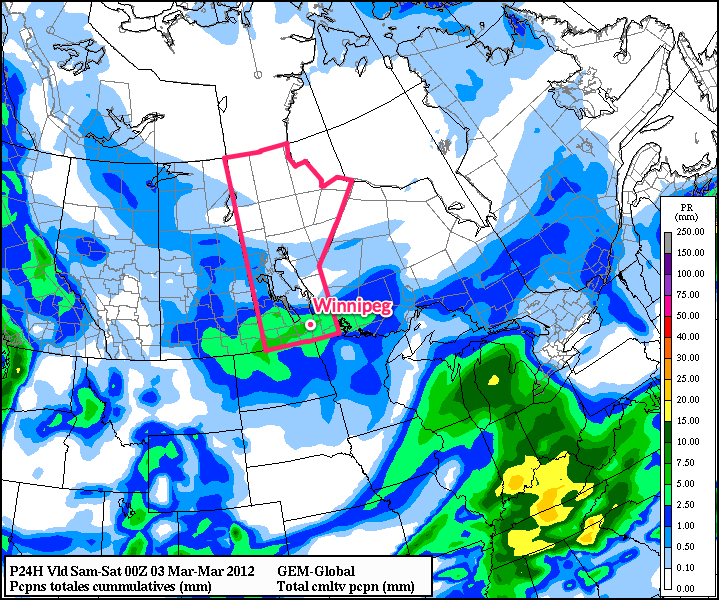
Snowfall accumulations will generally be close to 5cm, however there will be a swath near the Trans-Canada highway between Brandon and Winnipeg that will likely see total amounts in the 5-10cm range. Snow should taper off by evening, and we’ll see an overnight lows throughout the RRV around -15°C.
Over the weekend, we’ll see mostly sunny skies with daytime highs near between -10° and -5°C, with overnight lows between -20°C and -15°C. The next chance for precipitation will come Monday with a passage of a warm front that will push our temperature up into the plus mid-single digits.