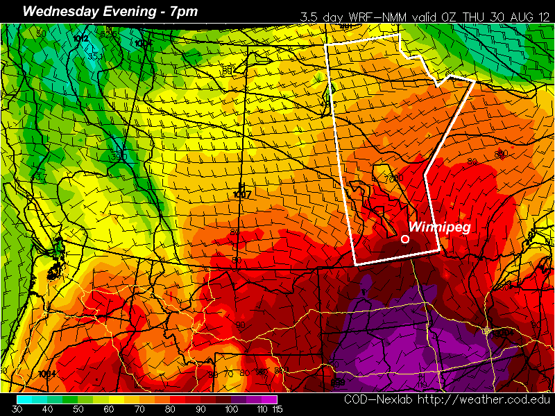
Some more hot weather is in store this week as we close out August. We might even see our hottest day of the summer!

Yet another ridge of high pressure will build over the Prairie provinces for this week, bringing more hot weather. Monday will be a nice day, with light winds and high temperatures in the mid to upper twenties in Southern Manitoba. Skies should remain mainly sunny as high pressure suppresses convective cloud cover. By Tuesday temperatures will climb up around the 30C mark, but humidity levels should remain low keeping conditions at least somewhat bearable. Wednesday could potentially be the warmest day so far this summer in many parts of Southern Manitoba. Current models give the following high temperature predictions (for Winnipeg):
- NAM: 36C
- ECMWF: 35C (estimated based on 850mb temps)
- GFS: 32C
- GEM: 30C
Based on recent model performances, the NAM should be the favoured solution at this point. Given that low humidity is expected on Wednesday, there certainly is the potential for temperatures to reach the mid and upper thirties in Southern Manitoba. The two main factors that will determine how hot it gets are:
- How much warm air manages to flow in at the low-levels on Wednesday
- Whether or not a moderate-strong low pressure system forms to our west, causing winds to stay southerly or south-easterly on Wednesday
If 850mb temperatures manage to sneak up into the mid twenties over Southern Manitoba on Wednesday and the wind veers to south-westerly or westerly, then expect high temperatures in the mid to upper thirties in most areas. However, if the wind stays more south-easterly on Wednesday with cooler 850mb temperatures, then highs will likely stay stuck around the 30-33C mark. Of course all the above points assume that we will see sunny skies on Wednesday. At this point there doesn’t appear to be anything which would indicate that we will see extensive cloud cover, but that is always a wildcard to consider.
A cold front is expected to pass through at some point on Wednesday night or Thursday, cooling temperatures back down into the twenties for Thursday and Friday.
