Historical Flooding in Colorado
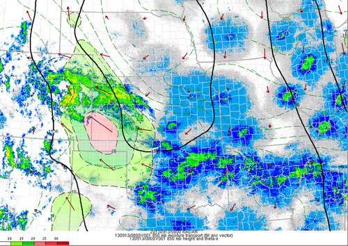
This past week Colorado has been absolutely swamped thanks to moisture streaming up from the Gulf of Mexico, riding up the Rocky Mountains (upslope flow) and then falling as rain. High pressure sliding down from the north in the US Plains as well as an upper-level low to the west drew in the moist air from the southeast. Generally, 850mb dewpoints could be found in the 15°C range and PWAT values around 40mm in Eastern Colorado. Plentiful moisture was in place – a recipe for heavy rains that had the possibility to fall for a long period of time. This became the case for Wednesday evening through Friday morning for Boulder, Colorado and surrounding communities.

As best described by NWS Boulder, flooding of “biblical” proportions took place is continues as of Friday night. Small creeks easily turned into raging rivers that inundated whole towns and mudslides blocked highways, took out buildings. The death toll is already at four but concerns of more as 172 people are still missing and some communities are literally cut off, with no roads leading in or out of town. Interstate 25 had been closed due to water running over it as well as numerous other highways that had simply been washed away.
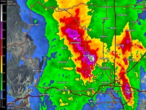
The average rainfall per year for Boulder, CO is around 525mm, this means that in a few days Boulder got over half its annual rainfall at 310mm. This easily beats out the old record for rainfall in September (243mm), and average of 43mm (this month; 721% above average September rainfall). Interestingly enough, the area which received all this rainfall was under a moderate to extreme drought as per the Drought Index.

It appears as though Boulder might get a break from the rain today as the upper-level low weakens and moves further east though there is still a slight chance for pop-up (non-severe) storms. Tomorrow will likely bring with it more rain for the region, unfortunately.
