After a very pleasant Friday that will see temperatures soaring into the upper 20’s under sunny skies, the weather will turn more unsettled as a complex of low pressure systems move across Manitoba. It won’t be a rainy weekend, but multiple chances for showers or thunderstorms will exist.
Warm but Windy Friday
Today will be a fairly pleasant day across the Red River Valley save for one aspect: the wind. Temperatures will climb into the upper 20’s, topping out at around 28°C with comfortable humidity as dew points settle around 15°C or so. The wind, however, will strengthen out of the south through the day as a low pressure system begins working its way into western Manitoba.
The winds will ease up this evening under mainly clear skies. It will be quite a mild night with the temperature dropping to only around 17°C. Some cloud cover will roll into the Red River Valley overnight as a cold front approaches.
Severe Thunderstorm Threat Returns Saturday
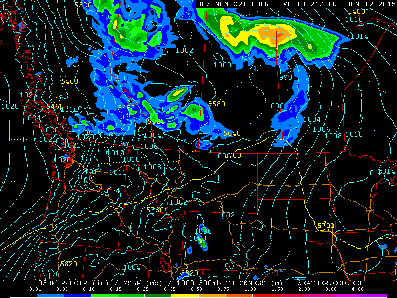
Tomorrow will bring a threat of severe thunderstorms to the Red River Valley. A slow-moving cold front will push across the region and is expected to trigger thunderstorms through the afternoon. Where exactly sees thunderstorm activity will depend on exactly how quickly the front manages to push eastwards, which is a bit of an uncertainty at this point.
Most convective parameters look pretty good; CAPE values are expected to climb to around 1500 J/kg as we head to a high near 28°C with a dew point around 17–18°C. This slightly humid air will make it feel more like 33–34°C before the cold front passes through. Ample bulk shear with a 50+ kt jet at 500mb looks favourable, however some synoptic subsidence may occur due to unfavourable jet positioning.
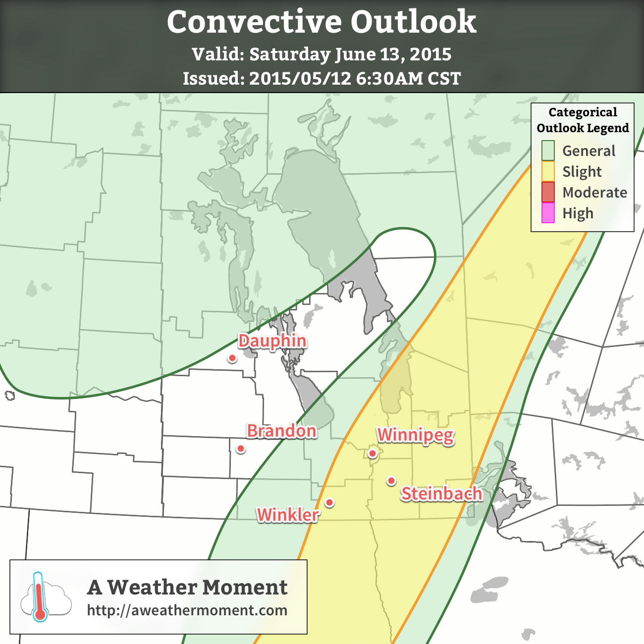
All in all, there exists a risk for severe thunderstorms along the cold front with main threats of strong winds and large hail. Other modes of severe weather are possible – such as tornadoes or flash flooding – in any severe thunderstorm, however are not expected to be primary threats on Saturday’s storms.
Otherwise, it will be a fairly pleasant day with a mix of sun and clouds and winds out of the south at around 30km/h becoming light as the day progresses. We’ll see some scattered cloud overnight on the way to a low in the mid-teens.
Showers Possible Sunday
Sunday will be a calmer day than Saturday, however the chance for some showers or even a rogue thundershower exists across much of Southern Manitoba as another disturbance ripples over the region. In general, it looks like Sunday will bring mixed to cloudy skies with a decent chance of some scattered shower activity. Temperatures will be cooler with highs of only around 23°C or so in the Red River Valley[1] thanks to the cloud cover and slightly cooler air mass. Skies should begin to break up through the Red River Valley on Sunday evening as temperatures dip to 13 or 14°C again.
- We could see temperatures creep higher, to around 25 or 26°C if enough sunshine managed to develop. ↩
A severe thunderstorm watch has been issued for the Red River Valley & southern Interlake for the potential of severe thunderstorms along a cold front slowly advancing eastwards. This front has a history of producing severe thunderstorms, first over Alberta and then Saskatchewan yesterday. Full watch text follows:
Conditions are favourable for the development of severe thunderstorms that may be capable of producing strong wind gusts and large hail.
A cold front pushing across the Red River valley this afternoon will combine with a warm and humid airmass to produce locally strong to severe thunderstorms this afternoon into this evening.
Large hail can damage property and cause injury. Strong wind gusts can toss loose objects, damage weak buildings, break branches off trees and overturn large vehicles. Remember, severe thunderstorms can produce tornadoes. Be prepared for severe weather. Take cover immediately, if threatening weather approaches.
Environment Canada meteorologists will update alerts as required. Please monitor local media or Weatheradio. To report severe weather, send an email to storm@ec.gc.ca or tweet reports to #MBStorm.