The early part of this week will remain very cold, but gradual warming is expected as the week progresses.
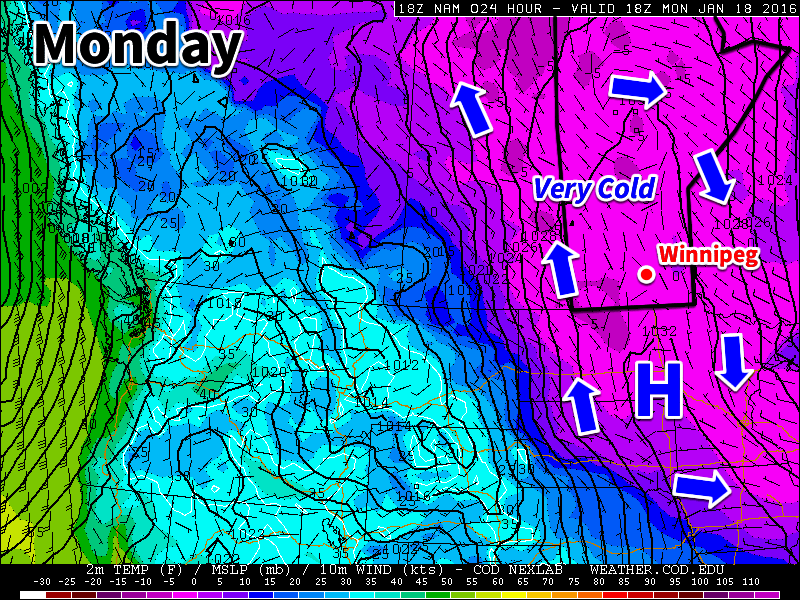
Monday
A surface ridge of high pressure will be centred over southern Manitoba today, continuing the chilly conditions that have plagued us for some time. The only good part about this ridge is that it will bring light winds to the region, at least keeping wind chill values at bay. High temperatures in southern Manitoba are expected to be near the -20C mark today under clearing skies. There is a slight chance of flurries early in the day before the clouds clear.
Tuesday
Tuesday will see slightly warmer weather in southern Manitoba as the surface high moves off to the east. Skies will be mainly cloudy, helping to maintain these slightly warmer conditions. Due to the presence of these clouds we may see some light flurry activity, but only trace accumulations will be possible. Winds will be noticeable stronger than Monday, with values of 20-30km/h out of the south.
Wednesday
Wednesday will remain mainly cloudy as a weak low pressure system approaches. We may again see some flurry activity throughout the day, but large accumulations are not expected. Some models bring measurable, but still light, accumulations of snow to southern Manitoba on Wednesday, so don’t be surprised if this forecast changes a bit. Winds will be generally light and from the south.
Long Range
The long range forecast shows us continuing to warm as we approach the weekend. Models suggest that late January will generally be warmer than normal (the normal high is currently around -13C). The current El Nino in the Pacific Ocean is hovering around record levels, thus we can expect it to begin more profoundly exerting its influence on our weather again before this winter is over.