A disturbance passing through southwestern Manitoba today will spread a few flurries into the Red River Valley through the day today, while snow giving accumulations remains to our west where a further 2-4 cm of snow is expected to fall. Another blast of Arctic air will plunge southwards behind this system, plunging temperatures 10-15°C below normal by the end of the week.
A few flurries will be in place throughout Winnipeg and the Red River Valley today as a low pressure system passes through southwestern Manitoba. West of the Valley, through Parkland & southwest Manitoba, the snowfall will be more organized, with between 2 to 4 cm piling up by the end of the day.
Amounts diminish quickly to the east, however, with only a dusting in the Red River Valley. The flurries will taper off by the evening, leaving us with mostly cloudy skies.
Temperature wise, today will be the best day of the week. Daytime highs should climb to around -14°C in Winnipeg today with winds out of the southeast between 10-20 km/h. Temperatures will be cool tonight, but the cloud cover will help moderate things ever so slightly. The overnight low in Winnipeg will fall to near -23°C with light northwesterly winds.
The story for the remainder of the work week is simple: Arctic air building in. Behind Wednesday’s low, an Arctic ridge will build southeastwards, ushering in colder air that will result in temperatures near 10°C below normal by Friday.
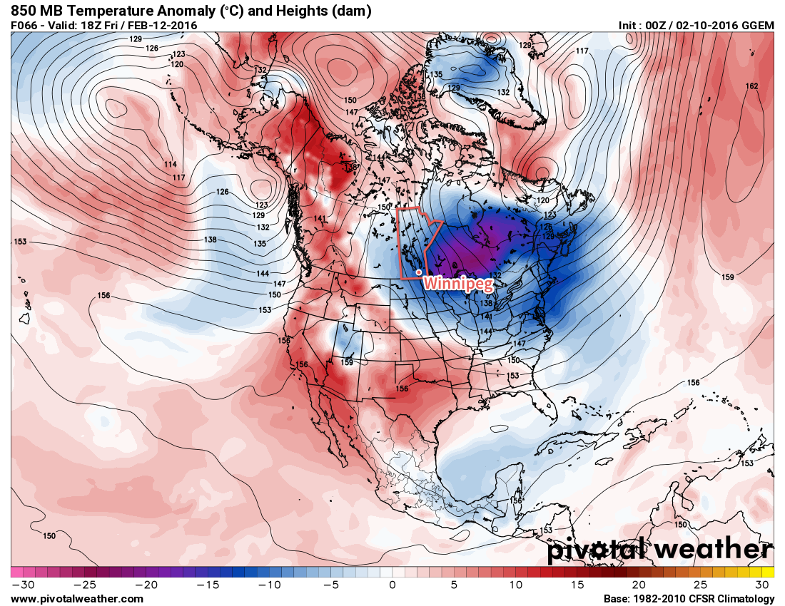
Thursday will be fairly cloudy as we remain relatively close to a strong frontal boundary to our west. As a result, temperatures will be similar to Wednesday but just a degree or two colder. That means in Winnipeg I expect to see a high near -15°C with winds remaining fairly light out of the west to northwest. Some cloud will begin breaking up on Thursday night as the ridge begins pushing into the southern Prairies, and the overnight low will dip to around -25 or -26°C under light northerly winds.
Friday will see clearing as the Arctic ridge moves over Southern Manitoba. This will be the coldest day of the week with high temperatures struggling to climb above -20°C. Friday night will be the coldest night of the week, with temperatures dipping precariously close to the -30°C mark, if not below it. Throughout the whole time, winds will remain light.
Long Range: Big-Time Warm-Up In The Cards?
While the cold weather will likely persist into the weekend, all signs point towards a dramatic warm-up for the beginning of next week and potentially persisting well through the week.
The first of several Pacific-sourced systems is expected to track across the Prairies on Monday, spreading warmer air eastwards as the Polar Vortex begins shifting eastwards. This system is forecast to be followed up by a much, much stronger system that is showing the potential of bringing significant amounts of warm air to the eastern Prairies. The potential for daytime highs above 0°C returns for the second half of next week.
Of course, along with any big warm-up, the potential exists for some particularly uncomfortable days with strong southerly winds and it’s currently unclear on where exactly precipitation associated with these systems will fall. More on that later this week!
The normal daytime high for Winnipeg is currently -9°C and the normal overnight low is -20°C.