Southern Manitoba will see one more day of showers and thunderstorms before a calmer, drier pattern moves in for the remainder of the work week.
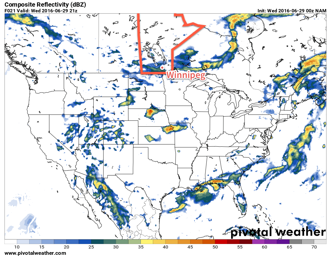
Today will bring another round of showers and thunderstorms to southern Manitoba as a cold front sweeps through the region. Under mixed skies, showers will develop through the morning, spreading southwards from the Parkland & Interlake regions into the Trans-Canada corridor and areas south through the afternoon. With MLCAPE values of 750-1250 J/kg and only around 25kt of bulk shear, the threat for severe thunderstorms will be minimal, although a quick pulse thunderstorm that quickly produces large hail and then falls apart isn't out of the question.
Temperatures will climb to near 25°C before cooling off as the cold front swings through in the afternoon. Winds will be relatively light, but we may get some slightly breezier conditions with winds out of the north to 20-30km/h behind the cold front. Skies will clear this evening and temperatures will dip down to a low near 11°C overnight.
Thursday will see a ridge of high pressure moving into the province, which will bring mainly sunny skies, breezy winds near 30km/h out of the north and a high near just 19°C. Expect an overnight low near 8°C on Thursday night with light winds.
As the ridge of high pressure moves east of the Red River Valley on Friday, winds will gradually shift out of the south and slightly warmer air will move into the region, pushing daytime highs in Winnipeg to near 22°C with a few afternoon clouds.
Long Range
The dry weather won't be long to stay as things turn more unsettled on the weekend. A pattern shift back towards a more active storm track that brings the chance for rain or thunderstorms. Saturday will likely be dry, but the chance for rain and thunderstorms appears to return on Sunday and then persist through much of next week as a very unsettled pattern takes hold.