Winnipeg will see a reprieve from the damp, cloudy weather this weekend as the clouds clear out later today and clear to mixed skies move in. Alongside the sun, daytime highs over 5°C above normal will remain in place, continuing the likely record-setting above normal temperature trend seen for the entirety of November so far.
Today will start off cloudy, however throughout the afternoon the clouds should begin to break up as some drier air moves in from the southwest. Without the persistent fog and mist in place, temperatures will have a bit more mobility than they have the past couple days, and Winnipeg should see a daytime high near 3°C. Winds should remain fairly light through the day out of the south to southwest. Expect clear skies giving way to a bit of cloud on Friday night, with temperatures dipping to a low near -3°C.
Saturday morning will start off with some cloud in the area as a warm front pushes through, but then we should see clearing and some sunshine for the afternoon.1 Temperatures should climb to a high near 3°C again with light winds out of the south to southeast. Skies should remain fairly clear on Saturday night with a low near -3°C again.
Sunday will bring increasing cloud to the city through the day as a significant weather system begins organizing south of the border. While skies will be mixed, temperatures will still be pleasant with highs yet again near 3°C. Winds will be out of the southeast at 10-20 km/h. Cloud cover will increase on Sunday night with temperatures dipping down to around 0°C.
Record Warmth
So far this month, Winnipeg has had an average high temperature of 8.1°C. With the forecast temperatures ahead, November will end with an average high temperature near 7.1°C and a mean temperature2 of approximately 2.6°C. The average high temperature will likely end up taking the #1 or #2 spot for warmest Novembers by average high temperature.
| Rank | Average Daily High (°C) | Average Daily Mean (°C) | Average Daily Low (°C) |
|---|---|---|---|
| 1 | 7.2 (2016) | 3.1 (2016) | -1.1 (2016) |
| 2 | 7.1 (2009) | 1.3 (1899) | -3.2 (1923) |
| 3 | 6.4 (1999) | 1.3 (1923) | -3.3 (1899) |
| 4 | 5.8 (1899) | 1.0 (1981) | -3.3 (1922) |
| 5 | 5.8 (1923) | 0.9 (2001) | -3.5 (1981) |
| 6 | 5.7 (2001) | 0.8 (2009) | -3.6 (1917) |
| 7 | 5.5 (1981) | 0.6 (1999) | -3.7 (1953) |
| 8 | 5.3 (1939) | 0.5 (1917) | -3.9 (2001) |
| 9 | 5.2 (1904) | 0.2 (1922) | -4.3 (1918) |
| 10 | 4.6 (1917) | 0.1 (1953) | -4.3 (1944) |
So far November has had an average overnight low of -0.8°C, with a forecast month-average of -1.0°C. This is a whopping 2.2°C above the previous record of -3.2°C set in 1923. The monthly mean temperature is forecast to end up at about 2.6°C, which crushes the previous record by 1.3°C. To put that in perspective, Winnipeg is forecast to break the previous monthly mean temperature record by the same amount as the spread from the current record to the 10th place entry.
Long Range
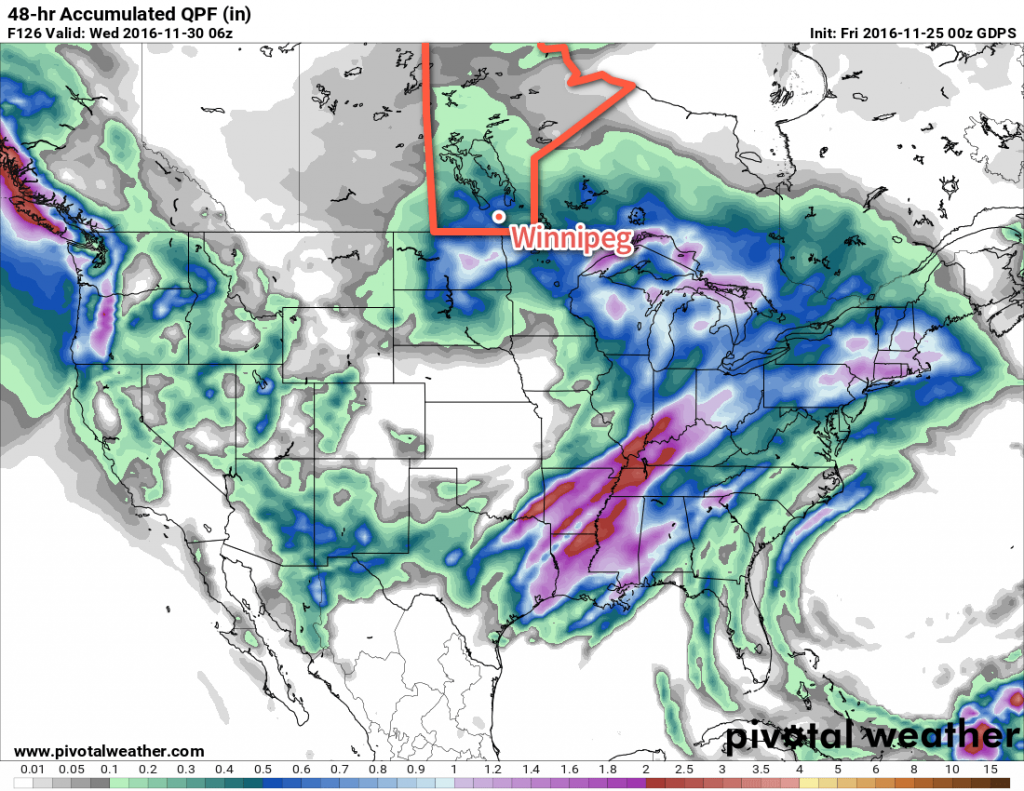
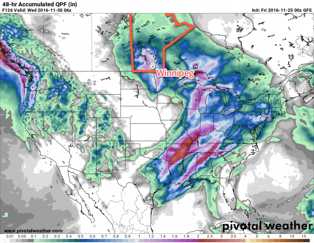
The start of next week threatens another winter storm for the region as a Colorado Low moves into Minnesota. Again there’s quite a bit of uncertainty as to how progressive the system will be and whether it will back into the Red River Valley or end up further east and missing the province. The general agreement is that the Red River Valley will be hit by this system, but how much precipitation will fall is a wild card.
The big challenge with this system, should it actually hit the Red River Valley, will be what will actually fall out of the sky. Best indications are that much of what falls may actually be rain rather than snow, but it’s far too early to put too much stock in any particular forecast other than saying that this system, should it hit Winnipeg, will likely bring a wintery mix to the region. We’ll be keeping an eye on it as the system develops!
Winnipeg’s seasonal daytime high is currently -5°C while the seasonal overnight low is -13°C.
- Most forecast models show clear skies in the afternoon behind the warm front, however a few outliers want to keep things cloudy. At this point, with a broad southwest to westerly flow expected in the warm sector, I think that skies should manage to clear out, but we’ll keep an eye on things incase pesky cloud manages to stick around. ↩
- The mean temperature is an average of high and low temperatures of each day. ↩


