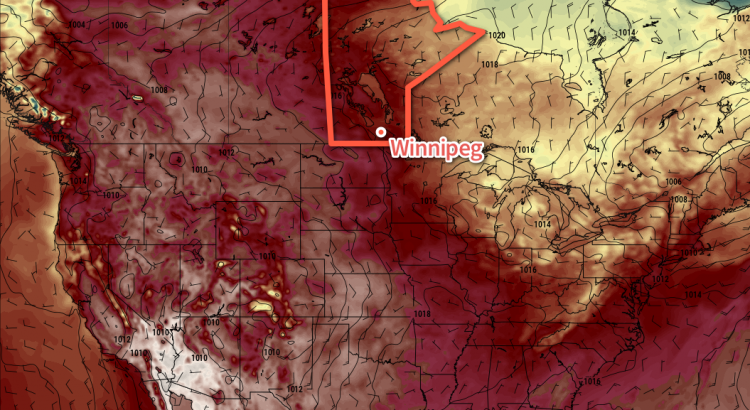
An upper-level ridge building into the Prairies will spread significantly warmer-than-seasonal temperatures back into the region while keeping the rain well away.
Winnipeg has quite the stretch of warm, dry weather ahead as an upper level ridge builds eastwards through Alberta and into the eastern Prairies over the next couple days. That said, it makes for a pretty short forecast.
Today will bring mixed skies as some cloud moves into the region associated with the warmer air moving in aloft. Winds will be light and temperatures will head to a high near 21°C. Clouds will stick around through the night as temperatures head to a low near 10°C.
Thursday will bring partly-cloudy skies to Winnipeg with a high around 22°C and a light northeast wind. The clouds should clear out by the evening and then temperatures head to a low near 8°C.
And for Friday, nothing but sunshine as highs climb to around the 23°C mark as winds pick up to around 15-20 km/h out of the south. Expect a low near 12°C on Friday night under clear skies.
Long Range
The warmth intensifies on the weekend with highs in Winnipeg climbing into the upper 20’s with a slight chance of even seeing a 30°C reading on Sunday. A cold front will move through on Sunday evening bringing a slight chance of a shower or thunderstorm, but then things go right back to sunny with warmer-than-seasonal temperatures continuing!
Winnipeg’s seasonal daytime high is currently 20°C while the seasonal overnight low is 8C.