Sweltering summer heat will slowly build into Winnipeg this week as an upper ridge builds moves into the region.
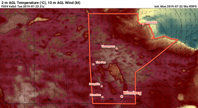
The only significant weather feature for southern Manitoba over the next few days will be a potent upper-level ridge building into the region. As it approaches, daytime highs will slowly climb to around 30°C with overnight lows moving from the mid-teens to around 20°C.
Conditions will remain dry over the next few days with sunny to partly cloudy skies in place right through Wednesday. Overnight Wednesday into Thursday morning there may end up being a chance of showers or thunderstorms as a low pressure system begins moving eastwards across southern Saskatchewan.
Humidity levels should remain comfortable through the first half of the week.
Long Range Outlook
The heat continues into the second half of the week, but Thursday in particularly looks sweltering. As the low pressure system passes by to the north, dew points are expected to climb to around 20°C. Assuming that the region ends up seeing enough sunshine, this would produce humidex values in the upper 30s. The humidity will ease heading into the weekend, but temperatures should remain warm with highs in the upper 20s or low 30s.
Today’s seasonal daytime high in Winnipeg is °C while the seasonal overnight low is °C.