Variable Cloudiness, Above-Seasonal Temperatures Ahead

This week is shaping up to be pleasant in Winnipeg with variable cloudiness and slightly above-seasonal temperatures.

Winnipeg will remain under the influence of a stationary high pressure system for the rest of the week. The result will be dry conditions with pleasant temperatures and variable cloudiness lasting into the weekend.

RDPS 2m Temperature Valid 21Z Thursday April 19, 2018
Temperatures will climb into the mid-teens on Thursday afternoon in the Red River Valley

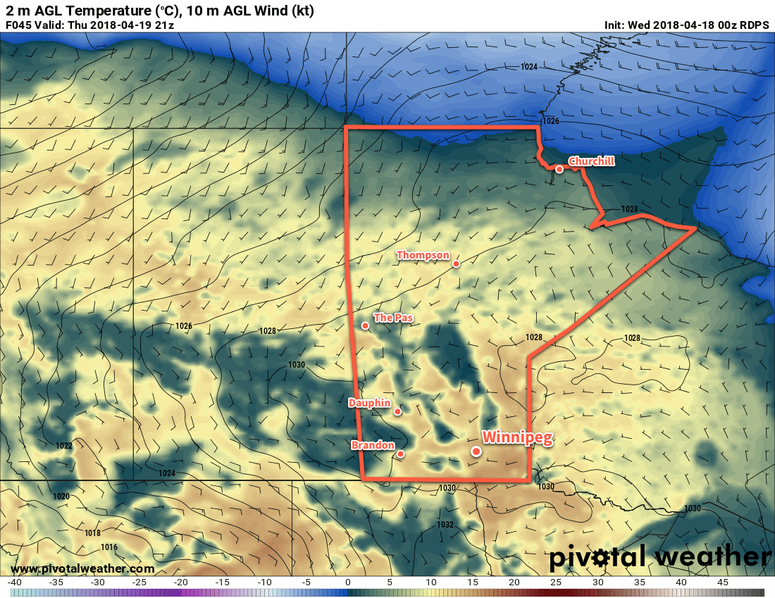
Temperatures over the coming days will trend to slightly above-seasonal values. Winnipeg will see highs in the low teens and overnight lows near 0°C as milder air gradually spreads across the Prairies. Thanks to the stationary high pressure system, winds will remain relatively light over the region. Wind speeds should remain around the 10 to 20 km/h range while the direction backs from northeasterly today to westerly on Thursday to southerly on Friday.

Long Range Outlook

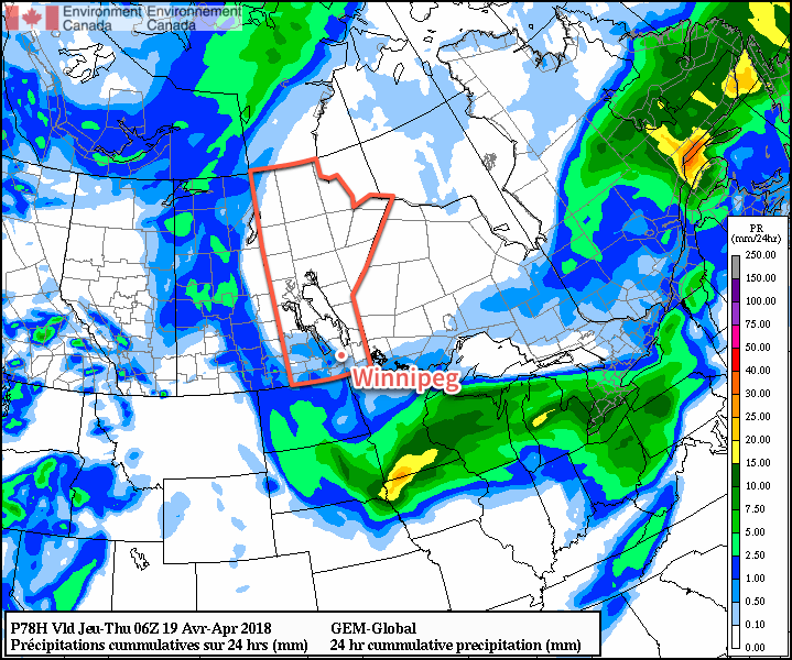
The weekend looks great, likely bringing daytime highs in the mid- to upper-teens and overnight lows well above 0°C. Notably, there are suggestions that dew point values will finally climb above 0°C, significantly helping melt any remaining snow. Precipitation continues to look unlikely.

I don’t want to count chickens before they hatch, but it seems likely that over the next week Winnipeg will finally be able to say goodbye to winter and start the spring cleaning!

Winnipeg’s seasonal daytime high is currently 11°C while the seasonal overnight low is -1°C.

Spring-Like Weather Finally Arrives

Temperatures are finally beginning to move back towards seasonal with 2018’s warmest temperatures thus far on the way!

Finally. The relentless chill that has remained over the province for a significant portion of March and April is giving way! Milder temperatures will build back into the region this week, sending daytime highs to the warmest values seen so far in 2018. While temperatures will still remain slightly below-normal, it will be a huge improvement over the days earlier this month that were 10 to 15°C colder than seasonal values!

It all begins today with a ridge of high pressure bringing sunny skies and light winds to Winnipeg. Temperatures will climb to a high near 7°C. This is still below the seasonal +10 to +11°C, but still significantly better than seen over the past weeks. Temperatures will dip to a low near -5°C tonight under clear skies.

Tuesday will bring partly cloudy skies to Winnipeg. The Red River Valley will be on the eastern edge of a system lifting into Northern Manitoba spreads overcast skies through parts of Saskatchewan and western Manitoba. Winds will be a bit more noticeable than Monday out of the east-southeast at 15 to 25 km/h. Temperatures will be quite mild, though, with a near-seasonal high of 10°C. Skies will cloud up Tuesday night as temperatures head to a low near 0°C.

RDPS 24hr. QPF valid 06Z Thrusday April 19, 2018
Some light showers will try to work into the Red River Valley Wednesday afternoon and evening.

Wednesday will bring cloudy skies to Winnipeg & the Red River Valley as systems pass by to the north and south of the region. There may be a slight chance for some showers later in the afternoon into the evening, but a light northeasterly wind will continue to push dry air into the Red River Valley and do its best to keep things at bay.1 Temperatures will climb to a high near 7°C again, then head to a low near 0°C on Wednesday night under cloudy skies.

Long Range Outlook

Long-range outlooks show the potential for some showers or snow on Thursday morning, then clearing working into Winnipeg later in the day. After that, it’s a trend towards seasonal to above-seasonal temperatures with highs in the mid- to upper-teens possible by the weekend!

Winnipeg’s seasonal daytime high is currently 11°C while the seasonal overnight low is -1°C.

  1. This dry air often spreads underneath precipitation, evaporating it either partially or fully before it reaches the ground.
NAM 2m Temperature Forecast valid 21Z Sunday April 15, 2018

Warmer Temperatures, Plenty of Sun Ahead

Winnipeg will see plenty of sun over the weekend with temperatures finally warming to near-seasonal values.

Winnipeg will be under the influence of a high pressure system for the next several days. This will result in plenty of sunshine, relatively light winds, and gradually warming temperatures.

Skies will be mainly sunny today, shifting towards partly cloudy on Saturday as the region may get grazed by cloud associated with a low pressure system in the United States. Winnipeg will likely see a partly cloudy skies on Sunday as a bit of cloud from a low pressure system tracking through the northern Prairies moves through. All that said, the forecast isn’t actually very pessimistic. Winnipeg will see plenty of sunshine over the next 3 days.

Winnipeg should finally begin shaking the pattern of below-normal temperatures with daytime highs climbing from near 0°C today to 6 or 7°C on Sunday. Overnight lows will also climb from near -10°C tonight into the mid-minus single digits for the weekend.

Winds will be breezy today, picking up to 20 to 30 km/h out of the north. They will diminish this evening, then remain relatively light at 10 to 20 km/h both Saturday and Sunday. Winds will be out of the east-southeast through the weekend.

Long Range Outlook

Winnipeg should see more sun to start next week with near-seasonal temperatures. Conditions turn a bit more unsettled mid-week, bringing a slight cool-down and chance for precipitation.

Winnipeg’s seasonal daytime high is currently 10°C while the seasonal overnight low is -2°C.

Light Snow Gives Way to Cool But Pleasant Conditions

Snow moving through the region today will give way to more sunshine, but below-seasonal temperatures remain.

Winnipeg will see another day with high temperatures above the freezing mark with cloud cover spreads eastwards into the Red River Valley. Winds will remain light, which should help make a relatively pleasant day. Skies in Winnipeg will become cloudy by late afternoon with light snow spreading into the region this evening. This system will bring 2 to 4 cm of snow to the city1, but higher amounts will fall to the west and southwest. 4 to 8 cm of snow is likely through Parkland and southwestern Manitoba, extending into the southwestern Red River Valley. The snow will ease to a few flurries overnight as temperatures dip to a low near -6°C.

24hr. RDPS Snow Accumulation (at 10:1 SLR) valid 12Z Thursday April 12, 2018
A swath of snow will fall across southwestern and south-central Manitoba Wednesday afternoon into Wednesday evening.

Any remaining flurries will taper off on Thursday morning as skies gradually clear. Temperatures will be similar to Wednesday with a high near +1°C, but northerly winds of 15 to 25 km/h will be more prominent in the afternoon. While Winnipeg will have more sun than cloud by the afternoon, the southern Red River Valley will likely have to wait until evening to see the cloud cover move out. Winds remain out of the north at 10 to 20 km/h on Thursday night as temperatures dip to a low near -11°C.

Friday will bring mainly sunny skies to Winnipeg as a ridge of high pressure builds in from the north. Winds will continue out of the north at 20 to 30 km/h. Temperatures will continue to be cool with a high near +1°C. Winds will ease on Friday night as temperatures dip to a low near -12°C.2

Long Range Outlook

The weekend is actually looking quite pleasant with plenty of sunshine and daytime highs climbing back into the mid-single digits.3 Winds look to remain light out of the east.

The next chance for precipitation looks to come mid-week with increasing cloud as a Colorado Low develops over the Northern Plains. On the bright side, it looks like a gradual trend towards seasonal temperatures through the course of the week!

Winnipeg’s seasonal daytime high is currently 9°C while the seasonal overnight low is -3°C.

  1. Amounts could end up a bit less due to snow melting on contact with the ground early in the event.
  2. With the incoming ridge of high pressure, it’s possible that temperatures could reach even a few degrees colder if the conditions are right.
  3. It has to be noted, though that this is still well below seasonal normals.