Weather Forecasts, Facts and News for Winnipeg & Southern Manitoba
Author: Brad
Brad lives in Winnipeg with his wife and two children and is the founder of A Weather Moment. He has loved weather from a very young age and has followed that passion through his life so far. He received a B.Sc. in Earth Sciences with Specialization in Atmospheric Sciences and is currently employed in the field of meteorology. You can find the author as WeatherInThePeg on Mastodon.
Although daytime highs will continue at slightly below-seasonal values in Winnipeg over the coming days, it will remain quite pleasant as the region still sees plenty of sunshine and light winds.
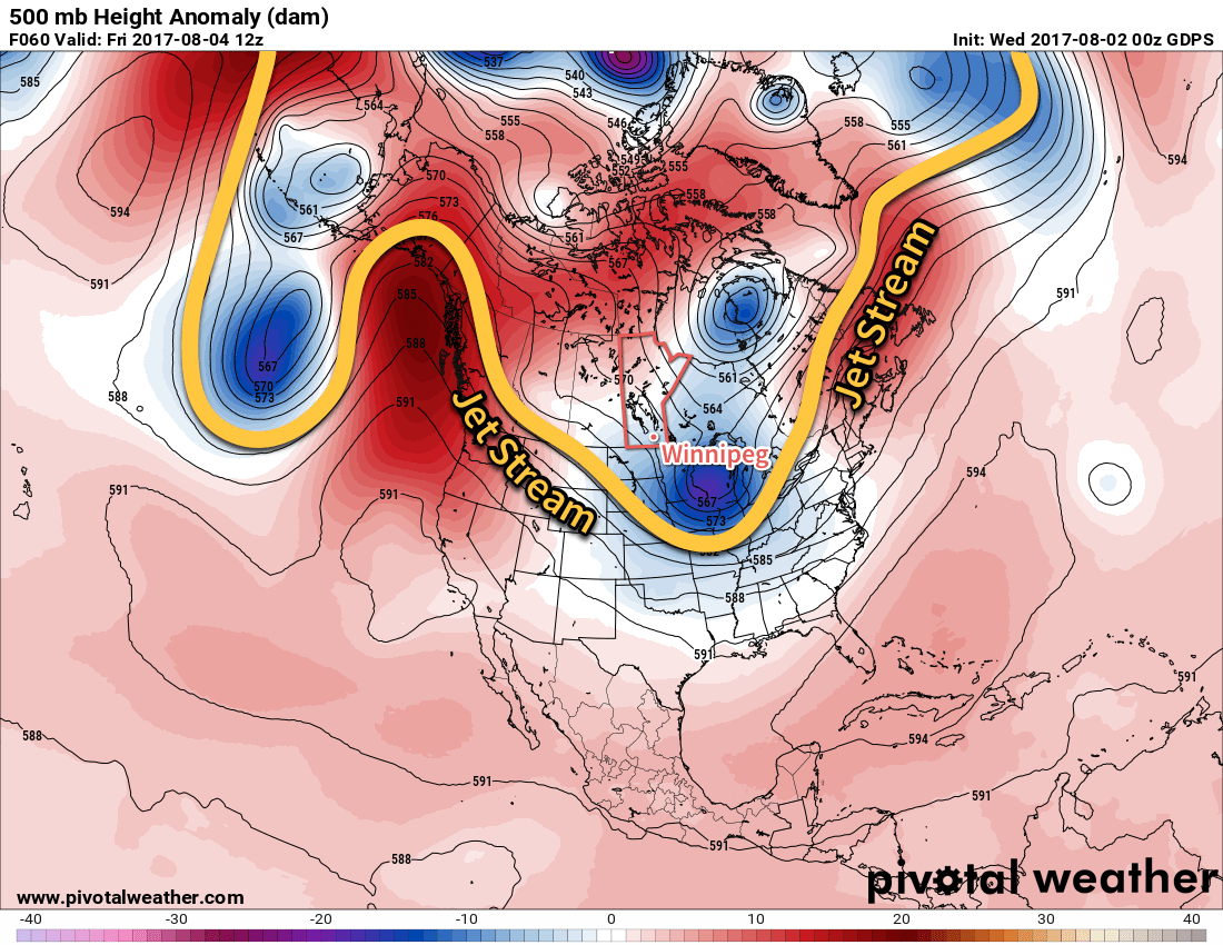
The weather over the next few days will be quite consistent as the overall pattern remains unchanged with the jet stream — and thus the storm track — diving southwards through Saskatchewan and into the central United States. The result is a persistent weak northwest to northerly flow over the region that will keep daytime highs slightly below-normal but bring pleasant summer days.
The jet stream will continue to dive southwards across the Western Prairies into the northern United States, keeping temperatures slightly cooler than normal across Southern Manitoba.
All the way through Sunday, daytime highs will sit around the 24°C mark with overnight lows between 11-13°C. Will be northwest to north at 10-20 km/h each day, and ease to west-northwest at 0-10 km/h at night. Each day should bring sunny skies in the morning, with a few clouds to partly cloudy skies in the afternoon. While rain in the Red River Valley is unlikely over the next couple days, an isolated shower or thundershower can’t be ruled out.1 And that’s pretty much it; overall there are some great days ahead!
Long Range
The nice weather continues Monday, but early indications are that a disturbance will roll across Southern Manitoba on Tuesday/Wednesday, potentially bringing some rainy weather with it. Behind that, it appears that the region will see more of the same: slightly below-seasonal highs and pleasant conditions.
Winnipeg’s seasonal daytime high is currently 26°C while the seasonal overnight low is 13°C.
Any thundershowers that develop will not be severe. ↩
There’s been no formal announcement for the recent updates to the bulletin viewer, but I’ve been working away at improving some aspects of it lately. Still working on parsing out some compatibility issues with a few bulletins, so expect to see continued improvements in the coming weeks. But, for now, here’s all the recent updates:
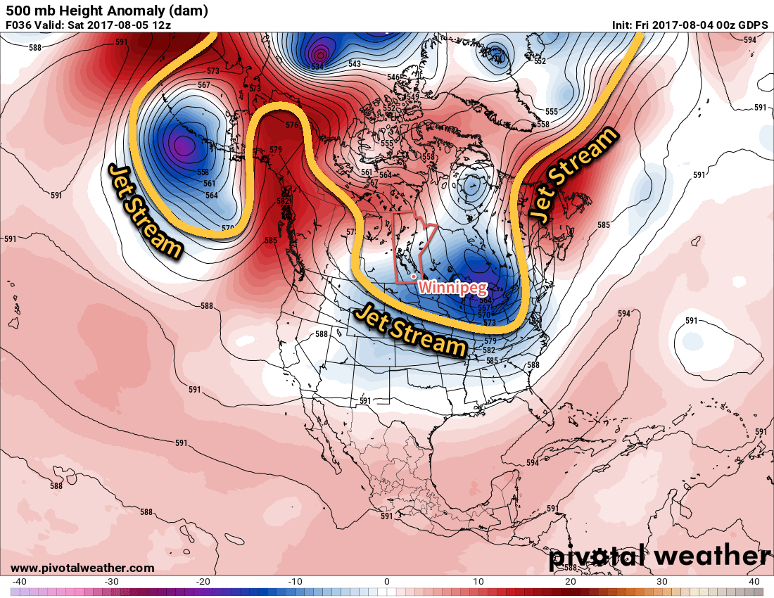
A big change is on the way for Winnipeg and the Red River Valley; after a stretch of hot and humid weather, the jet stream is plunging southwards and will spread significantly cooler conditions across the southern Prairies.
Today’s weather will be dominated by an upper-level low tracking into North Dakota, shunting the jet stream further south and bringing cooler air into the region. Here in Winnipeg, temperatures will climb to around 21°C this afternoon — some 5°C below normal — with northerly winds at around 15-20 km/h. We may see a few showers in the morning, but most of the day should be cloudy with no rain. Skies will clear out late tonight into the early morning hours of Thursday as temperatures dip to a low near 11°C.
This height anomaly map of the upper atmosphere shows how the jet stream will dive southwards, bringing cooler temperatures to southern Manitoba.
Thursday will bring clearing skies as a broad ridge of high pressure builds into the region. Winds will remain light, and with a bit of sunshine highs should be a little higher than Wednesday at around 24°C. There will be a very slight chance of an isolated shower developing along lake-breeze boundaries in the Interlake and drifting south towards Winnipeg in the late-afternoon, but that the chance is low. Skies will be clear Thursday night with a low near 11 or 12°C once again.
Friday will be more of the same; light northwesterly winds under partly cloudy skies with a high near 24°C. Temperatures will dip down to a low near 13°C on Friday night.
Long Range
Saturday will continue the cooler conditions with a high in the low 20’s, but a passing disturbance will bring a slight chance of some scattered showers or thunderstorms. The remainder of the weekend into next week will bring seasonal to slightly below-seasonal temperatures with mixed skies and occasional chances for showers.
Winnipeg’s seasonal daytime high is currently 26°C while the seasonal overnight low is 13°C.
The heat will stick around for just one more day before a cold front ushers in cooler temperatures that will persist through the remainder of the week. That cold front will also bring the threat of severe thunderstorms to the Red River Valley this afternoon as it slides southeastwards through the region.
Today’s weather focus for Winnipeg & the Red River Valley will be the continued heat and humidity in place and the cold front that will be shunting it out today. Temperatures will rise quickly this morning towards a daytime high near 30-31°C. With dew points still in the 18-20°C range, humidex values will climb into the upper 30’s once again. By early afternoon, a cold front will start slumping southwards into the Red River Valley, bringing with it a risk for thunderstorms.
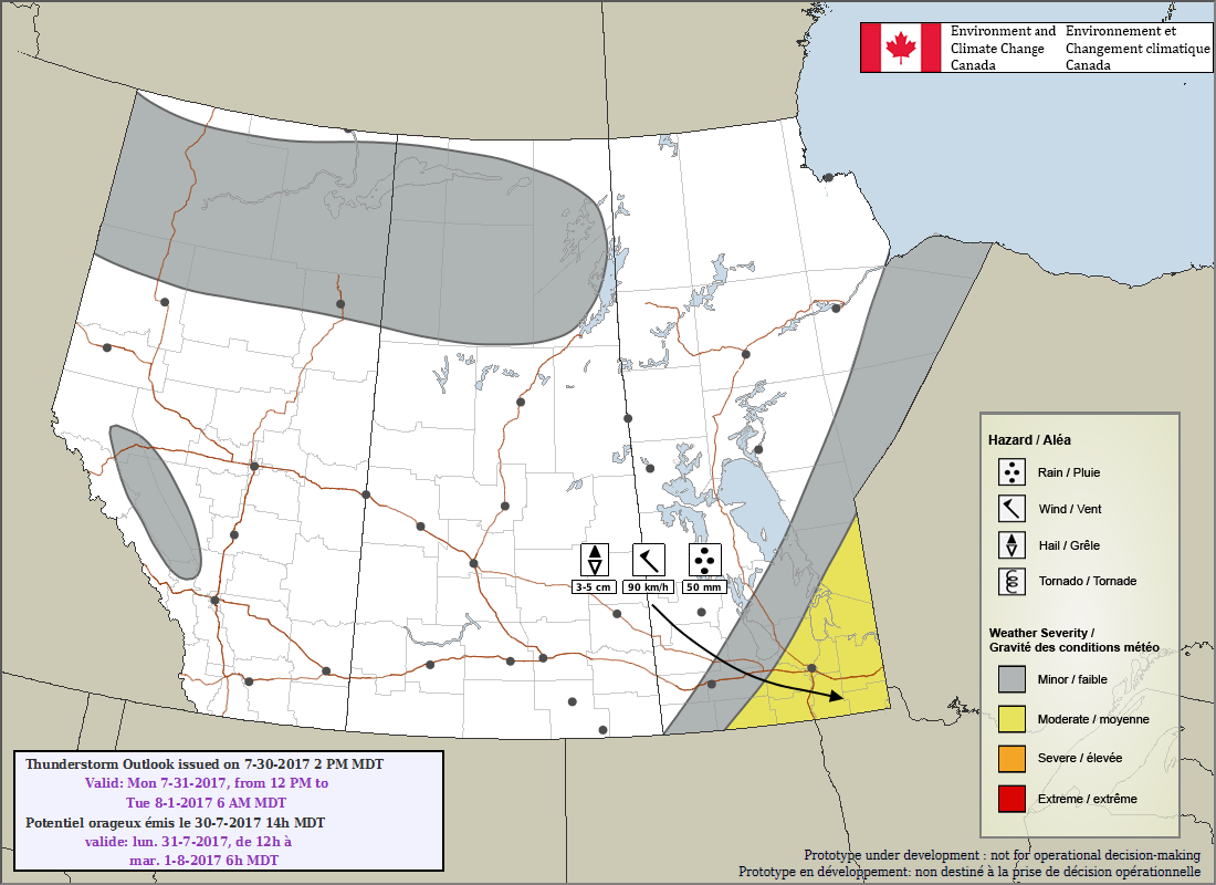
EC³ Day 1 Thunderstorm Outlook for July 31, 2017
As shown in ECCC’s thunderstorm outlook, there is a chance for severe thunderstorms over the Red River Valley and southeastern Manitoba.
Moisture: Surface dew points near 20°C will provide large amounts of energy for thunderstorms to work with.
Instability: The high dew points will combine with moderately steep mid-level lapse rates to produce MLCAPE values near 2500 J/kg.
Shear: Shear is lacking somewhat; 500 mb winds of 30-35 kt layered on top of south to southwesterly surface winds of 10 knots will produce bulk shear values near 25 kt.
Trigger: A cold front slumping southwards through the region.
The high instability coupled with middling shear but sharp trigger will combine to produce the threat of severe thunderstorms that quickly develop into a multicellular line and move to the southeast.
The primary threat with today’s thunderstorm will be large hail. As shown in ECCC’s outlook, hail up to 5 cm diameter — a bit larger than a golf ball — is possible in the worst storms that form today. Heavy rain will be the second threat as it’s quite likely the rainfall coming out of the line of storms is torrential. Whether or not there’s overland flooding will depend on how quickly the line is moving; at this point, it seems like things will be progressive enough that while the rain will be heavy, it won’t reach severe criteria (50 mm in under 1 hour). There may be strong winds in some of the storms, but it won’t be as common as large hail and heavy rain. There is not a significant tornado threat today.
The biggest uncertainty will be when exactly the thunderstorms start. If they form early, around 1PM or so, then they’ll initiate to the northwest of Winnipeg and move through the city early to mid-afternoon. Should the capping inversion hold longer and storms don’t form until 3-4PM, then it will be likely that the cold front has passed through Winnipeg and the storms fire to the south and southeast of the city. The southern Red River Valley and southeastern Manitoba have a high probability of seeing thunderstorms this afternoon.
Behind the cold front, winds shift out of the northwest to around 20 km/h as skies clear. Temperatures will drop to a low near 17°C tonight.
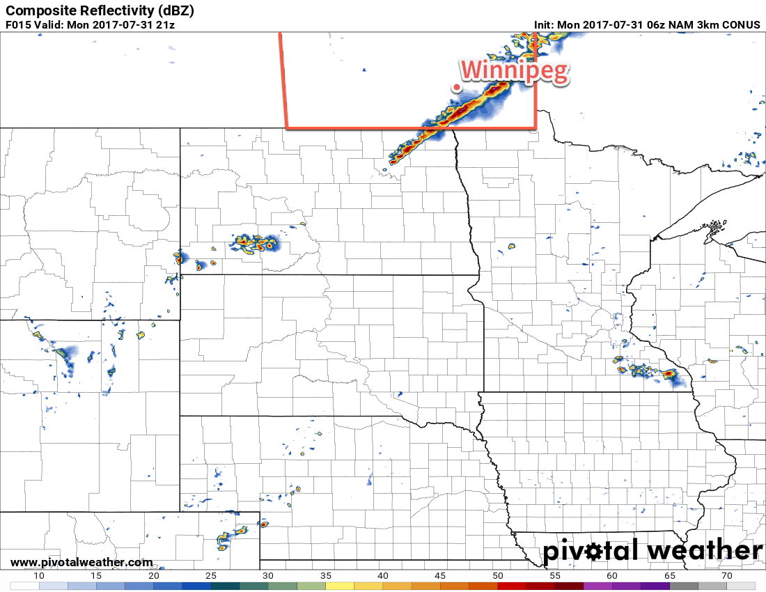
The 3km NAM model shows a line of thunderstorms moving through the Red River Valley late this afternoon.
Tuesday will start off sunny with skies becoming mixed in the afternoon as a weak disturbance moves towards the region. Temperatures will climb to a high near 26°C, but the humidity will be much more comfortable as dew points fall to the 11-13°C range in the continued light northwesterly winds. There may be a slight chance of some isolated showers in the afternoon. Tuesday night will bring some clearing in the evening, but then more organized cloud will begin moving in ahead of a low that will impact the region on Wednesday. Temperatures will drop to around 11°C.
Wednesday will bring cloudy skies and a good chance of showers to Winnipeg and the Red River Valley. It will be a relatively cool day with highs around the 20°C mark and continued light northerly winds. The chance for showers will taper off in the evening with temperatures dropping to a low near 11°C.
Long Range
The remainder of the work week looks quiet with temperatures near-seasonal, if not a bit below. There may be some chances for showers on Friday or Saturday, but it’s still looking a bit unclear at this point.
Winnipeg’s seasonal daytime high is currently 26°C while the seasonal overnight low is 13°C.