The remainder of this week will be marked by a notable increase in the humidity as a deep southerly allows the moisture to build into Southern Manitoba. Alongside the sweltering conditions, a low pressure system pushing across the Prairies over the coming days will bring a threat for strong to severe thunderstorms across Southern Saskatchewan & Southern Manitoba.
Today will be a hot day with the humidity gradually building in through the day. Winds will strengthen through the day out of the south to southeast to around 30km/h or so as temperatures climb into the upper 20’s. Skies will remain mainly sunny with just a few clouds expected. While the humidity will be comfortable to start the day with dew point values around 14°C or so, the weather will get considerably stickier as the day progresses with dew point values climbing into the upper teens or perhaps even hitting the 20°C mark in the evening. This will make for very humid conditions with humidex values in the mid–30’s.
Thursday will be the significant weather day for the second half of the week as a trough of low pressure passes across Southern Manitoba. Temperatures will soar towards the 30°C mark with significant humidity as dew point values once again push towards the 20°C mark, making the afternoon feel more like the upper 30’s. Winds will be lighter on Thursday than they will be on Wednesday, but there may be some brief breeziness late in the morning or early in the afternoon.
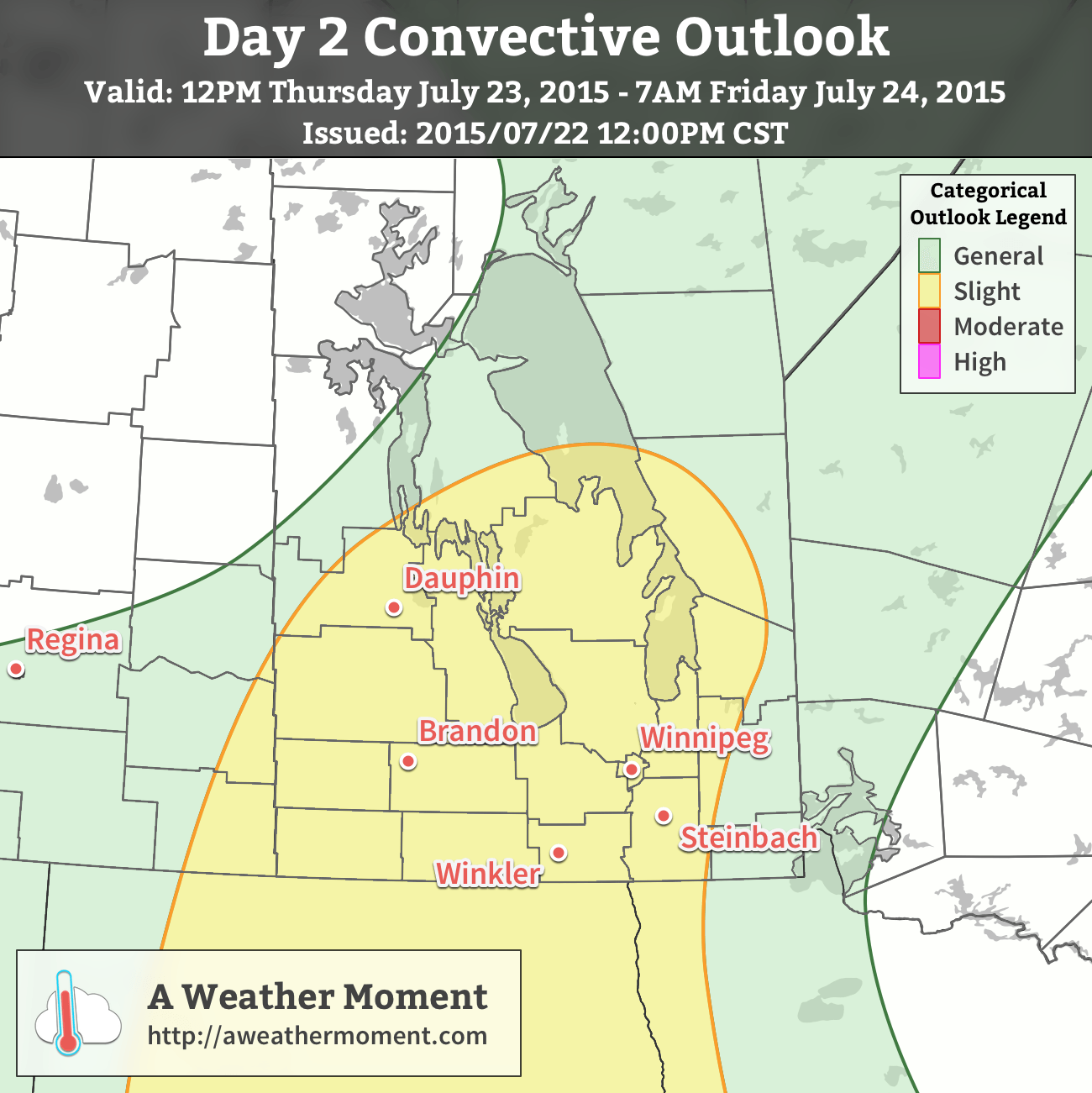
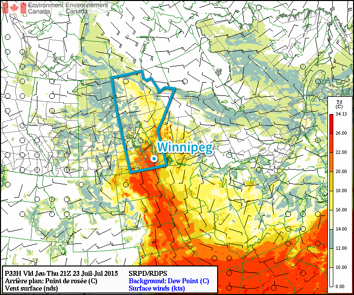
The heat and humidity will combine to pose a risk for some potent thunderstorm activity tomorrow afternoon. A trough of low pressure moving across the Red River Valley will serve as a trigger for convective activity sometime mid-to-late afternoon.[1] Winnipeg & the Red River Valley will see the risk for strong to severe thunderstorms – given a few conditions work out, more on that later – with large hail, strong winds and torrential downpours the primary threats. If an organized supercell manages to develop, the tornado threat with it (or them) will be slightly elevated. Looking through the guiding MIST principle for assessing convection:
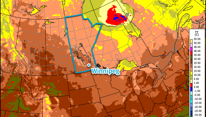
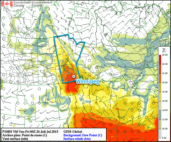
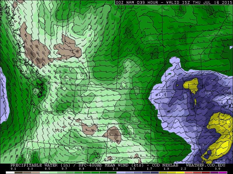
- Moisture: Abundant. Moisture transport coupled with vigorous evapotranspiration will combine to produce elevated surface dew point values near or exceeding 20°C by the end of the day.
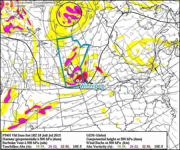
- Instability: Moderate instability with marked height falls ahead of an approaching shortwave coupled with the elevated moisture available through the boundary layer will produce MLCAPE values in the 2500 – 3000 J/kg range. The instability will carry into the evening hours with MUCAPE values remaining in the 2000+ J/kg range.
- Shear: Pretty good. Bulk shear values of 20–30kt will increase towards 30–40kt in the evening hours. Additionally, low-level profiles show moderate veering. The wind profiles support supercell or multi-cell storm development with upscale growth likely in the evening hours.
- Trigger: As mentioned, the trough pushing through the region associated with a low pressure system moving through the Dakotas will provide sufficient convergence to trigger thunderstorm activity.
The end result of all this is that thunderstorms are likely through Southwest Manitoba in the afternoon, with the threat pushing eastwards into the Red River Valley late afternoon into the evening. Storms will likely originate as supercells or multi-cell storms. Primary threats will be large hail and torrential rain, shifting towards hail/rain/wind as the storms organize & expand in coverage heading eastwards. Any supercell storms that manage to develop will likely pose a slight tornado risk.
Showers or thunderstorms are very likely Thursday evening/night as the system moves through. Stay alert of any watches or warnings issued by Environment Canada through the day into the evening on Thursday.
Friday will be a fairly quiet day. Things will stabilize behind the departing trough of low pressure, bringing clearing skies and a high in the upper 20’s with decreasing humidity. Expect a low in the upper teens on Friday night.
Summer Heat Returns for Weekend
The reprieve from the heat and humidity will be short-lived, however, as temperatures will climb back up to the 30°C mark with humid conditions returning as dew point values of 20°C or greater building back into the region. No precipitation is expected through the weekend.
- Although a wildcard remains of how long nocturnal convection from Wednesday night will persist into the daytime hours on Thursday. ↩