Southern Plains States Faced with Serious Flooding

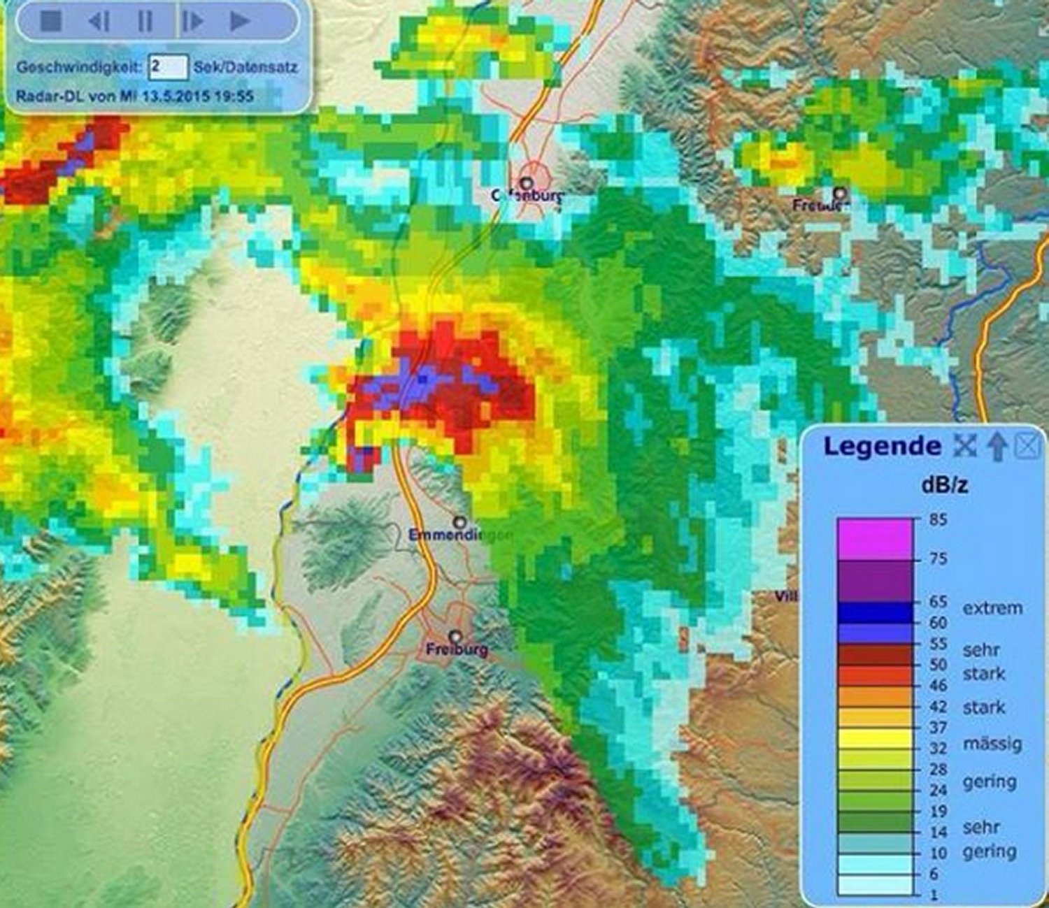
The western troughing pattern, with occasional cut-off lows that have been hanging around the west coast have done good work in eliminating the drought that was entrenched in the Southern Plains past few years. The copious amounts of rain that have fallen in the last month or so has not only taken out a large part of the drought, but caused serious flooding issues in the region. This heavy rainfall stemmed from several storm types; rounds of trailing severe thunderstorms, large areas of stratiform rain as well as slow moving storms the would drop significant amounts of rain. These have all occurred in the Oklahoma/north Texas region since the end of April.

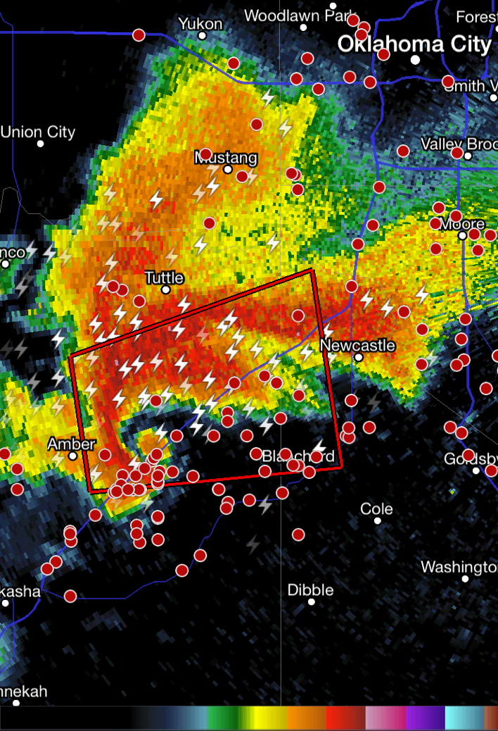
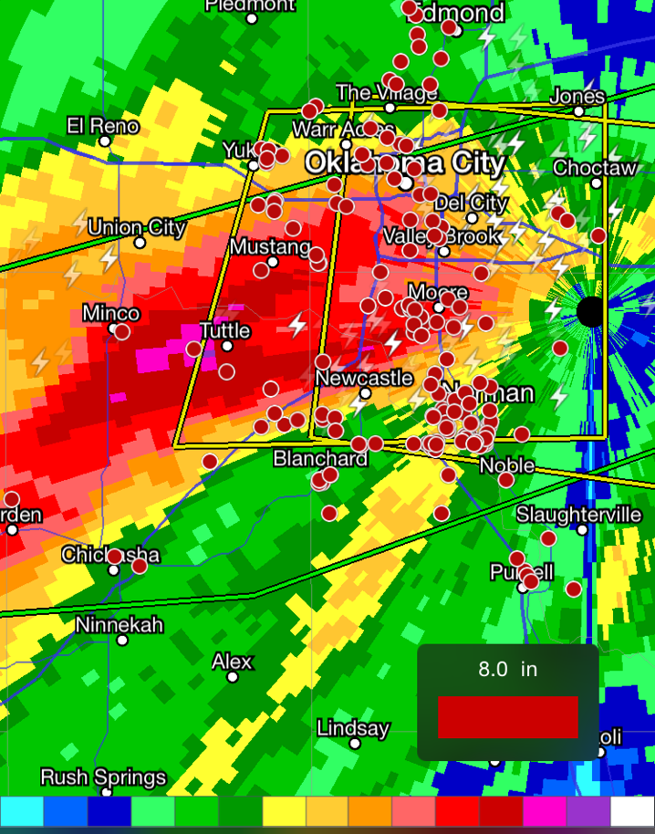
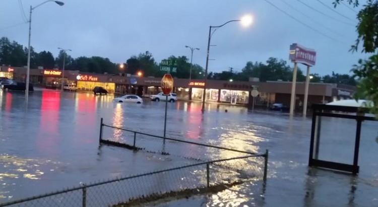
[map type=”hybrid” autofit=”1″ disable_scrollwheel=”1″] [pin tooltip=”Lake Eufalufa”]Lake Eufalufa, ok[/pin] [pin]Norman[/pin] [pin]Wichita Falls[/pin] [/map]

The flooding is not only wreaking havoc on farmers in the area, whose crops are struggling due to all the rain, but also the general population as several major highways in the region have been washed out and forced to close. Lake Eufalufa, one of Oklahoma’s major lakes is currently 14 feet above normal, causing many campsites nearby to be shut down. In Wichita Falls, Texas, neighbourhoods in low-lying areas were forced to evacuate ahead of the next system – the city announced they would be cutting power at all these neighbourhoods to prevent electrical fires. In Norman, Oklahoma, heavy rains from trailing storms turned parts of its Main Street into a fast flowing river this past week. It’s unclear how many people have been affected since the beginning of May throughout the south but two people are known to have died in the floods. The good news is the extreme drought, which covered 29% of the region last year, is now down to 0%.

Past 30-day rainfall in Oklahoma shows significant rainfall across much of the state, with a 495mm tally in Norman.

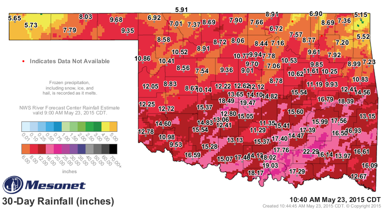
More rain is in the forecast for most of these regions this weekend – with possibly another significant rainfall in the works. In some of the hardest hit areas, such as central Oklahoma, more than 75 additional millimetres could fall this weekend; flood watches are already in effect and meteorologists are urging residents to limit travel.

Second Round of Storms Batters Southern Germany

Germany witnessed just about every type of severe weather over the past two weeks – tornadoes, golf ball size hail and severe straight-line winds.

[map autofit=”1″ disable_scrollwheel=”1″] [pin]Freiburg[/pin] [pin]Stettenhoffen[/pin] [/map]


This past week the atmosphere was primed for a second round of severe weather in the southwest part of Germany as a stationary front was draped across the region. The front separated warm moist air from the Mediterranean and cool air to the north of it, providing a sufficient trigger for storms. Modest MLCAPE values and veering wind profiles were also in place which meant that all the ingredients were in place for supercells. On Wednesday the 13th ESTOFEX, which issues forecast categories of potential danger for severe thunderstorm days (similar to the Storm Prediction Center), issued a level two threat – one below the highest level.

Radar scan of the supercell north of Freiburg, Germany. Note the hook echo and even possible debris ball. (Source: Meteo Europe)
Radar scan of the supercell north of Freiburg, Germany on Wednesday evening. Note the hook echo and even possible debris ball. (Source: Meteo Europe)

One impressive supercell formed just north of Freiburg, Germany which dropped 5cm diameter hailstones on the outskirts of the city – these reportedly injured a dozen residents. As it continued further east-northeast, the storm went on to produce what residents called a tornado, which damaged about 150 homes in Stettenhoffen and surrounding areas. The “tornado’s” strength is still being investigated and meteorologists are also looking at the damage paths to see if it was in fact a tornado or simply very strong straight-line winds. Some residents were injured from debris but luckily no one perished from the nasty storm.

These storms come about a week after a severe weather outbreak hit Germany in the first week of May. This outbreak consisted of several tornadoes in northern Germany as well as a potent bow echo that raced across the region bringing gusts of over 120km/h.

Multi-Day Severe Weather Setup Leads to Tornadoes, Flash Flooding in Oklahoma

Early May is typically when the severe weather season really ramps up in the US Plains and this week has certainly lived up to that. The region has seen severe weather every day since Wednesday and is expected to see more today. A western troughing pattern has been dominant the past few days, allowing a strong southerly flow to take place in the lower levels of the atmosphere – advecting in plenty of moisture from the Gulf of Mexico located nearby. High levels of instability, coupled with enough shear to support supercells was in place.

[map autofit=”1″ disable_scrollwheel=”1″] [pin tooltip=”Bridge Creek”]Bridge Creek, ok[/pin] [pin]Norman[/pin] [/map]

The worst day of the outbreak tornado-wise occurred on Wednesday where 48 tornadoes touched down from Nebraska, all the way down to Texas. A particularly dangerous situation unfolded in Oklahoma as a supercell with a history of producing tornadoes moved northeast along I-44 and through the large city of Norman where it dropped a tornado, later rated EF-1. The same supercell also produced an EF-2 tornado near Bridge Creek, shortly before it dropped the Norman tornado. Tornadoes were not the only threat on Wednesday; significant rains fell across Oklahoma, including Oklahoma City, which saw trailing supercells hit the city and as a result severe flash flooding. One person died from the storms, while a few dozen were injured. Ditches became raging creeks that spilled their banks onto highways and residential areas. It’s not uncommon to see supercells drop 100mm of rain or more in an hour. Radar indicated that some areas just southwest of Oklahoma City saw over 250mm on Wednesday. Numerous stations in the area broke their daily rainfall records from this event. A state of emergency was issued in 12 counties as a result of the storms.

Chickasha Supercell
The tornadic supercell that hit Norman in its early stages, showing an obvious hook. (Source: Radarscope)
Oklahoma Flooding Rains
Storm total accumulation for Wednesday through 9pm shows areas of over 250mm (pink areas). (Source: Radarscope)

More severe weather is expected today as the trough shifts slightly eastwards. There’s a chance that today could be the second significant tornado day in less than a week in the Plains – Kansas, southeast Colorado and northern Oklahoma regions are under the gun. However, there are still a few uncertainties due to the models showing some mid-day convection possibly limiting the heating. The Storm Prediction Center had issued a moderate risk for the region as of Friday night. Regardless of what happens in the first half of the day, there will be severe storms; residents in the region will have to keep an eye on the sky for large hail, severe winds, torrential rains and even tornadoes!

Eastern Australia Sees another Coastal Low

Elsewhere in Weather News posts are beginning to sound like a broken record with all the recent flooding stories coming out of Australia. This past week there were yet again significant flash flooding problems across regions of Australia.

[map zoom=”11″ type=”hybrid” autofit=”1″ disable_scrollwheel=”1″] [pin tooltip=”Last week’s flooding”]Maitland, AU[/pin] [pin tooltip=”This week’s flooding”]Lismore river[/pin] [/map]

Northern New South Wales and southern Queensland were hardest hit this time as a low pressure quickly wrapped up just off the Eastern Coast of Australia – very similar to the setup that occurred last week. Observation sites indicate that there was a large swath of 150-200mm that fell across Northern NSW along the coast in just over 24 hours. With already saturated soils from the past week’s storm that dumped around 50mm in the same area, conditions were primed for flash flooding once the heavier rain bands arrived. Similar to last week’s low featured in EIWN, strong wind gusts of up to 100km/h were also observed.

Surface Map analysis from overnight Thursday shows the east coast low just off Australia's eastern shores and the tropical storm Quang about to make landfall on Western Australia territory. (Source: BoM)
Surface Map analysis from overnight Thursday shows the east coast low just off Australia’s eastern shores and the tropical storm Quang about to make landfall on Western Australia territory. (Source: BoM)

Flash flooding was the main cause of the damage in the region once again, as roads washed out and numerous homes were inundated. The Wilson and Lismore rivers were expected to peak later today at a moderate flood stage, meaning that properties along the banks of the rivers are at risk. In total, six people died from the most recent flood events, five of the six as they attempted to drive through flood waters that covered roads. This brings a harsh reminder to residents that when roads get flooded out it’s best to turn around and not drive through.

The east coast low wasn’t the only form of severe weather to affect Australia this past week – a cyclone also formed in the Eastern Indian Ocean and strengthened in to a category four over open waters. After substantially weakening due to cooler waters near Australia’s coast the system made landfall on Northwestern Australia’s shores as a tropical storm, prompting officials to issue rainfall warnings in the region. Damage from the storm appears to have been minimal, other than some minor flooding.