This week will feature near seasonal temperatures and a brisk easterly flow as a stalled upper low sits to our south.
Today will be mainly cloudy, as a low pressure system to our south spreads clouds and showers over southern Manitoba. The main shower activity is expected to remain near the International border, though a few showers may creep a bit further north. Temperatures will be in the low teens with easterly winds at 20-30 km/h.
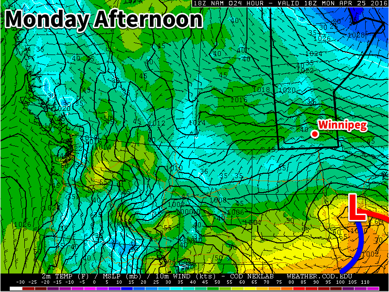
A low pressure system will sit to our south on Monday
Tuesday will be much the same as Monday, with temperatures in the low to mid teens under mainly cloudy skies. No rain is expected in the Red River Valley, though some light showers may occur in western Manitoba. Winds will be easterly at 20 km/h.
Wednesday will likely see a bit more sun, with skies being a mixture of sun and cloud. High temperatures will be in the mid teens with winds out of the east at 30 km/h.
Long Range
The long range forecast suggests that we will see more above seasonal weather as we move into May. The remainder of April will likely see temperatures around seasonal values, with highs in the mid teens.
Winnipeg will see another cool day before seasonal temperatures return on Saturday and stick around through the weekend and beyond. Overall the upcoming weather forecast could be described as "fairly boring" with no significant weather events expected in the next 5-7 days.
Winnipeg will see mainly cloudy skies today as a weak upper-level disturbance moves across the province. With all the cloud and a weak northerly wind, below-normal temperatures will persist with a high temperature of just 7°C. The afternoon will bring a slight chance of some shower activity, but it is overall expected to be quite light and may remain north of the Winnipeg. Temperatures will be chilly tonight as temperatures dip to +2°C under cloudy skies.
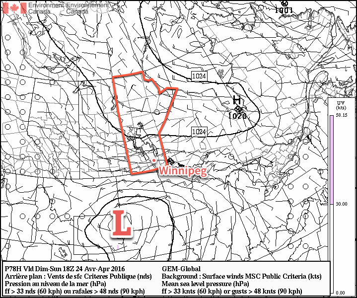
Saturday will be another cloudy day in Winnipeg and mark the start of the next weather system that, while not directly impacting us, will set the stage for the weather over the region for the next few days. A fairly potent low pressure system will begin building out of Montana into South Dakota, spreading cloud and rain through North Dakota towards the Canadian border. A strong deformation zone should set up just south of the border, keeping the precipitation States-side. In Manitoba, this system will produce primarily cloud and wind. As mentioned, we expect mainly cloudy skies for Winnipeg, and much of the remainder of Southern Manitoba, on Saturday. The wind will pick up out of the northeast, strengthening to about 30km/h here in Winnipeg, with values closer to 40 gusting 60 km/h over southwestern Manitoba.
Some of the cloud will begin to slump to the south on Saturday night as temperatures drop to the -1°C mark.
A strong low pressure system (L) in South Dakota will bring windy conditions to the Red River Valley on Sunday.
Sunday will bring partly cloudy skies for Winnipeg as the main cloud shield slumps to the international border.[1] Temperatures will continue near seasonal values with a high of 10°C. Unfortunately, it will feel quite chilly as a brisk northeasterly wind approaching 40km/h develops over the Red River Valley. Temperatures will dip down to the freezing mark on Sunday night once again with winds tapering off.
A quick glance ahead into next week shows pretty much more of the same; some sun, some cloud, and temperatures at or just below seasonal. Not much is expected precipitation wise until a system comes through in the second half of the week and brings the potential for some rain to the region.
Winnipeg’s seasonal daytime high is currently 13°C while the seasonal overnight low is 0°C.
This means that for areas in the southern Red River Valley, skies will likely be more mixed-to-cloudy. ↩
Today will bring a mixed bag of conditions to Winnipeg and area before a cold front sweeps through the region this evening and ushers in cooler air from Northern Manitoba.
We’re off to a misty, drizzle-filled start to the day here in Winnipeg thanks to a large area of stratus cloud that expanded northwards out of the Dakotas overnight. This expansive area of cloud—stretching from southeastern Saskatchewan across southern Manitoba and into northern Ontario—will remain in place until later this morning; by midday, westerly winds will begin building into the region and help to break up the clouds and bring an end to the fog patches and drizzle.
The sun should make an appearance in Winnipeg this afternoon as temperatures head towards a pleasant high of 20°C. The sunshine will be relatively short-lived as a cold slumping southwards out of central Manitoba spreads another batch of cloud southwards.
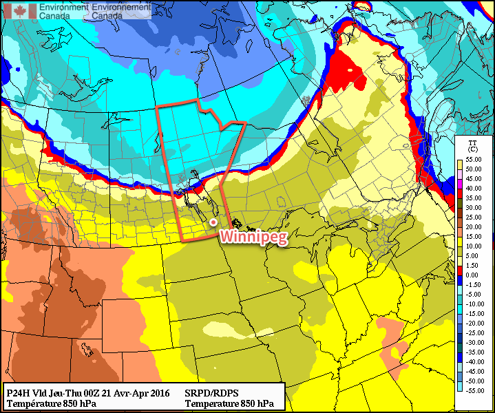
A cold front separates above-normal temperatures in southern Manitoba from well below-normal temperatures pushing southwards through northern Manitoba.
When the cold front slides through this evening, there will be a slight chance of an isolated shower or thundershower. This activity is not expected to be particularly widespread and will taper off very quickly once the sun begins to set. Breezy northerly winds of 20-30 km/h will move in behind the front ushering in cooler air that will send Winnipeg’s overnight low to near +2°C.
Thursday will be a pleasant but cool day with just a few clouds and a high near 8°C. Winds will continue to be breezy in the morning at 20-30 km/h, but will gradually taper off through the day. Expect an overnight low near -1°C with increasing cloud.
Friday will bring mainly cloudy skies as a frontal zone sets up across the eastern Prairies. Winds will be light and there will be just a slight chance of some light shower activity. Expect a high near 8°C once again and an overnight low near +1°C.
Winnipeg’s seasonal daytime high is currently 13°C while the seasonal overnight low is 0°C.
After a wet weekend across much of Southern Manitoba, improvement is on the way with more sun and warmth moving into the region to dry things out.
Today will be downright gorgeous compared to the last few days as the cloud cover that has plagued Winnipeg begins to clear out this morning. The sun should be out by this afternoon and temperatures will climb to an above-normal 15°C. Winds will be out of the northeast around 20 km/h. Temperatures will dip to +1°C tonight under clear skies.
Tuesday will be a beautiful sunny and warm day with just a few clouds in Winnipeg and a high approaching the 20°C mark. Tuesday night will continue mild with a few clouds and a low near 7°C.
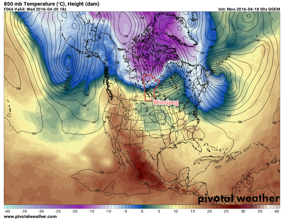
Cooler air (pink/purple) is poised to spill southwards on Wednesday night, but not before Winnipeg enjoys some mild temperatures.
Wednesday will be a nice day, but mark a transition back towards seasonal weather as a cold front slides towards the Red River Valley from the northwest. Winnipeg should see a daytime high near 19°C, but with increasing cloud as the day progresses. By evening, there is a slight chance of some showers moving through the city as the cold front passes. Behind the cold front winds will pick up out of the north to 30-40 km/h. With cooler air moving back into the region, Winnipeg will head towards a low near freezing.
Long Range
Behind this cold front, Winnipeg will transition to a slightly below-normal temperature pattern for a few days. A chance for some light snow or rain returns on Friday as a disturbance moves through the region. Once that passes, it appears Winnipeg will move into a seasonal trend with highs in the low teens and little precipitation expected throughout the first half of next week.
Winnipeg’s seasonal daytime high is currently 11°C while the seasonal overnight low is -1°C.