Weekend Warmth Returns

Some absolutely beautiful weather is on tap heading into this weekend as a stretch of above-normal temperatures sets up over Southern Manitoba. An upper-level ridge building into Manitoba will bring with it a surge of warmer air that will allow our temperatures to soar into the mid-to-upper teens with plenty of sunshine. A brief hiccup in the nice weather will move through on Sunday, but then it looks like a quick rebound for the upper ridge, maintaining warmer than seasonal temperatures across Southern Manitoba.1

Today will be a transition day from the cooler air behind yesterday’s cold front into the incoming warm air spreading eastwards with the upper-level ridge. Mainly sunny skies will be in place over the Red River Valley with a high near 12°C. Winds will start off light out of the northwest and back to the south by evening; winds will remain fairly light through the day, though, up to only around 10–15km/h. Tonight will bring clear skies and a low near +1°C and light winds.

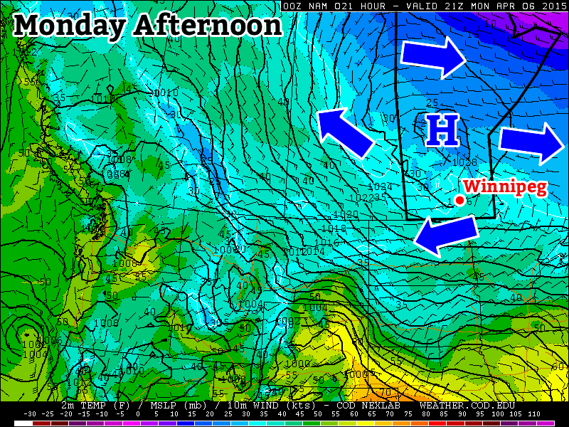
Saturday will be a beautiful day. Full sun combined with the warming temperatures aloft will allow our daytime high to climb to – a nearly 10°C above normal – 18°C. The winds will be, as they are often when we see big warm-ups, pretty stiff out of the south with sustained winds to 30–40km/h with gusts to around 50km/h. Winds will slowly taper off overnight, but with all the warm air in place over the region, we’ll see a balmy overnight low near 8°C with a bit of cloud cover moving in overnight.

GDPS 6hr QPF valid 18Z Sunday April 12, 2015
The GDPS is forecasting a line of showers moving through Southern Manitoba on Sunday morning, shown by this 6-hour precipitation accumulation forecast.

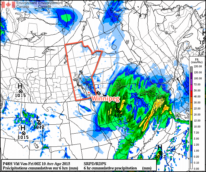
Sunday will be more of an unsettled day as a cold front moves through the region. The day will start off with increasing cloud and likely some showers moving through with the cold front. Behind the front, we’ll see clearing skies making for a sunny afternoon and a high near 14°C. Unfortunately, the winds will pick up out of the northwest behind the front and be pretty breezy; by late afternoon the winds will likely be up to 40 gusting 60km/h out of the northwest. There may be a slight chance of some late-day showers for Winnipeg, but it really ends up depending on the exact track of the upper-level low as it moves through. It looks most likely that any wrap-around showers will remain north of the city.

Sunday night will bring mainly clear skies and a low near +2°C as cooler air works in aloft.

Next Week At A Glance

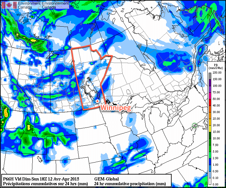
Next week looks to continue the warm streak with daytime highs in the mid-teens. Conditions look fairly dry with most the precipitation associated with any lows moving through remains further north into central Manitoba.

After a week of cooler temperatures, it looks like we finally get to switch into a more prolonged period of spring-like warmth.


  1. Seasonal daytime highs for this time of year in Winnipeg are around 10°C.

Mild Weather Returns to Winnipeg

A return to spring weather has arrived for Southern Manitoba with temperatures returning to seasonal to above-seasonal values for the remainder of the week. Plenty of clouds will be in place today, but sunnier skies will move in for Thursday and Friday, making for a great end to the work week.

Wednesday
8°C / -3°C
Mainly cloudy

Thursday
10°C / -2°C
A few clouds; chance of showers

Friday
10°C / -2°C
Mainly sunny

Today will be a fairly cloudy day thanks to a low pressure system moving through the Northern Plains of the United States. While the precipitation associated with the system will remain south of the border, a fair amount of cloud will push into our region making for a bit of a dreary day. Fortunately, temperatures will return to seasonal values with a high today near 8°C. Clouds will clear out overnight with the temperature dropping to around –3°C.

GPDS 6hr. QPF – Valid 00Z Friday April 10, 2015
A weak disturbance slumping southwards into the Red River Valley will bring a slight chance of showers to Winnipeg on Thursday.

Thursday and Friday will both be mainly sunny days with highs near 10°C and lows near –2°C. Little in the way of weather is expected on Friday, however tomorrow a weak disturbance slumping southeastwards will push into the Red River Valley and bring just a slight chance of showers late in the day to Winnipeg.

A Look At The Weekend

This weekend looks quite nice for Southern Manitoba with daytime highs in the teens and plenty of sunshine. Winds look fairly calm through the weekend, although they may end up breezy out of the south sometime Sunday for a few hours as a tough line approaches. As the trough moves through, we may see some shower activity on Sunday afternoon.

All in all a fairly nice weekend with a welcome return to warmer temperatures.

Gradually Warming Up

Temperatures will gradually warm this week as we move back into more spring-like conditions.

Monday will remain cool as a strong high pressure sits just off to our north

Monday

Monday
1°C / -4°C
Mainly Sunny

Today will remain on the cool side as a surface high remains parked off to our north. This high will keep arctic-ish air over southern Manitoba, suppressing high temperatures to near the freezing mark. Winds will be light however, making for a pleasant, but slightly chilly day.

Tuesday

Tuesday
4°C / -1°C
Mix of sun and cloud

Tuesday will see a slight uptick in temperatures over Monday, with values climbing a few degrees above zero. Skies will be a mixture of sun and cloud and winds will be breezy from the east. There may be a bit of snow on Tuesday night as a strong upper-impulse moves through, but accumulations will be small.

Wednesday

Wednesday
7°C / 0°C
Mainly Sunny

Wednesday will see temperatures increase further, with highs in the mid to upper single digits in southern Manitoba. Skies should remain mainly sunny with light winds, making for a nice day!

Long Range

The long range forecast shows increasingly warm temperatures toward the end of the week. Models suggest that above-normal weather will last into mid-April at least. This means highs frequently into the teens and very long range models even show our first 20C readings of the year!

Unseasonably Cool Weekend Ahead

Unseasonably cool temperatures will be seen across all of Manitoba through the duration of the Easter long weekend thanks to an Arctic air mass that was ushered into the region behind a potent cold front that brought intense snow showers and strong winds yesterday. In addition to the cooler temperatures, the s-word will likely be seen in many regions along and south of the Trans-Canada corridor over the next couple days.

Friday
-1°C / -9°C
Flurries beginning midday
Saturday
-3°C / -12°C
Morning snow likely, then clearing
Sunday
-2°C / -10°C
Mainly sunny & cool

A clear and cold start to the day in Winnipeg will see more cloud move into the area through the morning as a weak disturbance slides through the region. Flurries will move into the Red River Valley midday and linger into the evening. Winds will be light and daytime highs will climb to around -1°C. A chance for flurries will persist overnight as another weak disturbance begins approaching from Saskatchewan. Temperatures will dip to around -9°C tonight.

RDPS 24hr. QPF  – Valid 12Z April 4, 2015
Precipitation totals forecast by the RDPS from Friday morning through Saturday morning.

As the next disturbance ripples through tomorrow morning, it will push an area of snow through the province. Amounts from this band will be around 1cm and will be centered from the Parkland region southeastwards into the southwestern Red River Valley. Winnipeg will be on the northern edge of the system and will likely see some snow through the morning hours. Once the disturbance moves past, clearing will begin pushing into the Red River Valley. Daytime highs will be a bit cooler than today at around -3°C or so with winds out of the north at 20km/h. Saturday night will bring mainly clear skies and a low near -12°C.

Sunday will be another cool, but mainly sunny, day. For areas near the U.S. border, the story will be different as a low pressure system moving through the States pushes a band of flurries through the region Saturday night into Sunday morning. Highs will be around -2°C on Sunday with lows down to -10°C on Sunday night.

Long Range

Next week is looking like a return to form; daytime highs are expected to rebound to a seasonal 6°C by mid-week at the latest when a chance for showers returns as another low pressure system moves through Manitoba. Before then, we’ll see plenty of sunshine making for fairly pleasant days despite the slightly cooler-than-normal temperatures.